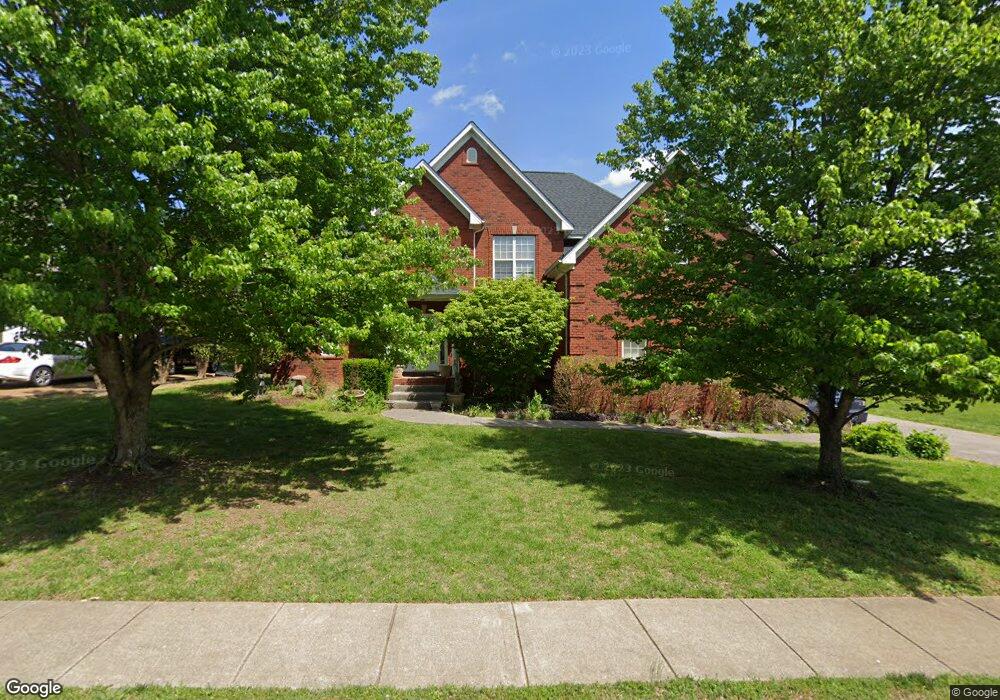
1082 Auldridge Dr Spring Hill, TN 37174
Estimated Value: $661,803 - $793,000
--
Bed
4
Baths
2,858
Sq Ft
$253/Sq Ft
Est. Value
About This Home
This home is located at 1082 Auldridge Dr, Spring Hill, TN 37174 and is currently estimated at $723,951, approximately $253 per square foot. 1082 Auldridge Dr is a home located in Williamson County with nearby schools including Primrose School of Spring Hill.
Ownership History
Date
Name
Owned For
Owner Type
Purchase Details
Closed on
Apr 21, 2005
Sold by
Burkeen Bruce A and Burkeen Christine P
Bought by
Herman Andrew M and Herman Kimberly S
Current Estimated Value
Home Financials for this Owner
Home Financials are based on the most recent Mortgage that was taken out on this home.
Original Mortgage
$246,400
Outstanding Balance
$127,146
Interest Rate
5.88%
Mortgage Type
Fannie Mae Freddie Mac
Estimated Equity
$596,805
Purchase Details
Closed on
Feb 9, 2004
Sold by
Vision Custom Homes Inc
Bought by
Burkeen Bruce A and Burkeen Christine P
Home Financials for this Owner
Home Financials are based on the most recent Mortgage that was taken out on this home.
Original Mortgage
$223,920
Interest Rate
3.67%
Mortgage Type
Purchase Money Mortgage
Create a Home Valuation Report for This Property
The Home Valuation Report is an in-depth analysis detailing your home's value as well as a comparison with similar homes in the area
Home Values in the Area
Average Home Value in this Area
Purchase History
| Date | Buyer | Sale Price | Title Company |
|---|---|---|---|
| Herman Andrew M | $308,000 | Realty Title & Escrow Co Inc | |
| Burkeen Bruce A | $279,900 | Security Title |
Source: Public Records
Mortgage History
| Date | Status | Borrower | Loan Amount |
|---|---|---|---|
| Open | Herman Andrew M | $246,400 | |
| Previous Owner | Burkeen Bruce A | $223,920 | |
| Closed | Burkeen Bruce A | $55,980 |
Source: Public Records
Tax History Compared to Growth
Tax History
| Year | Tax Paid | Tax Assessment Tax Assessment Total Assessment is a certain percentage of the fair market value that is determined by local assessors to be the total taxable value of land and additions on the property. | Land | Improvement |
|---|---|---|---|---|
| 2025 | $815 | $169,625 | $42,500 | $127,125 |
| 2024 | $815 | $110,300 | $22,500 | $87,800 |
| 2023 | $815 | $110,300 | $22,500 | $87,800 |
| 2022 | $2,018 | $110,300 | $22,500 | $87,800 |
| 2021 | $2,018 | $110,300 | $22,500 | $87,800 |
| 2020 | $1,866 | $86,375 | $16,250 | $70,125 |
| 2019 | $1,866 | $86,375 | $16,250 | $70,125 |
| 2018 | $1,805 | $86,375 | $16,250 | $70,125 |
| 2017 | $1,788 | $86,375 | $16,250 | $70,125 |
| 2016 | $1,762 | $86,375 | $16,250 | $70,125 |
| 2015 | -- | $71,825 | $15,000 | $56,825 |
| 2014 | -- | $71,825 | $15,000 | $56,825 |
Source: Public Records
Map
Nearby Homes
- 1083 Auldridge Dr
- 2165 Loudenslager Dr
- 2184 Loudenslager Dr
- 0 O'Hallorn Dr
- 0 Campbell Station Pkwy
- 2785 Rutland Ct
- 1092 Misty Morn Cir
- 2052 Hemlock Dr
- 2127 Loudenslager Dr
- 3024 Harrah Dr
- 403 Preakness Dr
- 2091 Hemlock Dr
- 2836 Pedigo Place
- 6011 Dupont Cove
- 2863 Windy Way
- 2021 Hemlock Dr
- 2112 Loudenslager Dr
- 2641 Buckner Rd
- 1039 Hemlock Dr
- 184 Mary Ann Cir
- 1080 Auldridge Dr
- 1084 Auldridge Dr
- 1085 Auldridge Dr
- 1078 Auldridge Dr
- 1187 Mccoury Ln
- 1081 Auldridge Dr
- 1185 Mccoury Ln
- 1189 Mccoury Ln
- 1079 Auldridge Dr
- 1076 Auldridge Dr
- 1183 Mccoury Ln
- 1179 Mccoury Ln
- 2064 N Amber Dr
- 1091 Auldridge Dr
- 1181 Mccoury Ln
- 1077 Auldridge Dr
- 2062 N Amber Dr
- 1074 Auldridge Dr
- 1089 Auldridge Dr
- 1075 Auldridge Dr