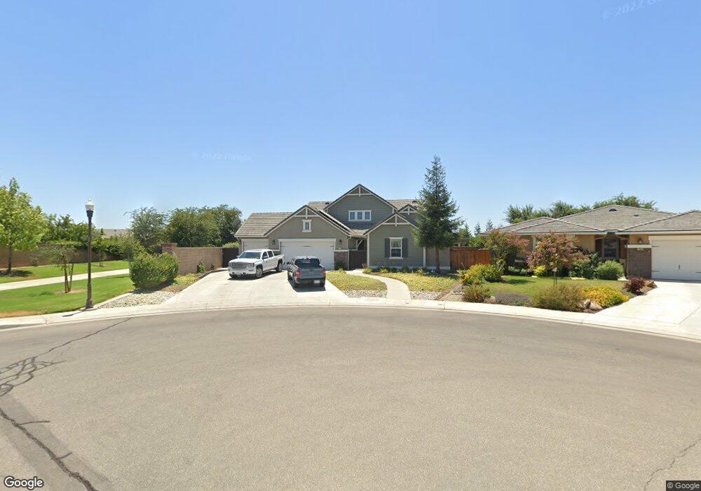
1082 Kaweah Ave Clovis, CA 93619
Estimated Value: $751,573 - $776,000
5
Beds
4
Baths
3,331
Sq Ft
$228/Sq Ft
Est. Value
About This Home
This home is located at 1082 Kaweah Ave, Clovis, CA 93619 and is currently estimated at $760,524, approximately $228 per square foot. 1082 Kaweah Ave is a home with nearby schools including Red Bank Elementary School, Clark Intermediate School, and Clovis High School.
Ownership History
Date
Name
Owned For
Owner Type
Purchase Details
Closed on
Apr 30, 2015
Sold by
Bmc Willow Brook Llc
Bought by
Scott Nicholas and Scott Kortney
Current Estimated Value
Home Financials for this Owner
Home Financials are based on the most recent Mortgage that was taken out on this home.
Original Mortgage
$353,872
Outstanding Balance
$272,115
Interest Rate
3.63%
Mortgage Type
New Conventional
Estimated Equity
$488,409
Create a Home Valuation Report for This Property
The Home Valuation Report is an in-depth analysis detailing your home's value as well as a comparison with similar homes in the area
Purchase History
| Date | Buyer | Sale Price | Title Company |
|---|---|---|---|
| Scott Nicholas | $442,500 | Old Republic Title Company |
Source: Public Records
Mortgage History
| Date | Status | Borrower | Loan Amount |
|---|---|---|---|
| Open | Scott Nicholas | $353,872 |
Source: Public Records
Tax History
| Year | Tax Paid | Tax Assessment Tax Assessment Total Assessment is a certain percentage of the fair market value that is determined by local assessors to be the total taxable value of land and additions on the property. | Land | Improvement |
|---|---|---|---|---|
| 2025 | $7,204 | $555,246 | $120,181 | $435,065 |
| 2023 | $6,932 | $533,687 | $115,515 | $418,172 |
| 2022 | $6,838 | $523,223 | $113,250 | $409,973 |
| 2021 | $6,657 | $512,965 | $111,030 | $401,935 |
| 2020 | $6,628 | $507,706 | $109,892 | $397,814 |
| 2019 | $6,499 | $497,752 | $107,738 | $390,014 |
| 2018 | $6,347 | $487,993 | $105,626 | $382,367 |
| 2017 | $6,242 | $478,425 | $103,555 | $374,870 |
| 2016 | $6,034 | $55,979 | $55,979 | $0 |
| 2015 | $1,208 | $55,139 | $55,139 | $0 |
| 2014 | $1,191 | $54,059 | $54,059 | $0 |
Source: Public Records
Map
Nearby Homes
- 1178 Blackwood Ave
- 2963 Finchwood Ave
- 3267 Portals Ave
- 3154 Mitchell Ave
- 3255 Roberts Ave
- 2871 Wrenwood Ave
- 603 Kaweah Ave
- 3045 Keats Ave
- 1009 El Molino Ave
- 2681 Wrenwood Ave
- 3497 Lincoln Ave
- 3479 Brimhall Ln
- 637 Coventry Ave
- 3537 Lincoln Ave
- 793 Applegate Ave
- 3549 Taylor Ln
- 3299 Poe Ave
- 2691 Morris Ave
- 4440 Bellaire Ave
- 4441 Bellaire Ave
- 1062 Kaweah Ave
- 1099 Whitmore Ave
- 1129 Whitmore Ave
- 3104 Lincoln Ave
- 1079 Whitmore Ave
- 1042 Kaweah Ave
- 3047 Portals Ave
- 3057 Portals Ave
- 3027 Portals Ave
- 3105 Lincoln Ave
- 1059 Whitmore Ave
- 1022 Kaweah Ave
- 3114 Lincoln Ave
- 3067 Portals Ave
- 1023 Kaweah Ave
- 1039 Whitmore Ave
- 3077 Portals Ave
- 1118 Whitmore Ave
- 3115 Lincoln Ave
- 1002 Kaweah Ave
Your Personal Tour Guide
Ask me questions while you tour the home.