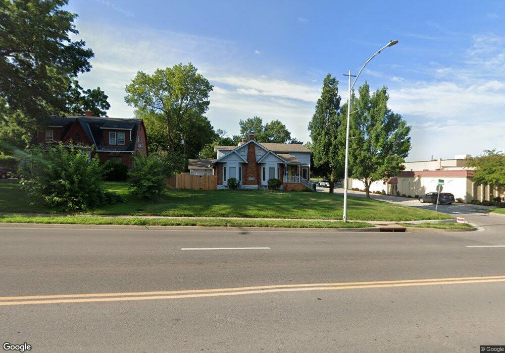
10821 Johnson Dr Shawnee, KS 66203
Estimated Value: $357,000 - $407,407
3
Beds
3
Baths
3,129
Sq Ft
$126/Sq Ft
Est. Value
About This Home
This home is located at 10821 Johnson Dr, Shawnee, KS 66203 and is currently estimated at $393,102, approximately $125 per square foot. 10821 Johnson Dr is a home located in Johnson County with nearby schools including Bluejacket / Flint Elementary, Hocker Grove Middle School, and Shawnee Mission North High School.
Ownership History
Date
Name
Owned For
Owner Type
Purchase Details
Closed on
Aug 22, 2002
Sold by
Dobbins Joy A
Bought by
Amos Family Inc
Current Estimated Value
Home Financials for this Owner
Home Financials are based on the most recent Mortgage that was taken out on this home.
Original Mortgage
$108,000
Outstanding Balance
$45,439
Interest Rate
6.47%
Estimated Equity
$347,663
Create a Home Valuation Report for This Property
The Home Valuation Report is an in-depth analysis detailing your home's value as well as a comparison with similar homes in the area
Home Values in the Area
Average Home Value in this Area
Purchase History
| Date | Buyer | Sale Price | Title Company |
|---|---|---|---|
| Amos Family Inc | -- | Security Land Title Company |
Source: Public Records
Mortgage History
| Date | Status | Borrower | Loan Amount |
|---|---|---|---|
| Open | Amos Family Inc | $108,000 |
Source: Public Records
Tax History Compared to Growth
Tax History
| Year | Tax Paid | Tax Assessment Tax Assessment Total Assessment is a certain percentage of the fair market value that is determined by local assessors to be the total taxable value of land and additions on the property. | Land | Improvement |
|---|---|---|---|---|
| 2024 | $3,916 | $37,076 | $4,288 | $32,788 |
| 2023 | $3,504 | $32,717 | $4,288 | $28,429 |
| 2022 | $3,393 | $31,556 | $3,889 | $27,667 |
| 2021 | $3,291 | $28,681 | $3,379 | $25,302 |
| 2020 | $2,953 | $25,381 | $3,081 | $22,300 |
| 2019 | $2,924 | $25,116 | $2,570 | $22,546 |
| 2018 | $2,654 | $22,690 | $2,404 | $20,286 |
| 2017 | $2,512 | $21,138 | $2,404 | $18,734 |
| 2016 | $2,045 | $16,952 | $2,404 | $14,548 |
| 2015 | $1,796 | $15,549 | $2,404 | $13,145 |
| 2013 | -- | $15,836 | $2,404 | $13,432 |
Source: Public Records
Map
Nearby Homes
- 11002 W 55th Terrace
- Ashwood Plan at Bristol Highlands - North
- The Fleetwood Plan at Bristol Highlands - The Villas
- Cypress II Plan at Bristol Highlands - North
- The Fleetwood Plan at Bristol Highlands - The Manors
- The Brentwood Plan at Bristol Highlands - The Villas
- Yorkshire V Plan at Bristol Highlands - North
- The Kirkwood Plan at Bristol Highlands - The Villas
- 8013 Payne St
- The Rockwood Plan at Bristol Highlands - The Villas
- Magnolia Plan at Bristol Highlands - North
- 10103 Johnson Dr
- 6420 Ballentine St
- 5308 Mcanany Dr
- 5933 Knox Ave
- 5845 Caenen St
- 11815 W 53rd St
- 10120 W 65th St
- 10116 W 52nd Terrace
- 5407 Halsey St
- 10815 Johnson Dr
- 10824 W 59th St
- 10809 Johnson Dr
- 10816 W 59th St
- 10801 Johnson Dr
- 5838 Ballentine St
- 5822 Ballentine St
- 10913 Johnson Dr
- 10823 W 59th St
- 10815 W 59th St
- 10721 Johnson Dr
- 5803 Bluejacket St
- 10919 Johnson Dr
- 10803 W 58th St
- 5902 Ballentine St
- 10901 W 59th St
- 5802 Bluejacket St
- 5831 Ballentine St
- 10911 W 59th St
- 5918 Bluejacket St