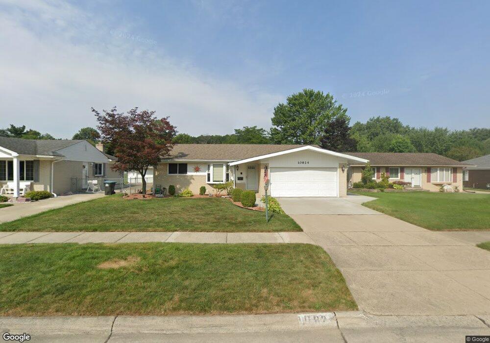
10824 Michael St Taylor, MI 48180
Estimated Value: $242,637 - $301,000
Studio
1
Bath
1,314
Sq Ft
$213/Sq Ft
Est. Value
About This Home
This home is located at 10824 Michael St, Taylor, MI 48180 and is currently estimated at $279,659, approximately $212 per square foot. 10824 Michael St is a home located in Wayne County with nearby schools including Holland Elementary School, Hoover Middle School, and Taylor High School.
Ownership History
Date
Name
Owned For
Owner Type
Purchase Details
Closed on
Apr 5, 2018
Sold by
Ambrose Margaret A
Bought by
Ambrose Margaret A and The Darrel G Armes And Yelondia J Armes
Current Estimated Value
Purchase Details
Closed on
Mar 24, 2014
Sold by
Ambrose Robert B and Ambrose Margaret A
Bought by
Ambrose Margaret A
Home Financials for this Owner
Home Financials are based on the most recent Mortgage that was taken out on this home.
Original Mortgage
$121,950
Outstanding Balance
$92,081
Interest Rate
4.24%
Mortgage Type
New Conventional
Estimated Equity
$187,578
Purchase Details
Closed on
Apr 20, 2000
Sold by
Revo Katherine M Schutte
Bought by
Ambrose Margaret A
Create a Home Valuation Report for This Property
The Home Valuation Report is an in-depth analysis detailing your home's value as well as a comparison with similar homes in the area
Home Values in the Area
Average Home Value in this Area
Purchase History
| Date | Buyer | Sale Price | Title Company |
|---|---|---|---|
| Ambrose Margaret A | -- | None Available | |
| Ambrose Margaret A | -- | Title Source Inc | |
| Ambrose Margaret A | $159,900 | -- |
Source: Public Records
Mortgage History
| Date | Status | Borrower | Loan Amount |
|---|---|---|---|
| Open | Ambrose Margaret A | $121,950 |
Source: Public Records
Tax History
| Year | Tax Paid | Tax Assessment Tax Assessment Total Assessment is a certain percentage of the fair market value that is determined by local assessors to be the total taxable value of land and additions on the property. | Land | Improvement |
|---|---|---|---|---|
| 2025 | $2,834 | $113,000 | $0 | $0 |
| 2024 | $2,744 | $109,600 | $0 | $0 |
| 2023 | $3,297 | $95,900 | $0 | $0 |
| 2022 | $2,618 | $86,700 | $0 | $0 |
| 2021 | $2,901 | $79,600 | $0 | $0 |
| 2020 | $2,875 | $72,700 | $0 | $0 |
| 2019 | $298,645 | $66,100 | $0 | $0 |
| 2018 | $2,250 | $56,800 | $0 | $0 |
| 2017 | $1,271 | $54,700 | $0 | $0 |
| 2016 | $2,803 | $53,400 | $0 | $0 |
| 2015 | $5,080 | $56,000 | $0 | $0 |
| 2013 | $5,040 | $51,300 | $0 | $0 |
| 2012 | $2,168 | $50,900 | $20,700 | $30,200 |
Source: Public Records
Map
Nearby Homes
- 25519 Rusty St
- 25112 Madden St
- 10935 Westlake St
- 25556 Rusty St
- 25737 Rusty St
- 10352 Gulley St
- 25790 Madden St
- 0 Goddard Unit 20251010304
- 25315 Baker St
- 25830 Belledale St
- 9756 Janet St
- Telegraph Telegraph Rd
- 26376 Partridge Dr Unit 89
- 26400 Partridge Dr Unit 88
- 000 Pine Lot A St
- 000 Beechdaly
- 000 Pine Lot B St
- Bayberry Plan at Cypress Garden
- Bannister Plan at Cypress Garden
- Cypress Plan at Cypress Garden
- 10836 Michael St
- 10812 Michael St
- 10812 Michael St
- 10848 Michael St
- 10800 Michael St
- 10817 Michael St
- 10833 Michael St
- 10860 Michael St
- 25234 Anna St
- 25189 Anna St
- 25222 Anna St
- 10872 Michael St
- 25210 Anna St
- 25223 Crisler St
- 25177 Anna St
- 25198 Anna St
- 25211 Crisler St
- 25174 Crisler St
- 25304 Goddard Rd
- 25320 Goddard Rd
Your Personal Tour Guide
Ask me questions while you tour the home.