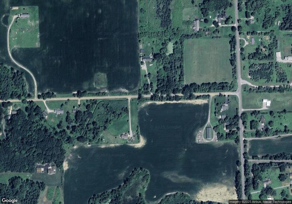
10826 E Cole Rd Durand, MI 48429
Estimated Value: $327,531 - $362,000
3
Beds
3
Baths
1,585
Sq Ft
$216/Sq Ft
Est. Value
About This Home
This home is located at 10826 E Cole Rd, Durand, MI 48429 and is currently estimated at $341,633, approximately $215 per square foot. 10826 E Cole Rd is a home located in Shiawassee County with nearby schools including Byron Area Elementary School, Byron Area Middle School, and Byron Area High School.
Ownership History
Date
Name
Owned For
Owner Type
Purchase Details
Closed on
Sep 18, 2013
Sold by
King Richard Lee
Bought by
King Ii Richard L and King Tina Marie
Current Estimated Value
Purchase Details
Closed on
Nov 30, 2011
Sold by
Fannie Mae
Bought by
King Richard L
Purchase Details
Closed on
May 25, 2011
Sold by
Bac Home Loans Servicing Lp
Bought by
Fannie Mae
Purchase Details
Closed on
Sep 29, 2010
Sold by
Campbell John Bradford and Campbell Hether Sue
Bought by
Bac Home Loans Servicing Lp
Create a Home Valuation Report for This Property
The Home Valuation Report is an in-depth analysis detailing your home's value as well as a comparison with similar homes in the area
Purchase History
| Date | Buyer | Sale Price | Title Company |
|---|---|---|---|
| King Ii Richard L | -- | Cislo Title Company | |
| King Richard L | $105,000 | -- | |
| Fannie Mae | -- | -- | |
| Bac Home Loans Servicing Lp | $220,531 | -- |
Source: Public Records
Tax History
| Year | Tax Paid | Tax Assessment Tax Assessment Total Assessment is a certain percentage of the fair market value that is determined by local assessors to be the total taxable value of land and additions on the property. | Land | Improvement |
|---|---|---|---|---|
| 2025 | $2,308 | $149,700 | $0 | $0 |
| 2024 | $2,232 | $136,600 | $0 | $0 |
| 2023 | $920 | $130,300 | $0 | $0 |
| 2022 | $2,056 | $117,900 | $0 | $0 |
| 2021 | $1,924 | $108,300 | $0 | $0 |
| 2020 | $1,869 | $98,200 | $0 | $0 |
| 2019 | $1,840 | $89,500 | $0 | $0 |
| 2018 | $1,798 | $82,700 | $0 | $0 |
| 2017 | $1,718 | $73,200 | $0 | $0 |
| 2016 | -- | $73,200 | $0 | $0 |
| 2015 | -- | $68,500 | $0 | $0 |
| 2014 | $9 | $66,200 | $0 | $0 |
Source: Public Records
Map
Nearby Homes
- 11700 Britton Rd
- 10160 Lehring Rd
- 0 Williams Rd
- vl Lehring Rd
- 8875 E Miller Rd
- 12102 Rolston Rd
- 11012 Duffield Rd
- 00 Lehring and Britton Roads
- Parcel E Turkey Trail
- Parcel F Turkey Trail
- Parcel D Turkey Trail
- 206 Emmett
- Parcel B Turkey Trail
- 336 Creek Pointe Cir
- 8390 E Pittsburg Rd
- 105 E Naldrette St
- 609 S Kingswood St
- 10001 E Goodall #372 Rd Unit 372
- 105 W John St
- 104 W John St
- 10851 E Cole Rd
- 10980 E Cole Rd
- 10078 S Byron Rd
- 9995 S Byron Rd
- 9995 S Byron Rd
- 9874 S Byron Rd
- 9991 S Byron Rd
- 10101 S Byron Rd
- 10093 S Byron Rd
- 10710 E Cole Rd
- 9923 S Byron Rd
- 9879 S Byron Rd
- 10670 E Cole Rd
- 10153 Byron Rd
- 9800 S Byron Rd
- 10540 E Cole Rd
- 10177 Byron Rd
- 10125 Byron Rd
- 10550 E Cole Rd
