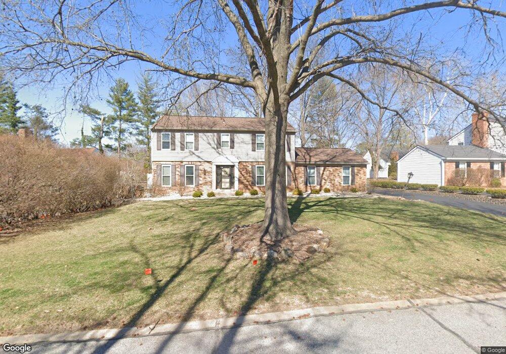
1083 Charolais Dr Ballwin, MO 63011
Estimated Value: $455,576 - $547,000
4
Beds
4
Baths
2,160
Sq Ft
$223/Sq Ft
Est. Value
About This Home
This home is located at 1083 Charolais Dr, Ballwin, MO 63011 and is currently estimated at $481,894, approximately $223 per square foot. 1083 Charolais Dr is a home located in St. Louis County with nearby schools including Kehrs Mill Elementary, Crestview Middle School, and Marquette Sr. High School.
Ownership History
Date
Name
Owned For
Owner Type
Purchase Details
Closed on
Dec 28, 2007
Sold by
Lyons Timothy Edward
Bought by
Collins Michael and Collins Karen
Current Estimated Value
Home Financials for this Owner
Home Financials are based on the most recent Mortgage that was taken out on this home.
Original Mortgage
$243,000
Outstanding Balance
$153,251
Interest Rate
6.23%
Mortgage Type
Purchase Money Mortgage
Estimated Equity
$328,643
Purchase Details
Closed on
Mar 18, 2003
Sold by
Smalley Mary J and Smalley Carrie E
Bought by
Lyons Timothy Edward
Home Financials for this Owner
Home Financials are based on the most recent Mortgage that was taken out on this home.
Original Mortgage
$186,000
Interest Rate
5.83%
Mortgage Type
Purchase Money Mortgage
Purchase Details
Closed on
Nov 14, 2000
Sold by
Howard Robert M and Howard Mary E
Bought by
Smalley Mark H and Smalley Carrie E
Create a Home Valuation Report for This Property
The Home Valuation Report is an in-depth analysis detailing your home's value as well as a comparison with similar homes in the area
Home Values in the Area
Average Home Value in this Area
Purchase History
| Date | Buyer | Sale Price | Title Company |
|---|---|---|---|
| Collins Michael | $270,000 | None Available | |
| Lyons Timothy Edward | $232,500 | -- | |
| Smalley Mark H | $225,000 | -- | |
| Smalley Mark H | -- | -- |
Source: Public Records
Mortgage History
| Date | Status | Borrower | Loan Amount |
|---|---|---|---|
| Open | Collins Michael | $243,000 | |
| Previous Owner | Lyons Timothy Edward | $186,000 | |
| Closed | Lyons Timothy Edward | $23,250 |
Source: Public Records
Tax History Compared to Growth
Tax History
| Year | Tax Paid | Tax Assessment Tax Assessment Total Assessment is a certain percentage of the fair market value that is determined by local assessors to be the total taxable value of land and additions on the property. | Land | Improvement |
|---|---|---|---|---|
| 2025 | $4,516 | $66,610 | $30,590 | $36,020 |
| 2024 | $4,516 | $64,540 | $22,950 | $41,590 |
| 2023 | $4,512 | $64,540 | $22,950 | $41,590 |
| 2022 | $4,311 | $57,260 | $22,950 | $34,310 |
| 2021 | $4,280 | $57,260 | $22,950 | $34,310 |
| 2020 | $4,399 | $56,130 | $22,880 | $33,250 |
| 2019 | $4,417 | $56,130 | $22,880 | $33,250 |
| 2018 | $4,196 | $50,260 | $19,060 | $31,200 |
| 2017 | $4,096 | $50,260 | $19,060 | $31,200 |
| 2016 | $4,077 | $48,110 | $14,310 | $33,800 |
| 2015 | $3,995 | $48,110 | $14,310 | $33,800 |
| 2014 | $3,723 | $43,700 | $10,960 | $32,740 |
Source: Public Records
Map
Nearby Homes
- 1020 Del Ebro Dr
- 2364 the Courts Dr
- 15740 Tambour Ct
- 2316 Coventry Farm Ct
- The Pinehurst Plan at The Glen at Kehrs Mill
- The Belmont Plan at The Glen at Kehrs Mill
- 927 Claytonbrook Dr Unit 3
- 407 Lennox Dr
- 910 Claytonbrook Dr Unit 1
- 2259 Sycamore Dr
- 9 Picardy Hill Dr
- 1019 Claytonbrook Dr Unit 1019
- 15921 Picardy Crest Ct
- 1131 Claytonbrook Ct Unit 1131
- 155 Forest Club Dr
- 295 Meadowbrook Country Club Estate
- 15 Meadowbrook Country Club Estate
- 2202 White Cedar Ct
- 312 Clayton Crossing Dr Unit 304
- 258 Meadowbrook Country Club Estate
- 1077 Charolais Dr
- 1089 Charolais Dr
- 1042 Camargo Dr
- 1036 Camargo Dr
- 1048 Camargo Dr
- 644 Charbray Dr
- 1071 Charolais Dr
- 1076 Charolais Dr
- 1030 Camargo Dr
- 1054 Camargo Dr
- 1095 Charolais Dr
- 1063 Charolais Dr
- 636 Charbray Dr
- 651 Charbray Dr
- 1070 Charolais Dr
- 1022 Camargo Dr
- 643 Charbray Dr
- 1060 Camargo Dr
- 1041 Camargo Dr
- 1035 Camargo Dr