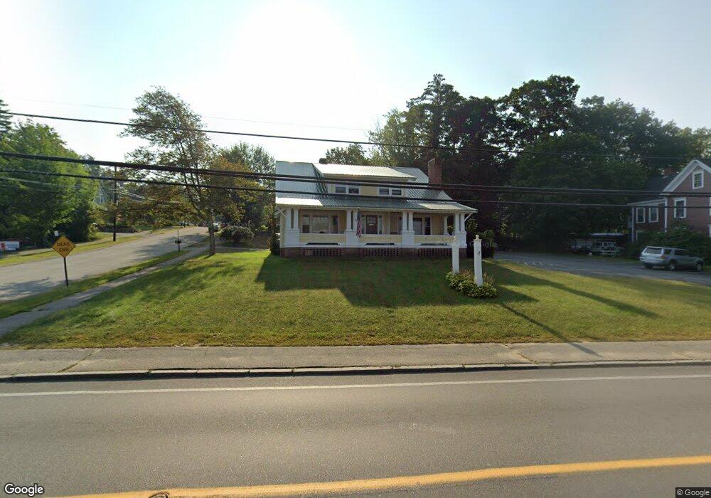
1083 Union Ave Laconia, NH 03246
Estimated Value: $476,880
--
Bed
2
Baths
2,570
Sq Ft
$186/Sq Ft
Est. Value
About This Home
This home is located at 1083 Union Ave, Laconia, NH 03246 and is currently estimated at $476,880, approximately $185 per square foot. 1083 Union Ave is a home located in Belknap County with nearby schools including Laconia Middle School, Laconia High School, and Holy Trinity Catholic School.
Ownership History
Date
Name
Owned For
Owner Type
Purchase Details
Closed on
Sep 13, 2018
Sold by
1083 Union Avenue Llc
Bought by
3 Way Realty Group Llc
Current Estimated Value
Purchase Details
Closed on
Nov 4, 1997
Sold by
Red Hot Props Llc
Bought by
Seed William H and Seed Pamela F
Home Financials for this Owner
Home Financials are based on the most recent Mortgage that was taken out on this home.
Original Mortgage
$130,000
Interest Rate
7.31%
Mortgage Type
Commercial
Create a Home Valuation Report for This Property
The Home Valuation Report is an in-depth analysis detailing your home's value as well as a comparison with similar homes in the area
Home Values in the Area
Average Home Value in this Area
Purchase History
| Date | Buyer | Sale Price | Title Company |
|---|---|---|---|
| 3 Way Realty Group Llc | $250,000 | -- | |
| 3 Way Realty Group Llc | $250,000 | -- | |
| Seed William H | $169,900 | -- | |
| Seed William H | $169,900 | -- |
Source: Public Records
Mortgage History
| Date | Status | Borrower | Loan Amount |
|---|---|---|---|
| Previous Owner | Seed William H | $130,000 | |
| Closed | 3 Way Realty Group Llc | $0 |
Source: Public Records
Tax History Compared to Growth
Tax History
| Year | Tax Paid | Tax Assessment Tax Assessment Total Assessment is a certain percentage of the fair market value that is determined by local assessors to be the total taxable value of land and additions on the property. | Land | Improvement |
|---|---|---|---|---|
| 2024 | $5,629 | $413,000 | $169,200 | $243,800 |
| 2023 | $4,767 | $342,700 | $144,700 | $198,000 |
| 2022 | $4,731 | $318,600 | $120,600 | $198,000 |
| 2021 | $5,641 | $299,100 | $112,600 | $186,500 |
| 2020 | $5,898 | $299,100 | $112,600 | $186,500 |
| 2019 | $5,938 | $288,400 | $101,900 | $186,500 |
| 2018 | $5,759 | $276,200 | $96,500 | $179,700 |
| 2017 | $5,695 | $270,800 | $91,100 | $179,700 |
| 2016 | $5,179 | $233,300 | $53,600 | $179,700 |
| 2015 | $5,850 | $263,500 | $56,400 | $207,100 |
| 2014 | $6,489 | $289,700 | $95,700 | $194,000 |
| 2013 | $6,282 | $284,500 | $90,500 | $194,000 |
Source: Public Records
Map
Nearby Homes
- 26 Saint Catherine St
- 88 Stark St
- 75 Stark St Unit 3
- 106 Valley St
- 122 Valley St
- 95 Massachusetts Ave
- Lot 32 Lady of the Lakes Estates
- 307 Elm St
- 311 Elm St
- 355 Elm St
- 98 Washington St
- 42 Kristen Dr Unit A
- 436 Elm St
- 32 David Lewis Rd
- 29 Port Way
- 240 Franklin St Unit 9
- 32 Chapin Terrace
- 7 Countryside Dr
- 131 Lake St Unit 301
- 131 Lake St Unit 214
- 15 Clark Ave
- 44 Saint Catherine St
- 23 Clark Ave
- 1084 Union Ave
- 18 Clark Ave
- 1061 Union Ave
- 1061 Union Ave Unit 3
- 25 Clark Ave
- 47 Saint Catherine St
- 1063 Union Ave
- 38 Saint Catherine St
- 26 Clark Ave
- 1057 Union Ave
- 33 Clark Ave
- 39 Saint Catherine St
- 30 Clark Ave
- 34 Clark Ave
- 33 Saint Catherine St
- 1047 Union Ave
- 1047 Union Ave Unit 1