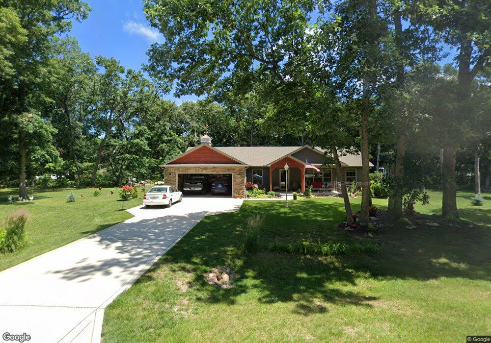
10833 N 555 E Demotte, IN 46310
Estimated Value: $346,587 - $401,000
3
Beds
2
Baths
1,828
Sq Ft
$208/Sq Ft
Est. Value
About This Home
This home is located at 10833 N 555 E, Demotte, IN 46310 and is currently estimated at $379,647, approximately $207 per square foot. 10833 N 555 E is a home with nearby schools including North Newton Junior/Senior High School.
Ownership History
Date
Name
Owned For
Owner Type
Purchase Details
Closed on
Mar 6, 2019
Sold by
Enterprises Armored and Homes Faith
Bought by
Mccarthy Donald R and Mccarthy Pamela D
Current Estimated Value
Home Financials for this Owner
Home Financials are based on the most recent Mortgage that was taken out on this home.
Original Mortgage
$80,000
Outstanding Balance
$70,191
Interest Rate
4.4%
Mortgage Type
New Conventional
Estimated Equity
$309,456
Purchase Details
Closed on
Aug 7, 2018
Sold by
Kentland Bank
Bought by
Armored Enterprises Inc
Purchase Details
Closed on
May 13, 2010
Sold by
Donald E Hartman
Bought by
Kentland Bank
Create a Home Valuation Report for This Property
The Home Valuation Report is an in-depth analysis detailing your home's value as well as a comparison with similar homes in the area
Home Values in the Area
Average Home Value in this Area
Purchase History
| Date | Buyer | Sale Price | Title Company |
|---|---|---|---|
| Mccarthy Donald R | -- | State Street Title | |
| Armored Enterprises Inc | $27,500 | -- | |
| Kentland Bank | -- | Hoffman & Stochel | |
| -- | -- | -- |
Source: Public Records
Mortgage History
| Date | Status | Borrower | Loan Amount |
|---|---|---|---|
| Open | Mccarthy Donald R | $80,000 |
Source: Public Records
Tax History Compared to Growth
Tax History
| Year | Tax Paid | Tax Assessment Tax Assessment Total Assessment is a certain percentage of the fair market value that is determined by local assessors to be the total taxable value of land and additions on the property. | Land | Improvement |
|---|---|---|---|---|
| 2024 | $2,446 | $295,100 | $33,900 | $261,200 |
| 2023 | $2,370 | $273,800 | $33,900 | $239,900 |
| 2022 | $2,572 | $253,200 | $33,900 | $219,300 |
| 2021 | $2,013 | $222,000 | $34,500 | $187,500 |
| 2020 | $2,063 | $215,600 | $34,500 | $181,100 |
| 2019 | $2,027 | $198,700 | $34,500 | $164,200 |
| 2018 | $620 | $29,800 | $29,800 | $0 |
| 2017 | $28 | $1,400 | $1,400 | $0 |
| 2016 | $28 | $1,400 | $1,400 | $0 |
| 2014 | $28 | $1,600 | $1,600 | $0 |
| 2013 | $28 | $1,600 | $1,600 | $0 |
Source: Public Records
Map
Nearby Homes
- 10901 N 555 E
- 10881 N 565 E
- 5592 E 1100 N
- 5338 E Lawler Ct Unit 67
- 10792 N 600 E
- 5527 E 1146 N
- 10446 N 500 E
- 10603 Georgetown Dr
- 4827 E 1040 N
- 10447 N 477 E
- 11546 Georgetown Dr
- 11565 Sherwood Dr
- 29.029 Acres E 900 N
- 4048 E Craig St
- 4092 Ethel St E
- 0 St Road 55
- 0 E St Rd 10 Unit NRA822456
- 0 Porter St Unit NRA824217
- 2801 E 1065 N
- 2790 E 1059 N