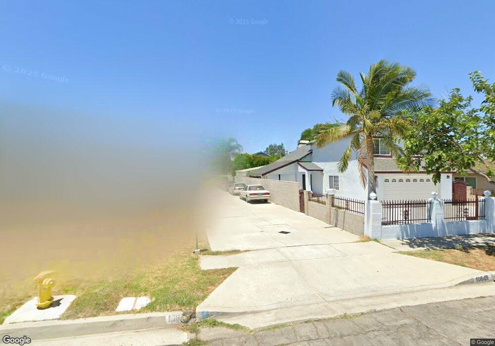
10847 Leland Ave Whittier, CA 90605
South Whittier NeighborhoodEstimated Value: $789,000 - $959,000
3
Beds
2
Baths
2,090
Sq Ft
$420/Sq Ft
Est. Value
About This Home
This home is located at 10847 Leland Ave, Whittier, CA 90605 and is currently estimated at $877,826, approximately $420 per square foot. 10847 Leland Ave is a home located in Los Angeles County with nearby schools including Pioneer High School, Carden Academy of Whittier, and St. Linus Elementary School.
Ownership History
Date
Name
Owned For
Owner Type
Purchase Details
Closed on
Mar 5, 1999
Sold by
Federal Home Loan Mortgage Corporation
Bought by
Salcedo Martin J and Salcedo Bertha
Current Estimated Value
Home Financials for this Owner
Home Financials are based on the most recent Mortgage that was taken out on this home.
Original Mortgage
$159,600
Outstanding Balance
$38,462
Interest Rate
6.7%
Estimated Equity
$839,364
Purchase Details
Closed on
Jun 4, 1998
Sold by
Castro Glorilyn
Bought by
California Mtg Service and Federal Home Loan Mortgage Corporation
Create a Home Valuation Report for This Property
The Home Valuation Report is an in-depth analysis detailing your home's value as well as a comparison with similar homes in the area
Home Values in the Area
Average Home Value in this Area
Purchase History
| Date | Buyer | Sale Price | Title Company |
|---|---|---|---|
| Salcedo Martin J | $168,000 | First American Title Co | |
| California Mtg Service | $175,892 | First American Title Ins Co |
Source: Public Records
Mortgage History
| Date | Status | Borrower | Loan Amount |
|---|---|---|---|
| Open | Salcedo Martin J | $159,600 |
Source: Public Records
Tax History Compared to Growth
Tax History
| Year | Tax Paid | Tax Assessment Tax Assessment Total Assessment is a certain percentage of the fair market value that is determined by local assessors to be the total taxable value of land and additions on the property. | Land | Improvement |
|---|---|---|---|---|
| 2025 | $3,903 | $297,843 | $141,082 | $156,761 |
| 2024 | $3,903 | $292,004 | $138,316 | $153,688 |
| 2023 | $3,787 | $286,279 | $135,604 | $150,675 |
| 2022 | $3,806 | $280,667 | $132,946 | $147,721 |
| 2021 | $3,721 | $275,165 | $130,340 | $144,825 |
| 2019 | $3,654 | $267,005 | $126,475 | $140,530 |
| 2018 | $3,492 | $261,771 | $123,996 | $137,775 |
| 2016 | $3,304 | $251,608 | $119,182 | $132,426 |
| 2015 | $3,222 | $247,829 | $117,392 | $130,437 |
| 2014 | $3,193 | $242,975 | $115,093 | $127,882 |
Source: Public Records
Map
Nearby Homes
- 10849 Inez St
- 11016 Inez St
- 11116 Leland Ave
- 13752 Bentongrove Dr
- 10745 Victoria Ave Unit 4
- 10745 Victoria Ave Unit 6
- 10745 Victoria Ave
- 11329 Telechron Ave
- 11426 Newgate Ave
- 11102 Eagle Ln
- 11118 Bunker Ln
- 13305 Meyer Rd Unit B
- 13538 Lukay St
- 10246 Parkinson Ave
- 13481 Meyer Rd
- 11531 Sunnybrook Ln
- 11518 Fidel Ave
- 10123 Lanett Ave
- 13649 Reis St
- 11428 Painter Ave
- 10845 Leland Ave
- 10849 Leland Ave
- 10851 Leland Ave
- 10903 Leland Ave
- 10833 Leland Ave
- 10825 Leland Ave
- 10827 Leland Ave
- 10840 Inez St
- 10817 Leland Ave
- 10844 Leland Ave
- 10915 Leland Ave
- 10850 Leland Ave
- 10838 Leland Ave
- 10821 Leland Ave
- 10902 Leland Ave
- 10830 Leland Ave
- 10838 Inez St
- 10844 Inez St
- 10815 Leland Ave
- 10906 Leland Ave