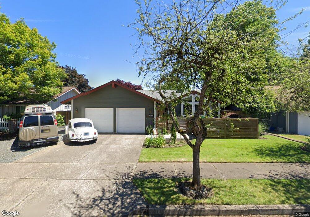
1085 Calvin St Eugene, OR 97401
Harlow NeighborhoodEstimated Value: $505,875 - $531,000
3
Beds
2
Baths
1,494
Sq Ft
$344/Sq Ft
Est. Value
About This Home
This home is located at 1085 Calvin St, Eugene, OR 97401 and is currently estimated at $513,219, approximately $343 per square foot. 1085 Calvin St is a home located in Lane County with nearby schools including Holt Elementary School, Monroe Middle School, and Sheldon High School.
Ownership History
Date
Name
Owned For
Owner Type
Purchase Details
Closed on
Jan 13, 2020
Sold by
Pierce Enda C and Mccarty Enda C
Bought by
Holmes Timothy A and Mccarty Enda C
Current Estimated Value
Purchase Details
Closed on
Jun 29, 2012
Sold by
Horton Christopher D and Horton Lucia T
Bought by
Pierce Enda C
Purchase Details
Closed on
Apr 6, 2010
Sold by
Horton Michael L
Bought by
Horton Christopher D and Horton Lucia T
Purchase Details
Closed on
Jan 22, 2010
Sold by
Horton Christopher D and Horton Lucia T
Bought by
Horton Michael L
Create a Home Valuation Report for This Property
The Home Valuation Report is an in-depth analysis detailing your home's value as well as a comparison with similar homes in the area
Home Values in the Area
Average Home Value in this Area
Purchase History
| Date | Buyer | Sale Price | Title Company |
|---|---|---|---|
| Holmes Timothy A | -- | None Available | |
| Pierce Enda C | $214,000 | Evergreen Land Title Company | |
| Horton Christopher D | $231,000 | None Available | |
| Horton Michael L | $231,000 | None Available |
Source: Public Records
Tax History
| Year | Tax Paid | Tax Assessment Tax Assessment Total Assessment is a certain percentage of the fair market value that is determined by local assessors to be the total taxable value of land and additions on the property. | Land | Improvement |
|---|---|---|---|---|
| 2025 | $4,252 | $218,218 | -- | -- |
| 2024 | $4,199 | $211,863 | -- | -- |
| 2023 | $4,199 | $205,693 | $0 | $0 |
| 2022 | $3,934 | $199,702 | $0 | $0 |
| 2021 | $3,695 | $193,886 | $0 | $0 |
| 2020 | $3,482 | $176,786 | $0 | $0 |
| 2019 | $3,363 | $171,637 | $0 | $0 |
| 2018 | $3,166 | $161,784 | $0 | $0 |
| 2017 | $3,024 | $161,784 | $0 | $0 |
| 2016 | $2,949 | $157,072 | $0 | $0 |
| 2015 | $2,864 | $152,497 | $0 | $0 |
| 2014 | $2,806 | $148,055 | $0 | $0 |
Source: Public Records
Map
Nearby Homes
- 1038 President St
- 1270 Calvin St
- 825 Waverly St
- 1271 Arcadia Dr
- 3700 Babcock Ln Unit 119
- 3700 Babcock Ln Unit 106
- 3025 Bailey Ln
- 1491 Victorian Way
- 1564 Regency Dr
- 0 Sprig Ln Unit Lot 3
- 0 Sprig Ln Unit Lot 3 766109892
- 446 Kodiak St
- 3090 Willakenzie Rd
- 2727 Gateway St Unit 27
- 2872 Suffolk Ct
- 2994 Dapple Way
- 3579 Oxbow Way
- 2746 Harlow Rd
- 1794 Kings St N
- 341 Ransom Ct
- 1055 Calvin St
- 1093 Calvin St
- 1066 Arcadia Dr
- 1097 Calvin St
- 1025 Calvin St
- 1076 Arcadia Dr
- 1054 Arcadia Dr
- 1074 Martha Ct
- 1056 Martha Ct
- 1084 Calvin St
- 1086 Arcadia Dr
- 3596 Vernon Way
- 1101 Calvin St
- 985 Calvin St
- 1096 Arcadia Dr
- 980 Martha Ct
- 990 Arcadia Dr
- 1040 Martha Ct
- 3576 Vernon Way
- 1105 Calvin St
Your Personal Tour Guide
Ask me questions while you tour the home.