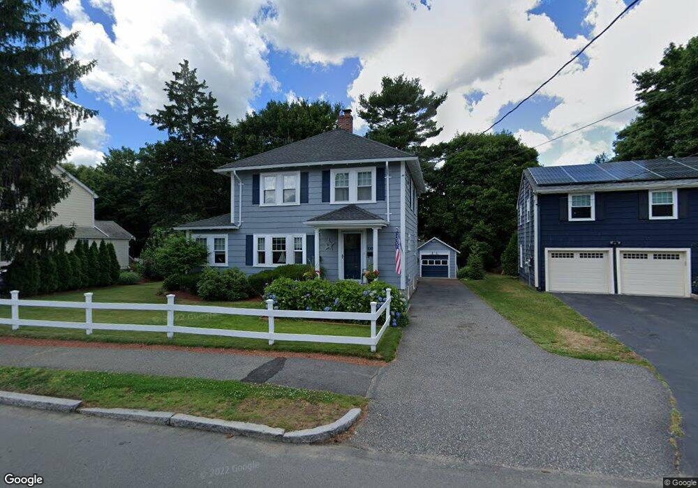
1085 Greendale Ave Needham, MA 02492
Estimated Value: $1,089,000 - $1,285,565
3
Beds
3
Baths
1,858
Sq Ft
$641/Sq Ft
Est. Value
About This Home
This home is located at 1085 Greendale Ave, Needham, MA 02492 and is currently estimated at $1,191,391, approximately $641 per square foot. 1085 Greendale Ave is a home located in Norfolk County with nearby schools including Broadmeadow Elementary School, High Rock Middle School, and Pollard Middle School.
Ownership History
Date
Name
Owned For
Owner Type
Purchase Details
Closed on
Jul 24, 2008
Sold by
Meade Peter J and Meade Mary J
Bought by
Stewart Christopher D and Stewart Donna M
Current Estimated Value
Home Financials for this Owner
Home Financials are based on the most recent Mortgage that was taken out on this home.
Original Mortgage
$520,000
Outstanding Balance
$340,197
Interest Rate
6.35%
Mortgage Type
Purchase Money Mortgage
Estimated Equity
$851,194
Create a Home Valuation Report for This Property
The Home Valuation Report is an in-depth analysis detailing your home's value as well as a comparison with similar homes in the area
Home Values in the Area
Average Home Value in this Area
Purchase History
| Date | Buyer | Sale Price | Title Company |
|---|---|---|---|
| Stewart Christopher D | $589,100 | -- |
Source: Public Records
Mortgage History
| Date | Status | Borrower | Loan Amount |
|---|---|---|---|
| Open | Stewart Christopher D | $520,000 |
Source: Public Records
Tax History Compared to Growth
Tax History
| Year | Tax Paid | Tax Assessment Tax Assessment Total Assessment is a certain percentage of the fair market value that is determined by local assessors to be the total taxable value of land and additions on the property. | Land | Improvement |
|---|---|---|---|---|
| 2025 | $8,906 | $840,200 | $566,900 | $273,300 |
| 2024 | $9,226 | $736,900 | $382,400 | $354,500 |
| 2023 | $9,208 | $706,100 | $382,400 | $323,700 |
| 2022 | $8,982 | $671,800 | $357,400 | $314,400 |
| 2021 | $8,754 | $671,800 | $357,400 | $314,400 |
| 2020 | $8,426 | $674,600 | $357,800 | $316,800 |
| 2019 | $7,896 | $637,300 | $325,300 | $312,000 |
| 2018 | $7,571 | $637,300 | $325,300 | $312,000 |
| 2017 | $7,113 | $598,200 | $325,300 | $272,900 |
| 2016 | $6,938 | $601,200 | $325,300 | $275,900 |
| 2015 | $6,788 | $601,200 | $325,300 | $275,900 |
| 2014 | $6,690 | $574,700 | $309,800 | $264,900 |
Source: Public Records
Map
Nearby Homes
- 1052 Greendale Ave
- 97 Great Plain Ave
- 201 Valley Rd
- 107 Valley Rd
- 242 Valley Rd
- 1206 Greendale Ave Unit 201
- 133 Lawton Rd
- 129 Lawton Rd
- 37 Cottage Cir
- 37 Cottage Cir Unit 37
- 178 South St
- 883 Greendale Ave
- 247 Broad Meadow Rd
- 701 Greendale Ave
- 342 Needham St
- 8 Wilshire Park
- 175 Schoolmaster Ln
- 26 Pinewood Rd
- 62 Washington Ave
- 297 Pine St
- 1091 Greendale Ave
- 1081 Greendale Ave
- 31 Fairfield St
- 25 Fairfield St
- 1077 Greendale Ave
- 39 Fairfield St
- 1082 Greendale Ave
- 1097 Greendale Ave
- 19 Fairfield St
- 1098 Greendale Ave
- 1071 Greendale Ave
- 1100 Greendale Ave
- 15 Fairfield St
- 1072 Greendale Ave
- 1078 Greendale Ave
- 1065 Greendale Ave
- 17 Peacedale Cir
- 1106 Greendale Ave
- 53 Fairfield St
- 32 Fairfield St