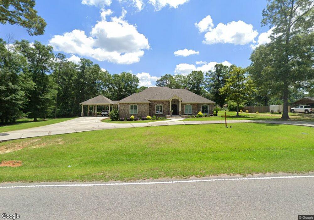
10855 Beverly Jeffries Hwy Unit 22 Citronelle, AL 36522
Estimated Value: $417,000 - $471,000
--
Bed
--
Bath
3,368
Sq Ft
$129/Sq Ft
Est. Value
About This Home
This home is located at 10855 Beverly Jeffries Hwy Unit 22, Citronelle, AL 36522 and is currently estimated at $435,091, approximately $129 per square foot. 10855 Beverly Jeffries Hwy Unit 22 is a home located in Mobile County with nearby schools including McDavid-Jones Elementary School, Lott Middle School, and Citronelle High School.
Ownership History
Date
Name
Owned For
Owner Type
Purchase Details
Closed on
Oct 30, 2020
Sold by
Best Joseph D and Best Jessica C
Bought by
Stewart Steven and Stewart Delain
Current Estimated Value
Home Financials for this Owner
Home Financials are based on the most recent Mortgage that was taken out on this home.
Original Mortgage
$313,500
Outstanding Balance
$278,970
Interest Rate
2.8%
Mortgage Type
New Conventional
Estimated Equity
$156,121
Purchase Details
Closed on
Jun 8, 2007
Sold by
Perez Israel and Perez Margie H
Bought by
Best Joseph D
Create a Home Valuation Report for This Property
The Home Valuation Report is an in-depth analysis detailing your home's value as well as a comparison with similar homes in the area
Home Values in the Area
Average Home Value in this Area
Purchase History
| Date | Buyer | Sale Price | Title Company |
|---|---|---|---|
| Stewart Steven | $330,000 | Fmt | |
| Best Joseph D | $19,000 | Slt | |
| Best Joseph D | -- | Slt |
Source: Public Records
Mortgage History
| Date | Status | Borrower | Loan Amount |
|---|---|---|---|
| Open | Stewart Steven | $313,500 |
Source: Public Records
Tax History Compared to Growth
Tax History
| Year | Tax Paid | Tax Assessment Tax Assessment Total Assessment is a certain percentage of the fair market value that is determined by local assessors to be the total taxable value of land and additions on the property. | Land | Improvement |
|---|---|---|---|---|
| 2024 | $1,661 | $31,690 | $1,000 | $30,690 |
| 2023 | $1,661 | $34,140 | $1,500 | $32,640 |
| 2022 | $1,658 | $31,650 | $1,700 | $29,950 |
| 2021 | $1,446 | $27,750 | $1,700 | $26,050 |
| 2020 | $1,460 | $28,020 | $1,700 | $26,320 |
| 2019 | $1,499 | $28,740 | $1,500 | $27,240 |
| 2018 | $1,499 | $28,740 | $0 | $0 |
| 2017 | $1,469 | $26,960 | $0 | $0 |
| 2016 | $164 | $3,000 | $0 | $0 |
| 2013 | $164 | $3,000 | $0 | $0 |
Source: Public Records
Map
Nearby Homes
- 00000 Beverly Jeffries Hwy
- 0 Dogwood Dr Unit LOT 2 10608062
- 0 Dogwood Dr Unit 7179557
- 10805 Mitt Dr
- 10835 Mitt Dr
- 11135 Hickory Ct
- 10645 Dogwood Dr
- 0 Wilson Dr Unit 7179706
- 19335 Robert Walker Rd
- 0 Robert Walker Rd
- 12950 Beverly Jeffries Hwy
- 8770 State St
- 8525 South St
- 8800 W Williams St
- 8520 W Lebaron Ave
- 19645 N 5th St
- 8375 Lloyd Ln
- 18280 S 6th St
- 18975 S 3rd St
- 19850 N 5th St
- 10855 Beverly Jeffries Hwy
- 10865 Beverly Jeffries Hwy
- 10865 Beverly Jeffries Hwy Unit 1
- 1 Beverly Jeffries Hwy Unit CAMP 1
- 1 Beverly Jeffries Hwy
- 10895 Beverly Jeffries Hwy
- 10925 Beverly Jeffries Hwy
- 000 Beverly Jeffries Hwy Unit LOT 6 & 7
- 00 Beverly Jeffries Hwy Unit LOT 17
- 15455 Beverly Jeffries Hwy
- 2 Beverly Jeffries Hwy
- 11550 Beverly Jeffries Hwy
- 6 Beverly Jeffries Hwy
- 3 Beverly Jeffries Hwy
- 6 Beverly Jeffries Hwy Unit 6
- 10815 Beverly Jeffries Hwy
- 10870 Bayleaf Dr
- 10890 Bayleaf Dr
- 10830 Bayleaf Dr
- 10790 Bayleaf Dr