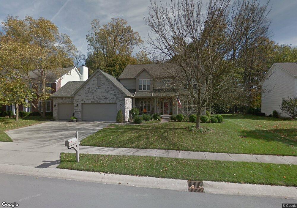
10855 Weston Dr Carmel, IN 46032
West Carmel NeighborhoodEstimated Value: $516,000 - $564,408
4
Beds
3
Baths
3,734
Sq Ft
$143/Sq Ft
Est. Value
About This Home
This home is located at 10855 Weston Dr, Carmel, IN 46032 and is currently estimated at $535,602, approximately $143 per square foot. 10855 Weston Dr is a home located in Hamilton County with nearby schools including Towne Meadow Elementary School, Creekside Middle School, and Carmel High School.
Ownership History
Date
Name
Owned For
Owner Type
Purchase Details
Closed on
Jul 29, 2003
Sold by
Ufford Mark G and Ufford Abigail
Bought by
Drzewiecki David S and Drzewiecki Cathy J
Current Estimated Value
Home Financials for this Owner
Home Financials are based on the most recent Mortgage that was taken out on this home.
Original Mortgage
$141,000
Outstanding Balance
$60,687
Interest Rate
5.31%
Mortgage Type
Unknown
Estimated Equity
$474,915
Create a Home Valuation Report for This Property
The Home Valuation Report is an in-depth analysis detailing your home's value as well as a comparison with similar homes in the area
Home Values in the Area
Average Home Value in this Area
Purchase History
| Date | Buyer | Sale Price | Title Company |
|---|---|---|---|
| Drzewiecki David S | -- | -- |
Source: Public Records
Mortgage History
| Date | Status | Borrower | Loan Amount |
|---|---|---|---|
| Open | Drzewiecki David S | $141,000 | |
| Closed | Drzewiecki David S | $111,700 |
Source: Public Records
Tax History Compared to Growth
Tax History
| Year | Tax Paid | Tax Assessment Tax Assessment Total Assessment is a certain percentage of the fair market value that is determined by local assessors to be the total taxable value of land and additions on the property. | Land | Improvement |
|---|---|---|---|---|
| 2024 | $4,393 | $441,800 | $129,100 | $312,700 |
| 2023 | $4,393 | $411,200 | $81,300 | $329,900 |
| 2022 | $4,047 | $356,200 | $81,300 | $274,900 |
| 2021 | $3,482 | $309,500 | $81,300 | $228,200 |
| 2020 | $3,218 | $286,500 | $81,300 | $205,200 |
| 2019 | $3,047 | $273,100 | $81,300 | $191,800 |
| 2018 | $3,080 | $279,100 | $58,700 | $220,400 |
| 2017 | $3,134 | $281,200 | $58,700 | $222,500 |
| 2016 | $2,996 | $272,900 | $58,700 | $214,200 |
| 2014 | $2,568 | $251,500 | $59,400 | $192,100 |
Source: Public Records
Map
Nearby Homes
- 10890 Weston Dr
- 10739 Gettysburg Place
- 10928 Valley Forge Cir
- 4141 W 116th St
- 10680 Morristown Ct
- 4514 Golden Eagle Ct
- 2987 Cameo Dr
- 3717 Zuker Ct
- 10470 Roxley Bend
- 3853 Abney Highland Dr
- 4248 Stone Lake Dr
- 6330 Mayfield Ln
- 3747 W 121st St
- 3733 W 121st St
- 10547 Noma Ct
- 11915 Kelso Dr Unit 2
- 10211 Tammer Dr
- 35 Spring Dr
- 3521 Inverness Blvd
- 1 Woodard Bluff
- 10859 Weston Dr
- 10849 Independence Way
- 10863 Weston Dr
- 3808 Vanguard Cir
- 3807 Vanguard Cir
- 10845 Independence Way
- 10869 Weston Dr
- 10850 Independence Way
- 3810 Vanguard Cir
- 3807 Brigade Cir
- 3809 Vanguard Cir
- 10838 Independence Way
- 10871 Weston Dr
- 10846 Weston Dr
- 3809 Brigade Cir
- 10835 Independence Way
- 3812 Vanguard Cir
- 3811 Vanguard Cir
- 10851 Independence Way
- 10843 Weston Dr