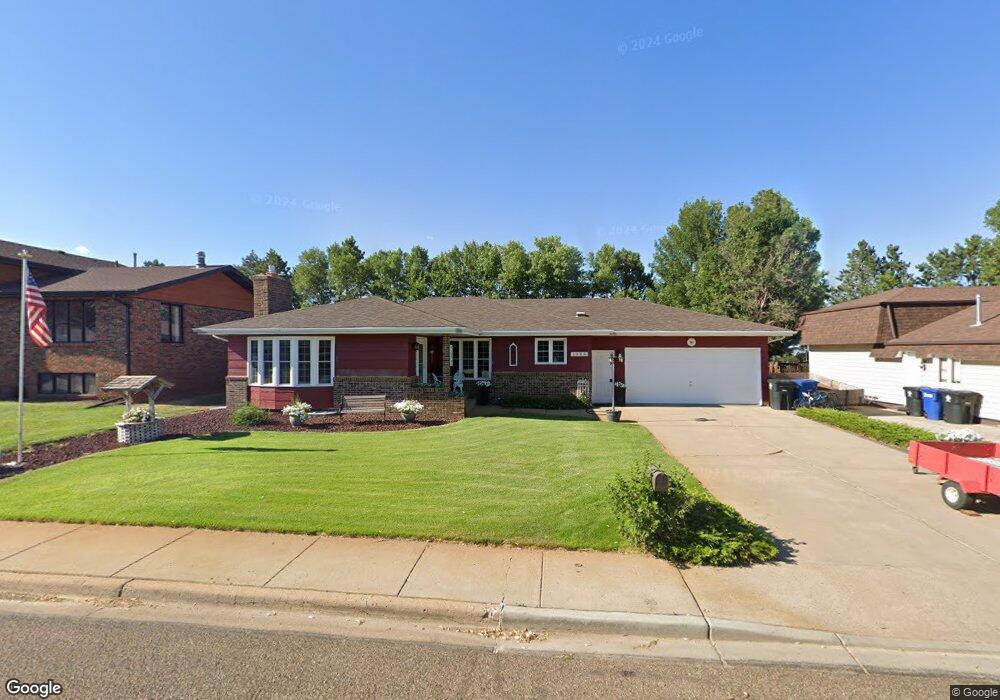
1086 13th St W Dickinson, ND 58601
Estimated Value: $345,000 - $373,965
3
Beds
2
Baths
1,531
Sq Ft
$233/Sq Ft
Est. Value
About This Home
This home is located at 1086 13th St W, Dickinson, ND 58601 and is currently estimated at $356,655, approximately $232 per square foot. 1086 13th St W is a home located in Stark County with nearby schools including Trinity Catholic Schools.
Ownership History
Date
Name
Owned For
Owner Type
Purchase Details
Closed on
May 9, 2023
Sold by
Brost Allen R and Brost Diane B
Bought by
Brost Family Trust
Current Estimated Value
Purchase Details
Closed on
Jul 1, 2019
Sold by
Kovash Perry and Kovash Sonja
Bought by
Brost Allen R and Brost Diane B
Home Financials for this Owner
Home Financials are based on the most recent Mortgage that was taken out on this home.
Original Mortgage
$126,000
Interest Rate
4%
Mortgage Type
New Conventional
Create a Home Valuation Report for This Property
The Home Valuation Report is an in-depth analysis detailing your home's value as well as a comparison with similar homes in the area
Home Values in the Area
Average Home Value in this Area
Purchase History
| Date | Buyer | Sale Price | Title Company |
|---|---|---|---|
| Brost Family Trust | -- | None Listed On Document | |
| Brost Allen R | $252,000 | Queen City Abstract |
Source: Public Records
Mortgage History
| Date | Status | Borrower | Loan Amount |
|---|---|---|---|
| Previous Owner | Brost Allen R | $126,000 |
Source: Public Records
Tax History
| Year | Tax Paid | Tax Assessment Tax Assessment Total Assessment is a certain percentage of the fair market value that is determined by local assessors to be the total taxable value of land and additions on the property. | Land | Improvement |
|---|---|---|---|---|
| 2025 | $595 | $264,000 | $41,100 | $222,900 |
| 2024 | $3,255 | $264,000 | $41,100 | $222,900 |
| 2023 | $632 | $264,000 | $41,100 | $222,900 |
| 2022 | $2,473 | $124,300 | $0 | $0 |
| 2021 | $2,421 | $235,300 | $41,100 | $194,200 |
| 2020 | $2,454 | $217,000 | $41,100 | $175,900 |
| 2019 | $2,270 | $217,000 | $41,100 | $175,900 |
| 2017 | $2,122 | $217,000 | $41,100 | $175,900 |
| 2015 | $2,122 | $242,400 | $41,200 | $201,200 |
| 2014 | $2,219 | $234,700 | $41,200 | $193,500 |
| 2013 | -- | $226,900 | $41,200 | $185,700 |
Source: Public Records
Map
Nearby Homes
- 1248 12th St W
- 1130 12th Ave W
- 1322 13th St W
- 1423 W High St
- 1586 14th St W
- 1638 14th St W
- 0 Block 6 Lot 6 Grassland Dr
- Block 6 Lot 4 Grassland Dr
- Block 6 Lot 6 Grassland Dr
- Block 6 Lot 5 Grassland Dr
- Block 6 Lot 3 Grassland Dr
- 0 Block 6 Lot 5 Grassland Dr
- 1760 Sunrise Dr
- 1772 Sunrise Dr
- 0 Block 6 Lot 11 Sunrise Dr
- 0 Block 6 Lot 10 Sunrise Dr
- 0 Block 6 Lot 9 Sunrise Dr
- 0 Block 6 Lot 4 Grassland Dr
- 0 Lot 8 Block 6 Prairie Creek
- 1814 Sunrise Dr
Your Personal Tour Guide
Ask me questions while you tour the home.