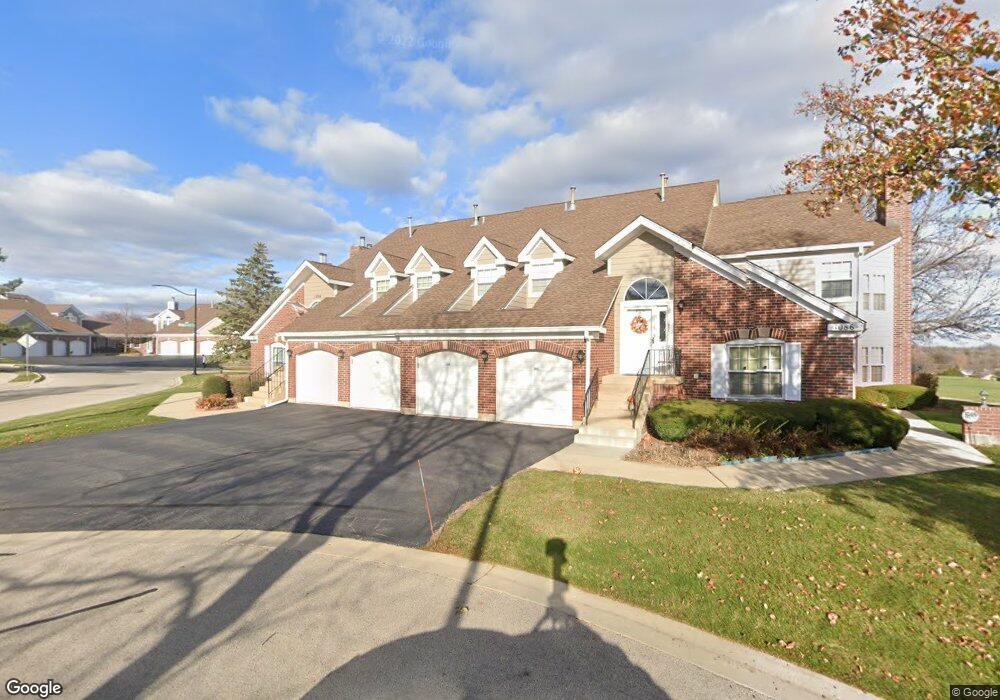
1086 Saint Andrews Ct Unit 191 Algonquin, IL 60102
Estimated Value: $272,627 - $278,000
2
Beds
2
Baths
1,500
Sq Ft
$184/Sq Ft
Est. Value
About This Home
This home is located at 1086 Saint Andrews Ct Unit 191, Algonquin, IL 60102 and is currently estimated at $275,907, approximately $183 per square foot. 1086 Saint Andrews Ct Unit 191 is a home located in McHenry County with nearby schools including Westfield Community School, Kenneth E Neubert Elementary School, and Harry D Jacobs High School.
Ownership History
Date
Name
Owned For
Owner Type
Purchase Details
Closed on
Jun 4, 2010
Sold by
First Midwest Bank
Bought by
Sfikas Mike and Sfikas Evangeline
Current Estimated Value
Home Financials for this Owner
Home Financials are based on the most recent Mortgage that was taken out on this home.
Original Mortgage
$60,000
Outstanding Balance
$40,527
Interest Rate
5.13%
Mortgage Type
New Conventional
Estimated Equity
$235,381
Purchase Details
Closed on
Jul 25, 2005
Sold by
Smith Perry C H
Bought by
Smith Perry C H
Purchase Details
Closed on
Feb 17, 1997
Sold by
Smith Perry C and Smith Joanne L
Bought by
Smith Perry C and Smith Joanne L
Purchase Details
Closed on
Aug 16, 1995
Sold by
Olga Lally Revocable Trust
Bought by
Smith Perry C H and Smith Joanne L
Home Financials for this Owner
Home Financials are based on the most recent Mortgage that was taken out on this home.
Original Mortgage
$122,000
Interest Rate
7.55%
Create a Home Valuation Report for This Property
The Home Valuation Report is an in-depth analysis detailing your home's value as well as a comparison with similar homes in the area
Home Values in the Area
Average Home Value in this Area
Purchase History
| Date | Buyer | Sale Price | Title Company |
|---|---|---|---|
| Sfikas Mike | $130,000 | Ticor | |
| Smith Perry C H | -- | -- | |
| Smith Perry C | -- | -- | |
| Smith Perry C H | $123,500 | -- |
Source: Public Records
Mortgage History
| Date | Status | Borrower | Loan Amount |
|---|---|---|---|
| Open | Sfikas Mike | $60,000 | |
| Previous Owner | Smith Perry C H | $122,000 |
Source: Public Records
Tax History Compared to Growth
Tax History
| Year | Tax Paid | Tax Assessment Tax Assessment Total Assessment is a certain percentage of the fair market value that is determined by local assessors to be the total taxable value of land and additions on the property. | Land | Improvement |
|---|---|---|---|---|
| 2024 | $1,894 | $70,188 | $15,898 | $54,290 |
| 2023 | $2,027 | $62,775 | $14,219 | $48,556 |
| 2022 | $2,505 | $60,384 | $22,849 | $37,535 |
| 2021 | $2,592 | $56,255 | $21,287 | $34,968 |
| 2020 | $2,623 | $54,263 | $20,533 | $33,730 |
| 2019 | $2,682 | $51,937 | $19,653 | $32,284 |
| 2018 | $2,784 | $45,511 | $18,155 | $27,356 |
| 2017 | $2,909 | $42,874 | $17,103 | $25,771 |
| 2016 | $3,072 | $40,212 | $16,041 | $24,171 |
| 2013 | -- | $45,812 | $14,965 | $30,847 |
Source: Public Records
Map
Nearby Homes
- 1028 Interloch Ct Unit 163
- 12 White Oak Ct
- 1850 White Oak Dr
- SWC Talaga and Algonquin Rd
- 1 N Hubbard St
- 1820 Crofton Dr
- 1721 Fernwood Ln
- 2021 Brindlewood Ln
- 741 Regal Ln
- 2043 Peach Tree Ln Unit 4122
- 1210 Brandywine Cir
- 700 Fairfield Ln
- 18 Dellwood Ct Unit 4204
- 2101 Peach Tree Ln Unit 4094
- 000 County Line Rd
- 1860 Haverford Dr
- 2060 Dorchester Ave
- 1900 Waverly Ln
- 6 Sutcliff Ct
- 1362 S Parkview Terrace
- 1082 Saint Andrews Ct Unit 192
- 1088 Saint Andrews Ct
- 1653 Edgewood Dr Unit 183
- 1651 Edgewood Dr Unit 181
- 1655 Edgewood Dr
- 1657 Edgewood Dr Unit 18B
- 1077 Saint Andrews Ct Unit 304
- 1106 Saint Andrews Ct Unit 202
- 1148 Saint Andrews Ct Unit 221
- 1104 Saint Andrews Ct Unit 203
- 1102 Saint Andrews Ct Unit 204
- 1146 Saint Andrews Ct Unit 222
- 1104 St Andrews Ct
- 1071 Saint Andrews Ct Unit 301
- 1071 Saint Andrews Ct Unit 1071
- 1073 Saint Andrews Ct Unit 303
- 1075 Saint Andrews Ct Unit 302
- 1073 Saint Andrews Ct Unit 4
- 1075 Saint Andrews Ct Unit 1
- 1108 Saint Andrews Ct Unit 201