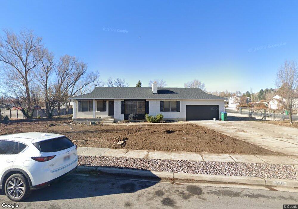
10861 N 5870 W Highland, UT 84003
Estimated Value: $733,857 - $839,000
5
Beds
3
Baths
3,114
Sq Ft
$247/Sq Ft
Est. Value
About This Home
This home is located at 10861 N 5870 W, Highland, UT 84003 and is currently estimated at $769,619, approximately $247 per square foot. 10861 N 5870 W is a home located in Utah County with nearby schools including Highland Elementary School, Mountain Ridge Junior High School, and Lone Peak High School.
Ownership History
Date
Name
Owned For
Owner Type
Purchase Details
Closed on
Feb 14, 2024
Sold by
Mountford Robin A and Mountford Kevin
Bought by
K & M Spackman Holdings Llp
Current Estimated Value
Purchase Details
Closed on
Oct 31, 2023
Sold by
Mountford Robin and Mountford Kevin
Bought by
K & M Spackman Holdings Llp
Home Financials for this Owner
Home Financials are based on the most recent Mortgage that was taken out on this home.
Original Mortgage
$620,000
Interest Rate
7.19%
Mortgage Type
Seller Take Back
Purchase Details
Closed on
Jun 16, 2008
Sold by
Brown Gail N
Bought by
Mountford Robin A and Mountford Kevin
Home Financials for this Owner
Home Financials are based on the most recent Mortgage that was taken out on this home.
Original Mortgage
$270,000
Interest Rate
6.07%
Mortgage Type
Purchase Money Mortgage
Create a Home Valuation Report for This Property
The Home Valuation Report is an in-depth analysis detailing your home's value as well as a comparison with similar homes in the area
Home Values in the Area
Average Home Value in this Area
Purchase History
| Date | Buyer | Sale Price | Title Company |
|---|---|---|---|
| K & M Spackman Holdings Llp | -- | Stewart Title | |
| K & M Spackman Holdings Llp | -- | Stewart Title | |
| Mountford Robin A | -- | Title West Highland Offic |
Source: Public Records
Mortgage History
| Date | Status | Borrower | Loan Amount |
|---|---|---|---|
| Previous Owner | K & M Spackman Holdings Llp | $620,000 | |
| Previous Owner | Mountford Robin A | $270,000 |
Source: Public Records
Tax History
| Year | Tax Paid | Tax Assessment Tax Assessment Total Assessment is a certain percentage of the fair market value that is determined by local assessors to be the total taxable value of land and additions on the property. | Land | Improvement |
|---|---|---|---|---|
| 2025 | $2,760 | $354,640 | -- | -- |
| 2024 | $2,760 | $340,945 | $0 | $0 |
| 2023 | $2,610 | $347,820 | $0 | $0 |
| 2022 | $2,612 | $337,425 | $0 | $0 |
| 2021 | $2,245 | $432,100 | $188,800 | $243,300 |
| 2020 | $2,109 | $398,100 | $164,200 | $233,900 |
| 2019 | $1,912 | $377,500 | $164,200 | $213,300 |
| 2018 | $1,886 | $353,900 | $152,200 | $201,700 |
| 2017 | $1,811 | $181,390 | $0 | $0 |
| 2016 | $1,793 | $167,805 | $0 | $0 |
| 2015 | $1,817 | $161,205 | $0 | $0 |
| 2014 | $1,591 | $139,920 | $0 | $0 |
Source: Public Records
Map
Nearby Homes
- 10818 N 6000 W
- 10801 N 6000 W
- 5843 W Avonmore Cir
- 11124 N 6000 W
- 5538 W Naples Dr Unit 125
- 5538 W Turin Ln
- 5519 W Coventry Rd
- 11248 Hawkstone Way Unit 109
- 6024 Hawkstone Way Unit 108
- 11228 Hawkstone Way Unit 110
- 10919 N Town Center Blvd
- 10862 N Marble Manor
- 10825 N Black Shale Loop Unit 503
- 5983 W 11270 N Unit 4
- 5976 W 11270 N Unit 5
- 10507 N 5470 W
- 5348 W 10700 N
- 10531 N Alpine Hwy
- 10434 N 6400 W
- 5747 W Yorkshire Ct
- 10862 N 5920 W
- 10839 N 5870 W
- 10864 N 5870 W
- 10893 N 5870 W
- 10838 N 5920 W
- 10840 N 5870 W
- 10884 N 5870 W
- 5908 W 10880 N
- 10815 N 5870 W
- 5889 W 10920 N
- 10855 N 5800 W
- 10814 N 5920 W
- 10841 N 5920 W
- 10829 N 5800 W
- 10816 N 5870 W
- 10883 N 5920 W
- 11306 N Brookline Dr
- 11324 N 4650 W Unit 10
- 11303 N 4650 W Unit 12
- 11302 N 4650 W Unit 11
Your Personal Tour Guide
Ask me questions while you tour the home.