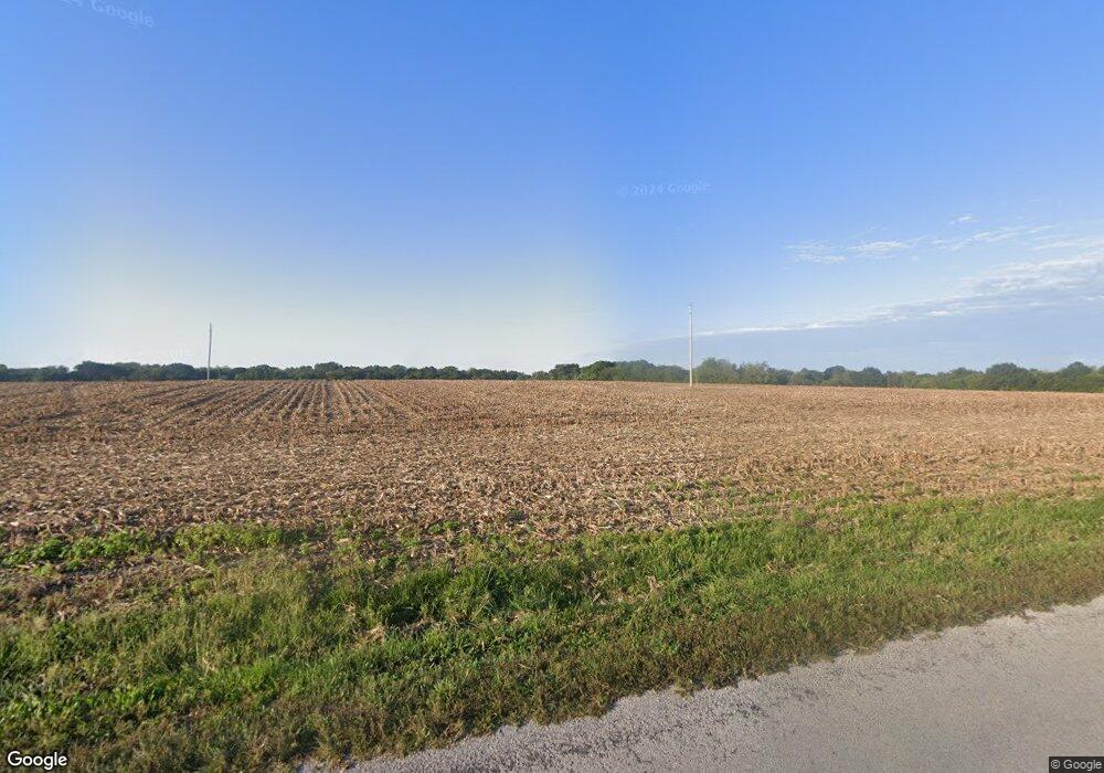
10865 Ridge Rd Sparta, IL 62286
Estimated Value: $20,000 - $122,000
--
Bed
--
Bath
--
Sq Ft
1.52
Acres
About This Home
This home is located at 10865 Ridge Rd, Sparta, IL 62286 and is currently estimated at $71,000. 10865 Ridge Rd is a home located in Randolph County with nearby schools including Sparta High School.
Ownership History
Date
Name
Owned For
Owner Type
Purchase Details
Closed on
Apr 10, 2013
Sold by
Dixon Daniel
Bought by
Cowell Charles G and Cowell Rebecca S
Current Estimated Value
Home Financials for this Owner
Home Financials are based on the most recent Mortgage that was taken out on this home.
Original Mortgage
$237,297
Interest Rate
4%
Mortgage Type
Unknown
Purchase Details
Closed on
May 16, 2005
Sold by
Kelley Charles H and Kelley Deborah D
Bought by
Dixon Daniel W
Home Financials for this Owner
Home Financials are based on the most recent Mortgage that was taken out on this home.
Original Mortgage
$25,000
Interest Rate
7.5%
Mortgage Type
Adjustable Rate Mortgage/ARM
Create a Home Valuation Report for This Property
The Home Valuation Report is an in-depth analysis detailing your home's value as well as a comparison with similar homes in the area
Home Values in the Area
Average Home Value in this Area
Purchase History
| Date | Buyer | Sale Price | Title Company |
|---|---|---|---|
| Cowell Charles G | $45,000 | None Available | |
| Dixon Daniel W | $40,000 | None Available |
Source: Public Records
Mortgage History
| Date | Status | Borrower | Loan Amount |
|---|---|---|---|
| Closed | Cowell Charles G | $237,297 | |
| Previous Owner | Dixon Daniel W | $25,000 |
Source: Public Records
Tax History Compared to Growth
Tax History
| Year | Tax Paid | Tax Assessment Tax Assessment Total Assessment is a certain percentage of the fair market value that is determined by local assessors to be the total taxable value of land and additions on the property. | Land | Improvement |
|---|---|---|---|---|
| 2024 | $104 | $1,405 | $1,405 | $0 |
| 2023 | $97 | $1,305 | $1,305 | $0 |
| 2022 | $86 | $1,305 | $1,305 | $0 |
| 2021 | $91 | $1,230 | $1,230 | $0 |
| 2020 | $85 | $1,261 | $1,261 | $0 |
| 2019 | $84 | $1,130 | $1,130 | $0 |
| 2018 | $84 | $1,246 | $1,246 | $0 |
| 2017 | $71 | $1,140 | $1,140 | $0 |
| 2016 | $77 | $1,100 | $1,100 | $0 |
| 2015 | $78 | $1,100 | $1,100 | $0 |
| 2014 | $78 | $1,120 | $1,120 | $0 |
| 2013 | $730 | $2,800 | $1,135 | $1,665 |
Source: Public Records
Map
Nearby Homes
- 1007 Hillcrest Dr
- 1119 Norwood Dr
- 715 W Broadway St
- 1117 Meadow Ln
- 336 W Jackson St
- 801 N Market St
- 515 N Market St
- 501 N Market St
- 119 Fox Run
- 35 Bogey Run
- 1125 N Market St
- 140&142 W Broadway
- 321 Sunset Dr
- 332 S Saint Louis St
- 410 S Saint Louis St
- 321 S Market St
- 105 S Washington
- 115 W 4th St
- 151 Doc Lin Dr
- 255 Delwood Dr
- 707 Campbell Dr
- 803 Hillcrest Dr
- 606 Hillcrest Dr
- 800 Hillcrest Dr
- 805 Hillcrest Dr
- 315 Hillcrest Dr
- 624 Athens Ave
- 705 Campbell Dr
- 807 Hillcrest Dr
- 620 Athens Ave
- 803 Cretan Ct
- 303 Hillcrest Dr
- 701 Campbell Dr
- 1247 W Broadway St
- 805 Cretan Ct
- 1201 W Broadway St
- 1205 W Broadway St
- 616 Athens Ave
- 615 Athens Ave
- 1001 Hillcrest Dr
