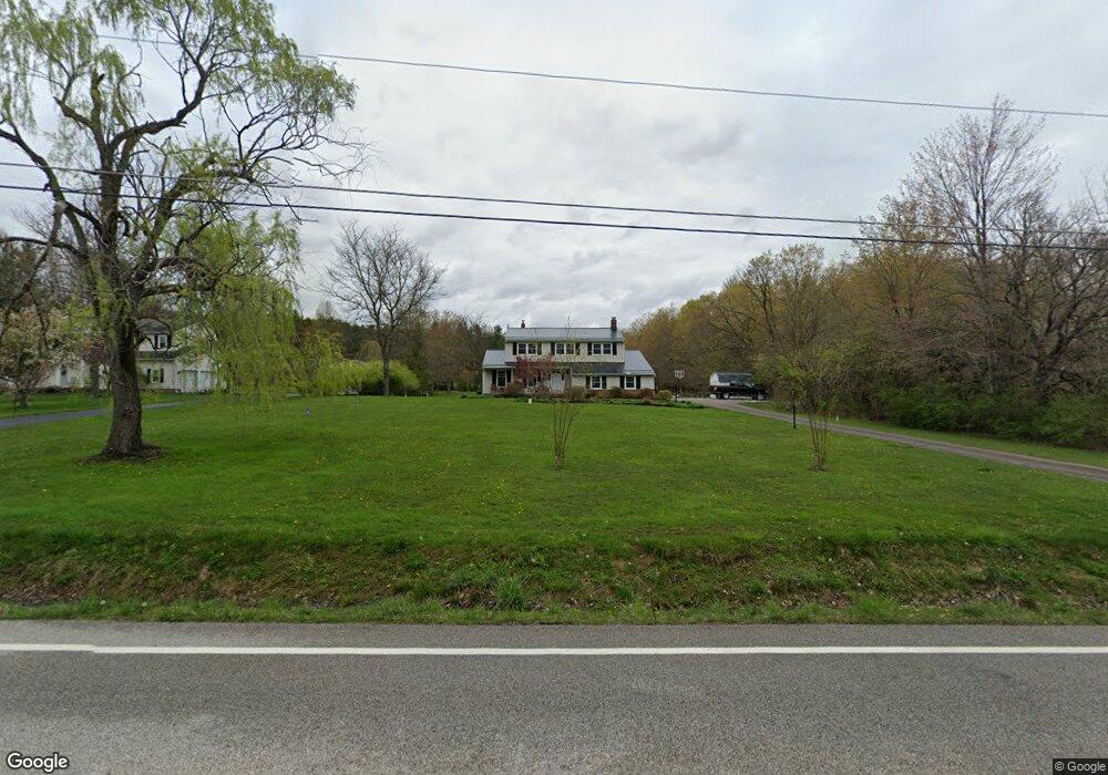
10880 Sherman Rd Chardon, OH 44024
Estimated Value: $353,000 - $477,000
4
Beds
3
Baths
2,100
Sq Ft
$190/Sq Ft
Est. Value
About This Home
This home is located at 10880 Sherman Rd, Chardon, OH 44024 and is currently estimated at $398,789, approximately $189 per square foot. 10880 Sherman Rd is a home located in Geauga County with nearby schools including Chardon High School and Notre Dame Elementary School.
Ownership History
Date
Name
Owned For
Owner Type
Purchase Details
Closed on
Nov 12, 2020
Bought by
Joshua Filla and Jamie Filla
Current Estimated Value
Home Financials for this Owner
Home Financials are based on the most recent Mortgage that was taken out on this home.
Interest Rate
2.84%
Purchase Details
Closed on
Jan 1, 1990
Bought by
Brancel John R
Create a Home Valuation Report for This Property
The Home Valuation Report is an in-depth analysis detailing your home's value as well as a comparison with similar homes in the area
Home Values in the Area
Average Home Value in this Area
Purchase History
| Date | Buyer | Sale Price | Title Company |
|---|---|---|---|
| Joshua Filla | $220,000 | -- | |
| Brancel John R | -- | -- |
Source: Public Records
Mortgage History
| Date | Status | Borrower | Loan Amount |
|---|---|---|---|
| Closed | Joshua Filla | -- |
Source: Public Records
Tax History Compared to Growth
Tax History
| Year | Tax Paid | Tax Assessment Tax Assessment Total Assessment is a certain percentage of the fair market value that is determined by local assessors to be the total taxable value of land and additions on the property. | Land | Improvement |
|---|---|---|---|---|
| 2024 | $5,613 | $114,980 | $16,490 | $98,490 |
| 2023 | $5,613 | $114,980 | $16,490 | $98,490 |
| 2022 | $4,007 | $70,530 | $13,720 | $56,810 |
| 2021 | $3,989 | $70,530 | $13,720 | $56,810 |
| 2020 | $3,521 | $70,530 | $13,720 | $56,810 |
| 2019 | $3,116 | $62,690 | $13,720 | $48,970 |
| 2018 | $3,327 | $62,690 | $13,720 | $48,970 |
| 2017 | $3,116 | $62,690 | $13,720 | $48,970 |
| 2016 | $3,187 | $62,580 | $13,720 | $48,860 |
| 2015 | $3,001 | $62,580 | $13,720 | $48,860 |
| 2014 | $3,001 | $62,580 | $13,720 | $48,860 |
| 2013 | $3,021 | $62,580 | $13,720 | $48,860 |
Source: Public Records
Map
Nearby Homes
- 12386 Auburn Rd
- 11955 Fowlers Mill Rd
- 10970 Wood Hollow Dr
- 10571 Mayfield Rd
- 0 Fowlers Mill Rd Unit 5140846
- 10891 Nollwood Dr
- 11571 Basswood Rd
- 11785 Stonegate Dr
- 11430 Parkside Rd
- 11524 Lakeview Rd
- 11375 Bean Rd
- 10036 Wilson Mills Rd
- 11625 Regent Park Dr
- 13190 N Bridle Trail
- 10263 Wye Rd
- 10504 Mulberry Rd
- 13044 Coachman Dr
- 11440 Woodiebrook Rd
- 13228 Boulder Glen Dr
- S/L 19 Sutton Place
- 10864 Sherman Rd
- 10850 Sherman Rd
- 10910 Sherman Rd
- 10845 Sherman Rd
- 10836 Sherman Rd
- 10915 Sherman Rd
- 10814 Sherman Rd
- 10826 Sherman Rd
- 10792 Sherman Rd
- 10945 Sherman Rd
- 10834 Sherman Rd
- 12155 Burlington Glen Dr
- 12170 Burlington Glen Dr
- 10830 Sherman Rd
- 12145 Burlington Glen Dr
- 12219 Fowlers Mill Rd
- 12205 Fowlers Mill Rd
- 10765 Sherman Rd
- 12189 Fowlers Mill Rd
- 12299 Fowlers Mill Rd