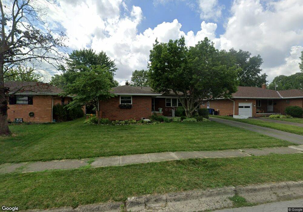
1089 Fordham Rd Columbus, OH 43224
Maize-Morse NeighborhoodEstimated Value: $261,000 - $370,000
3
Beds
3
Baths
1,335
Sq Ft
$233/Sq Ft
Est. Value
About This Home
This home is located at 1089 Fordham Rd, Columbus, OH 43224 and is currently estimated at $311,034, approximately $232 per square foot. 1089 Fordham Rd is a home located in Franklin County with nearby schools including Maize Road Elementary School, Medina Middle School, and Mifflin High School.
Ownership History
Date
Name
Owned For
Owner Type
Purchase Details
Closed on
Jul 22, 2011
Sold by
Kulewicz John J and Kulewicz Thomas J
Bought by
Young Patrick Alan
Current Estimated Value
Home Financials for this Owner
Home Financials are based on the most recent Mortgage that was taken out on this home.
Original Mortgage
$89,911
Outstanding Balance
$61,827
Interest Rate
4.5%
Mortgage Type
FHA
Estimated Equity
$249,207
Purchase Details
Closed on
Feb 16, 2011
Sold by
Estate Of Stanley J Kulewicz
Bought by
Kulewicz John J and Kulewicz Thomas J
Create a Home Valuation Report for This Property
The Home Valuation Report is an in-depth analysis detailing your home's value as well as a comparison with similar homes in the area
Home Values in the Area
Average Home Value in this Area
Purchase History
| Date | Buyer | Sale Price | Title Company |
|---|---|---|---|
| Young Patrick Alan | $92,300 | Talon Group | |
| Kulewicz John J | -- | None Available |
Source: Public Records
Mortgage History
| Date | Status | Borrower | Loan Amount |
|---|---|---|---|
| Open | Young Patrick Alan | $89,911 |
Source: Public Records
Tax History Compared to Growth
Tax History
| Year | Tax Paid | Tax Assessment Tax Assessment Total Assessment is a certain percentage of the fair market value that is determined by local assessors to be the total taxable value of land and additions on the property. | Land | Improvement |
|---|---|---|---|---|
| 2024 | $3,869 | $86,210 | $19,250 | $66,960 |
| 2023 | $3,820 | $86,205 | $19,250 | $66,955 |
| 2022 | $2,769 | $53,380 | $7,880 | $45,500 |
| 2021 | $2,773 | $53,380 | $7,880 | $45,500 |
| 2020 | $2,777 | $53,380 | $7,880 | $45,500 |
| 2019 | $2,573 | $42,420 | $6,300 | $36,120 |
| 2018 | $2,284 | $42,420 | $6,300 | $36,120 |
| 2017 | $2,572 | $42,420 | $6,300 | $36,120 |
| 2016 | $2,203 | $33,250 | $5,950 | $27,300 |
| 2015 | $1,999 | $33,250 | $5,950 | $27,300 |
| 2014 | $2,004 | $33,250 | $5,950 | $27,300 |
| 2013 | $1,244 | $41,825 | $6,265 | $35,560 |
Source: Public Records
Map
Nearby Homes
- 1071 Loring Rd
- 4441 Wetmore Rd E
- 1266 Pershing Dr
- 1116 Tulsa Dr
- 1191 Bryson Rd
- 1125 Upland Dr
- 1130 Carbone Dr
- 4840 Almont Dr
- 1064 Hillsdale Dr
- 4904 Almont Dr
- 814 Meadowview Dr
- 4455 Kenfield Rd
- 4983 Almont Dr
- 4791 Bourke Rd
- 1414 Alvina Dr
- 4815 Bourke Rd
- 4761 Colonel Perry Dr
- 4800 Bourke Rd
- 4143 Karl Rd Unit 314
- 4145 Karl Rd Unit 223
- 1081 Fordham Rd
- 1097 Fordham Rd
- 1073 Fordham Rd
- 1082 Marland Dr N
- 1090 Marland Dr N
- 1076 Marland Dr N
- 1068 Marland Dr N
- 1090 Fordham Rd
- 1065 Fordham Rd
- 1082 Fordham Rd
- 1098 Fordham Rd
- 1098 Marland Dr N
- 1113 Fordham Rd
- 1074 Fordham Rd
- 1106 Fordham Rd
- 1060 Marland Dr N
- 1057 Fordham Rd
- 1066 Fordham Rd
- 1114 Fordham Rd
- 1121 Fordham Rd