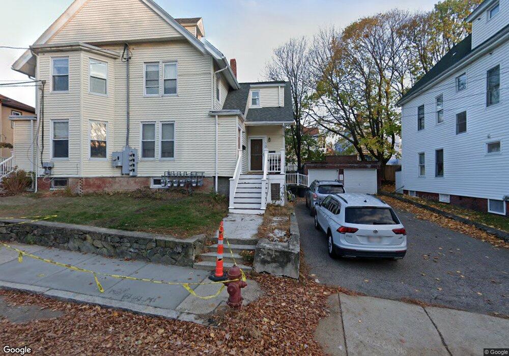
109 Bartlett St Unit 1 Somerville, MA 02145
Magoun Square NeighborhoodEstimated Value: $486,470 - $588,000
1
Bed
1
Bath
687
Sq Ft
$784/Sq Ft
Est. Value
About This Home
This home is located at 109 Bartlett St Unit 1, Somerville, MA 02145 and is currently estimated at $538,868, approximately $784 per square foot. 109 Bartlett St Unit 1 is a home located in Middlesex County with nearby schools including Somerville High School and Bright Future Educare Center.
Ownership History
Date
Name
Owned For
Owner Type
Purchase Details
Closed on
May 20, 2005
Sold by
Tancredi Perry
Bought by
Hatch Bethany
Current Estimated Value
Home Financials for this Owner
Home Financials are based on the most recent Mortgage that was taken out on this home.
Original Mortgage
$188,000
Outstanding Balance
$98,716
Interest Rate
5.95%
Mortgage Type
Purchase Money Mortgage
Estimated Equity
$440,152
Create a Home Valuation Report for This Property
The Home Valuation Report is an in-depth analysis detailing your home's value as well as a comparison with similar homes in the area
Home Values in the Area
Average Home Value in this Area
Purchase History
| Date | Buyer | Sale Price | Title Company |
|---|---|---|---|
| Hatch Bethany | $235,000 | -- |
Source: Public Records
Mortgage History
| Date | Status | Borrower | Loan Amount |
|---|---|---|---|
| Open | Hatch Bethany | $188,000 |
Source: Public Records
Tax History Compared to Growth
Tax History
| Year | Tax Paid | Tax Assessment Tax Assessment Total Assessment is a certain percentage of the fair market value that is determined by local assessors to be the total taxable value of land and additions on the property. | Land | Improvement |
|---|---|---|---|---|
| 2025 | $4,581 | $419,900 | $0 | $419,900 |
| 2024 | $4,270 | $405,900 | $0 | $405,900 |
| 2023 | $4,161 | $402,400 | $0 | $402,400 |
| 2022 | $4,025 | $395,400 | $0 | $395,400 |
| 2021 | $3,901 | $382,800 | $0 | $382,800 |
| 2020 | $3,659 | $362,600 | $0 | $362,600 |
| 2019 | $3,864 | $359,100 | $0 | $359,100 |
| 2018 | $3,428 | $303,100 | $0 | $303,100 |
| 2017 | $3,244 | $278,000 | $0 | $278,000 |
| 2016 | $3,031 | $241,900 | $0 | $241,900 |
| 2015 | $3,045 | $241,500 | $0 | $241,500 |
Source: Public Records
Map
Nearby Homes
- 79 Partridge Ave
- 441 Broadway
- 466 Medford St Unit 4
- 496 Medford St
- 456 Medford St Unit 3
- 474 Broadway Unit 26
- 25 Browning Rd
- 35 Richardson St Unit 2
- 35 Richardson St Unit 4
- 35 Richardson St Unit 1
- 35 Richardson St Unit Cottage
- 3 Vinal St
- 303 Lowell St Unit 1
- 301 Lowell Street Condo Unit 31
- 34 Fiske Ave Unit C
- 34 Fiske Ave Unit B
- 34 Fiske Ave Unit A
- 32 Richardson St
- 7 Bond St
- 89 Heath St
- 111 Bartlett St Unit 2
- 111 Bartlett St Unit 1
- 109 Bartlett St Unit 2
- 111 Bartlett St Unit 2 111
- 111 Bartlett St
- 107 Bartlett St
- 115 Bartlett St
- 115 Bartlett St
- 115 Bartlett St Unit 2
- 115 Bartlett St Unit 1
- 103 Bartlett St Unit 2
- 103 Bartlett St
- 119 Bartlett St
- 119 Bartlett St Unit 1
- 119 Bartlett St Unit 3
- 116 Bartlett St
- 114 Bartlett St
- 52 Adams St Unit 3
- 52 Adams St Unit 2
- 52 Adams St Unit 1