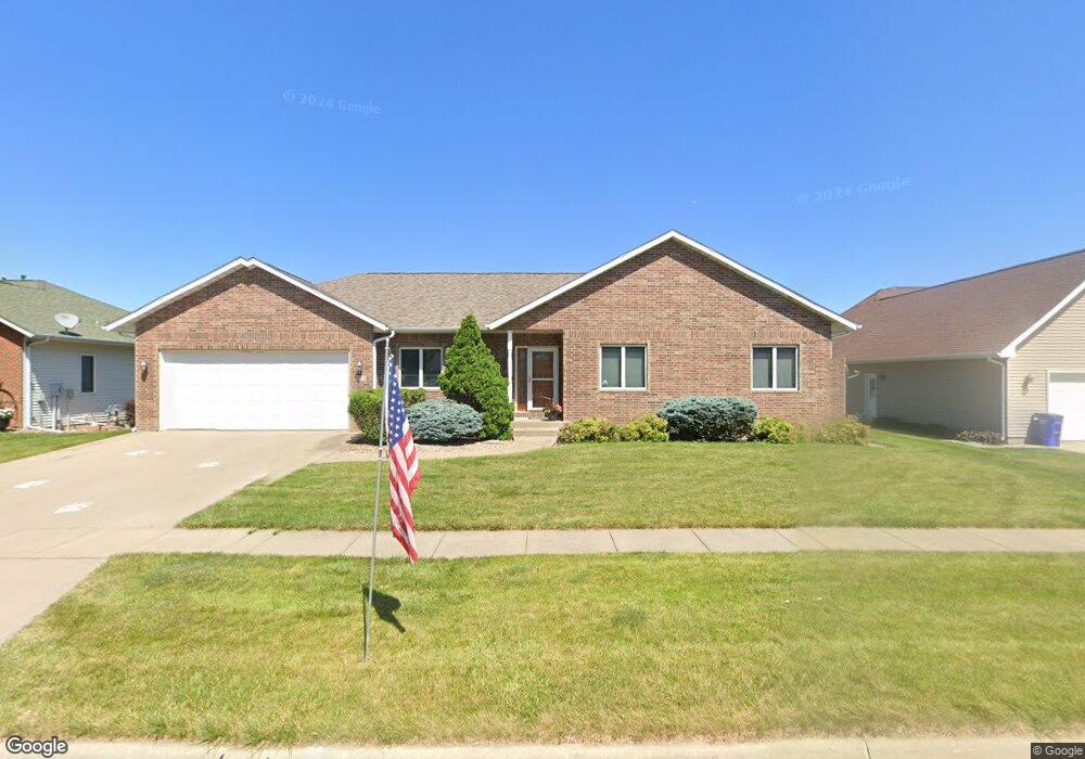
109 Bickford Dr West Branch, IA 52358
Estimated Value: $387,000 - $468,000
4
Beds
4
Baths
1,576
Sq Ft
$270/Sq Ft
Est. Value
About This Home
This home is located at 109 Bickford Dr, West Branch, IA 52358 and is currently estimated at $425,852, approximately $270 per square foot. 109 Bickford Dr is a home located in Johnson County with nearby schools including Hoover Elementary School, West Branch Middle School, and West Branch High School.
Ownership History
Date
Name
Owned For
Owner Type
Purchase Details
Closed on
Jul 31, 2008
Sold by
Duhn Brian L and Duhn Margaret M
Bought by
Sexton Ricky J and Sexton Julie Y
Current Estimated Value
Home Financials for this Owner
Home Financials are based on the most recent Mortgage that was taken out on this home.
Original Mortgage
$212,000
Outstanding Balance
$139,551
Interest Rate
6.39%
Mortgage Type
Purchase Money Mortgage
Estimated Equity
$286,301
Create a Home Valuation Report for This Property
The Home Valuation Report is an in-depth analysis detailing your home's value as well as a comparison with similar homes in the area
Home Values in the Area
Average Home Value in this Area
Purchase History
| Date | Buyer | Sale Price | Title Company |
|---|---|---|---|
| Sexton Ricky J | $265,000 | None Available |
Source: Public Records
Mortgage History
| Date | Status | Borrower | Loan Amount |
|---|---|---|---|
| Open | Sexton Ricky J | $212,000 |
Source: Public Records
Tax History Compared to Growth
Tax History
| Year | Tax Paid | Tax Assessment Tax Assessment Total Assessment is a certain percentage of the fair market value that is determined by local assessors to be the total taxable value of land and additions on the property. | Land | Improvement |
|---|---|---|---|---|
| 2025 | $6,088 | $393,500 | $45,800 | $347,700 |
| 2024 | $5,934 | $363,500 | $45,800 | $317,700 |
| 2023 | $5,732 | $363,500 | $45,800 | $317,700 |
| 2022 | $5,608 | $297,100 | $39,600 | $257,500 |
| 2021 | $5,570 | $297,100 | $39,600 | $257,500 |
| 2020 | $5,570 | $281,900 | $39,600 | $242,300 |
| 2019 | $5,462 | $281,900 | $39,600 | $242,300 |
| 2018 | $4,914 | $297,100 | $0 | $0 |
| 2017 | $5,206 | $271,900 | $39,600 | $232,300 |
| 2016 | $5,418 | $271,900 | $39,600 | $232,300 |
| 2015 | $5,418 | $287,400 | $39,600 | $247,800 |
| 2014 | $5,058 | $266,700 | $39,600 | $227,100 |
Source: Public Records
Map
Nearby Homes
- 122 acres m/l Cedar Johnson Rd
- 1 Ember Ln
- 2 Lazy Brook Dr
- 4 Lazy Brook Dr
- 2 Greenview Dr
- 436 Dawson Dr
- 0 122 Acres M L Cedar Johnson Rd
- Lot 17 the Meadows Subdivision Part 5
- 817 Prairie View Dr
- Lot 17 Meadows Subdivision Part 5
- 719 Sullivan St
- Lot 4 Meadows Subdivision Part 6
- Lot 12 Meadows Subdivision Part 6
- Lot 10 Meadows Subdivision Part 6
- Lot 15 Meadows Subdivision Part 6
- Lot 6 Meadows Subdivision Part 6
- Lot 9 Meadows Subdivision Part 6
- Lot 8 Meadows Subdivision Part 6
- Lot 18 Meadows Subdivision Part 6
- Lot 7 Meadows Subdivision Part 6
- 105 Bickford Dr
- 113 Bickford Dr
- 851 Cedar Johnson Rd Unit Lot 12
- 855 Cedar Johnson Rd
- 117 Bickford Dr
- 101 Bickford Dr
- 853 Cedar Johnson Rd Unit Lot 13
- 110 Bickford Dr
- 114 Bickford Dr
- 106 Bickford Dr
- 857 Cedar Johnson Rd
- 118 Bickford Dr
- 121 Bickford Dr
- 102 Bickford Dr
- 11 Serenity Cir
- 122 Bickford Dr
- 162 Bickford Dr
- 166 Bickford Dr
- 158 Bickford Dr
- 1 Ember Ln Unit lot 16