Estimated Value: $361,000 - $488,000
--
Bed
--
Bath
3,204
Sq Ft
$134/Sq Ft
Est. Value
About This Home
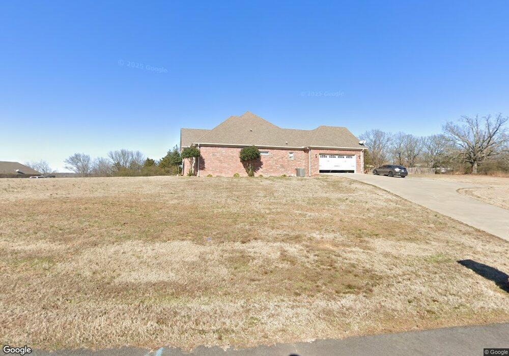
This home is located at 109 Brandi Ln, Beebe, AR 72012 and is currently estimated at $428,351, approximately $133 per square foot. 109 Brandi Ln is a home with nearby schools including Beebe Elementary School, Beebe Junior High School, and Beebe Middle School.
Ownership History
Date
Name
Owned For
Owner Type
Purchase Details
Closed on
Jul 16, 2020
Sold by
Barton & Barton Inc
Bought by
Bpg Holdings Llc
Current Estimated Value
Home Financials for this Owner
Home Financials are based on the most recent Mortgage that was taken out on this home.
Original Mortgage
$233,000
Interest Rate
3.1%
Mortgage Type
Commercial
Purchase Details
Closed on
May 29, 2013
Sold by
Drennan Mark and Drennan Misty
Bought by
Burrow Joseph T and Burrow Jennifer L
Home Financials for this Owner
Home Financials are based on the most recent Mortgage that was taken out on this home.
Original Mortgage
$309,700
Interest Rate
3.43%
Mortgage Type
New Conventional
Create a Home Valuation Report for This Property
The Home Valuation Report is an in-depth analysis detailing your home's value as well as a comparison with similar homes in the area
Home Values in the Area
Average Home Value in this Area
Purchase History
| Date | Buyer | Sale Price | Title Company |
|---|---|---|---|
| Bpg Holdings Llc | $218,000 | None Available | |
| Burrow Joseph T | $326,000 | None Available |
Source: Public Records
Mortgage History
| Date | Status | Borrower | Loan Amount |
|---|---|---|---|
| Closed | Bpg Holdings Llc | $233,000 | |
| Previous Owner | Burrow Joseph T | $309,700 |
Source: Public Records
Tax History Compared to Growth
Tax History
| Year | Tax Paid | Tax Assessment Tax Assessment Total Assessment is a certain percentage of the fair market value that is determined by local assessors to be the total taxable value of land and additions on the property. | Land | Improvement |
|---|---|---|---|---|
| 2025 | $2,617 | $64,290 | $6,750 | $57,540 |
| 2024 | $2,582 | $64,290 | $6,750 | $57,540 |
| 2023 | $2,090 | $64,290 | $6,750 | $57,540 |
| 2022 | $2,033 | $64,290 | $6,750 | $57,540 |
| 2021 | $1,925 | $64,290 | $6,750 | $57,540 |
| 2020 | $1,818 | $52,890 | $6,000 | $46,890 |
| 2019 | $2,153 | $52,890 | $6,000 | $46,890 |
| 2018 | $1,948 | $52,890 | $6,000 | $46,890 |
| 2017 | $2,153 | $52,890 | $6,000 | $46,890 |
| 2016 | $2,153 | $52,890 | $6,000 | $46,890 |
| 2015 | $2,021 | $49,650 | $6,000 | $43,650 |
| 2014 | $244 | $6,000 | $6,000 | $0 |
Source: Public Records
Map
Nearby Homes
- Lot 16 & 17 Autumn Ln
- 104 Autumn Ln
- Tract 11 Artesia Ln
- Tract 9 Artesia Ln
- Tract 4 Artesia Ln
- 101 Artesia Ln
- 101 Ridge Cove
- 102 E Lake Cove
- 723 Swinging Bridge Rd
- 271 Dugger Rd
- 235 Dugger Rd
- 114 Lynnwood Acres Rd
- 000 Louie Pruitt Rd
- Lot 21 Wes Moore Rd
- 235 Michelle Dr
- 233 Michelle Dr
- 224 Michelle Dr
- 223 Michelle Dr
- 221 Michelle Dr
- 220 Michelle Dr
- 107 Brandi Ln
- 108 Brandi Ln
- 124 Timberline Dr
- 120 Timberline Dr
- 106 Brandi Ln
- 128 Timberline Dr
- 105 Brandi Ln
- 104 Brandi Ln
- 132 Timberline Dr
- 0 Timberline Dr Unit 18004502
- 117 Timberline Dr
- Lot 17 Autumn Ln
- 183 Stoney Point Church Rd
- 121 Timberline Dr
- 103 Brandi Ln
- Lot 16 Autumn Ln
- 136 Timberline Dr
- 113 Artesia Ln
- 102 Brandi Ln
- 116 Timberline Dr