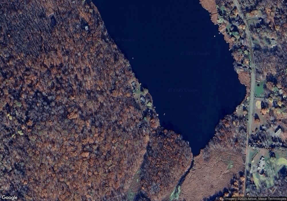
109 Cat Track Rd Ancram, NY 12502
Estimated Value: $239,855 - $499,000
2
Beds
2
Baths
2,000
Sq Ft
$185/Sq Ft
Est. Value
About This Home
This home is located at 109 Cat Track Rd, Ancram, NY 12502 and is currently estimated at $370,964, approximately $185 per square foot. 109 Cat Track Rd is a home located in Columbia County with nearby schools including Taconic Hills Elementary School and Taconic Hills Junior/Senior High School.
Ownership History
Date
Name
Owned For
Owner Type
Purchase Details
Closed on
Nov 16, 2022
Sold by
Eipstein Christine
Bought by
Benizri Krinsky E
Current Estimated Value
Purchase Details
Closed on
Nov 8, 2013
Sold by
Talcott Jane
Bought by
Benizri-Krinsky Esther
Purchase Details
Closed on
May 5, 2010
Sold by
Kasowitz Elizabeth
Bought by
Talcott Jane
Purchase Details
Closed on
Mar 31, 2001
Sold by
Estate De Blanco Carmelo
Bought by
Talcott Jane
Purchase Details
Closed on
Apr 1, 1999
Sold by
Derby John F
Bought by
Talcott Jane and Kasowitz Elizabeth
Create a Home Valuation Report for This Property
The Home Valuation Report is an in-depth analysis detailing your home's value as well as a comparison with similar homes in the area
Home Values in the Area
Average Home Value in this Area
Purchase History
| Date | Buyer | Sale Price | Title Company |
|---|---|---|---|
| Benizri Krinsky E | $110,000 | First American Title | |
| Benizri-Krinsky Esther | $180,000 | -- | |
| Talcott Jane | $260,000 | -- | |
| Talcott Jane | $133,155 | Andrew J Baldwin | |
| Talcott Jane | $20,000 | -- | |
| Talcott Jane | -- | Baldwin, Jr Andrew |
Source: Public Records
Tax History Compared to Growth
Tax History
| Year | Tax Paid | Tax Assessment Tax Assessment Total Assessment is a certain percentage of the fair market value that is determined by local assessors to be the total taxable value of land and additions on the property. | Land | Improvement |
|---|---|---|---|---|
| 2024 | $3,694 | $200,200 | $115,500 | $84,700 |
| 2023 | $3,644 | $200,200 | $115,500 | $84,700 |
| 2022 | $3,768 | $200,200 | $115,500 | $84,700 |
| 2021 | $3,806 | $200,200 | $115,500 | $84,700 |
| 2020 | $3,832 | $200,200 | $115,500 | $84,700 |
| 2019 | $3,824 | $200,200 | $115,500 | $84,700 |
| 2018 | $3,824 | $200,200 | $115,500 | $84,700 |
| 2017 | $3,675 | $200,200 | $115,500 | $84,700 |
| 2016 | $3,595 | $200,200 | $115,500 | $84,700 |
| 2015 | -- | $175,000 | $65,000 | $110,000 |
| 2014 | -- | $246,000 | $100,300 | $145,700 |
Source: Public Records
Map
Nearby Homes
- 0 County Route 27
- L34&35 County Route 27
- L35 County Route 27
- L34 County Route 27
- Lot 34&35 County Route 27
- Lot 35 County Route 27
- Lot 34 County Route 27
- Lot34&35 County Route 27
- Lot 34 Vista Ln
- Lot 34 Route 27
- 333 County Route 27
- 40 Stonewall Ridge Rd
- 333 County Route 27
- 12 Pioneer Dr
- 20 Snyder Pond Rd
- 2206 Route 7a
- 2206 County Route 7
- 53 Snyder Pond Rd
- 1030 County Route 27a
- 49 High Meadow Rd
- 101 - 109 Cat Track Rd
- 101 Cat Track Rd
- 101 Cat Track Rd
- 125 Cat Track Rd
- 74 Cat Track Rd
- 82 Cat Track Rd
- 77 Cat Track Rd
- 1227 County Route 27a
- 1231 County Route 27a
- 66 Cat Track Rd
- 231 County Route 27
- 1239 Chrysler Pond
- 62 Cat Track Rd
- 1220 County Route 27a
- 54 Cat Track Rd
- 1198 County Route 27a
- 1230 County Route 27a
- 1212 County Route 27a
- 1238 County Route 27a
- 1236 County Route 27a
