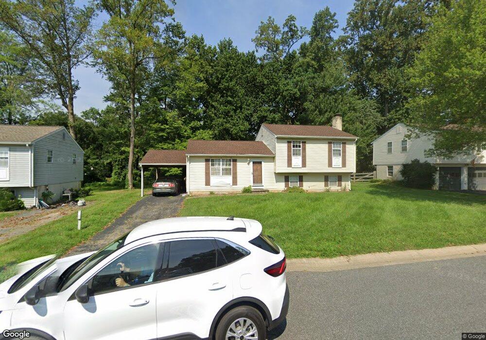
109 Cedar Ave Newark, DE 19711
Estimated Value: $335,000 - $384,000
3
Beds
2
Baths
1,400
Sq Ft
$262/Sq Ft
Est. Value
About This Home
This home is located at 109 Cedar Ave, Newark, DE 19711 and is currently estimated at $366,856, approximately $262 per square foot. 109 Cedar Ave is a home located in New Castle County with nearby schools including R. Elisabeth Maclary Elementary School, Shue-Medill Middle School, and Newark High School.
Ownership History
Date
Name
Owned For
Owner Type
Purchase Details
Closed on
May 19, 2011
Sold by
Hausmann Joseph and Adams Jennifer M
Bought by
Pilato Edward C
Current Estimated Value
Home Financials for this Owner
Home Financials are based on the most recent Mortgage that was taken out on this home.
Original Mortgage
$208,575
Outstanding Balance
$141,496
Interest Rate
4.37%
Mortgage Type
FHA
Estimated Equity
$225,360
Purchase Details
Closed on
May 31, 2007
Sold by
Conte Christopher D
Bought by
Hausmann Joseph and Adams Jennifer M
Home Financials for this Owner
Home Financials are based on the most recent Mortgage that was taken out on this home.
Original Mortgage
$226,100
Interest Rate
6.19%
Mortgage Type
Purchase Money Mortgage
Create a Home Valuation Report for This Property
The Home Valuation Report is an in-depth analysis detailing your home's value as well as a comparison with similar homes in the area
Home Values in the Area
Average Home Value in this Area
Purchase History
| Date | Buyer | Sale Price | Title Company |
|---|---|---|---|
| Pilato Edward C | $107,000 | First American Title Inc Co | |
| Hausmann Joseph | $238,000 | None Available |
Source: Public Records
Mortgage History
| Date | Status | Borrower | Loan Amount |
|---|---|---|---|
| Open | Pilato Edward C | $208,575 | |
| Previous Owner | Hausmann Joseph | $226,100 |
Source: Public Records
Tax History
| Year | Tax Paid | Tax Assessment Tax Assessment Total Assessment is a certain percentage of the fair market value that is determined by local assessors to be the total taxable value of land and additions on the property. | Land | Improvement |
|---|---|---|---|---|
| 2024 | $2,975 | $67,700 | $14,000 | $53,700 |
| 2023 | $2,897 | $67,700 | $14,000 | $53,700 |
| 2022 | $2,877 | $67,700 | $14,000 | $53,700 |
| 2021 | $2,816 | $67,700 | $14,000 | $53,700 |
| 2020 | $2,738 | $67,700 | $14,000 | $53,700 |
| 2019 | $2,718 | $67,700 | $14,000 | $53,700 |
| 2018 | $2,374 | $67,700 | $14,000 | $53,700 |
| 2017 | $2,293 | $67,700 | $14,000 | $53,700 |
| 2016 | $2,275 | $67,700 | $14,000 | $53,700 |
| 2015 | $2,080 | $67,700 | $14,000 | $53,700 |
| 2014 | $2,081 | $67,700 | $14,000 | $53,700 |
Source: Public Records
Map
Nearby Homes
- 27 Laurel Ave
- 1905 Capitol Trail
- 214 Darwin Dr
- 91 Old Red Mill Rd
- 102 Longview Dr
- 35 Old Manor Rd
- 2705 Creekside Dr
- 2 Henderson Hill Rd
- 11 Aronimink Dr
- 221 S Dillwyn Rd
- 14 S Dillwyn Rd
- 105 Chapel Hill Dr
- 6 Thornhollow Rd
- 230 Aronimink Dr
- 163 Valley Cir
- 59 Valley Cir
- 1013 9th St
- 128 E Green Valley Cir
- 106 Caladium Ln
- 159 E Green Valley Cir
Your Personal Tour Guide
Ask me questions while you tour the home.