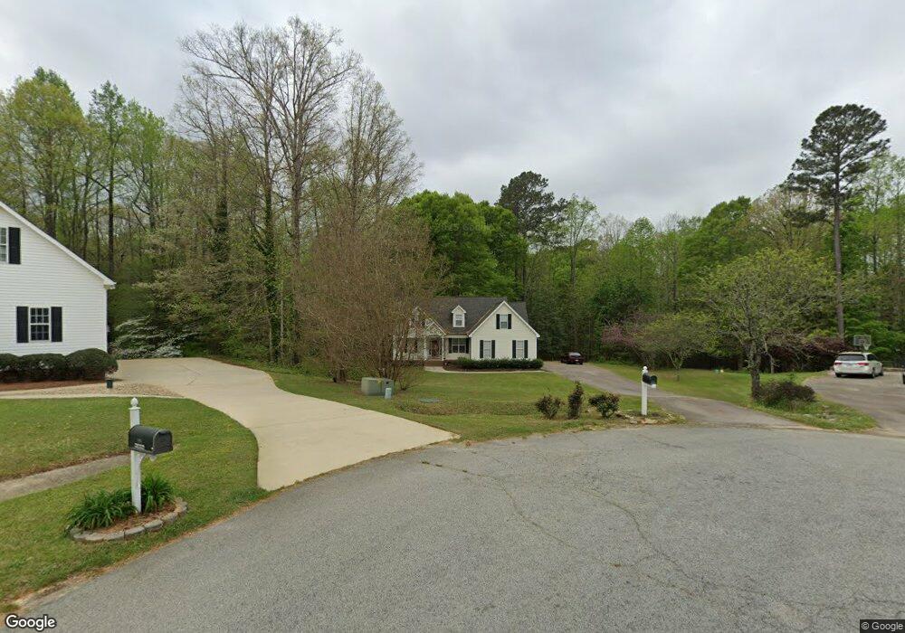
109 Crawdad Ct Garner, NC 27529
Estimated Value: $387,000 - $479,000
3
Beds
2
Baths
1,855
Sq Ft
$241/Sq Ft
Est. Value
About This Home
This home is located at 109 Crawdad Ct, Garner, NC 27529 and is currently estimated at $446,221, approximately $240 per square foot. 109 Crawdad Ct is a home located in Johnston County with nearby schools including West View Elementary School, Cleveland Middle School, and West Johnston High School.
Ownership History
Date
Name
Owned For
Owner Type
Purchase Details
Closed on
Mar 17, 2004
Sold by
Sabatino Scott
Bought by
Sabitino Scott
Current Estimated Value
Purchase Details
Closed on
Sep 4, 2003
Sold by
Sabitino Scott
Bought by
Fannie Mae
Purchase Details
Closed on
Aug 28, 2003
Sold by
Fannie Mae
Bought by
Fannie Mae
Purchase Details
Closed on
Aug 27, 2003
Sold by
Fannie Mae
Bought by
Bunn Derek
Create a Home Valuation Report for This Property
The Home Valuation Report is an in-depth analysis detailing your home's value as well as a comparison with similar homes in the area
Home Values in the Area
Average Home Value in this Area
Purchase History
| Date | Buyer | Sale Price | Title Company |
|---|---|---|---|
| Sabitino Scott | -- | -- | |
| Fannie Mae | -- | -- | |
| Fannie Mae | -- | -- | |
| Bunn Derek | -- | -- |
Source: Public Records
Tax History
| Year | Tax Paid | Tax Assessment Tax Assessment Total Assessment is a certain percentage of the fair market value that is determined by local assessors to be the total taxable value of land and additions on the property. | Land | Improvement |
|---|---|---|---|---|
| 2025 | $2,679 | $421,900 | $90,000 | $331,900 |
| 2024 | $2,226 | $274,820 | $54,870 | $219,950 |
| 2023 | $2,157 | $274,820 | $54,870 | $219,950 |
| 2022 | $2,226 | $274,820 | $54,870 | $219,950 |
| 2021 | $2,226 | $274,820 | $54,870 | $219,950 |
| 2020 | $2,308 | $274,820 | $54,870 | $219,950 |
| 2019 | $2,254 | $274,820 | $54,870 | $219,950 |
| 2018 | $1,887 | $224,660 | $48,290 | $176,370 |
| 2017 | $1,887 | $224,660 | $48,290 | $176,370 |
| 2016 | $1,887 | $224,660 | $48,290 | $176,370 |
| 2015 | $1,887 | $224,660 | $48,290 | $176,370 |
| 2014 | $1,887 | $224,660 | $48,290 | $176,370 |
Source: Public Records
Map
Nearby Homes
- 50 Linden Ct
- 222 Susan Dr
- 200 Reese Dr
- 48 Banbury Ct
- 55 Dolores Ct
- 232 Fawn Hill Ct
- 181 Fawn Hill Ct
- 648 Fieldtrial Cir
- 595 Durwood Dr
- 111 Artic Cir
- 72 Meadowmist Dr
- 248 Old Hickory Dr
- 131 Artic Cir
- 356 Fieldtrial Cir
- 304 Artic Cir
- 236 Fieldtrial Cir
- 368 Artic Cir
- 102 Ina Joe Place
- 403 Airedale Trail
- 49 Dandy Flush Ct
Your Personal Tour Guide
Ask me questions while you tour the home.