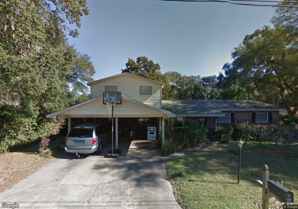
109 Michael Ave Fort Walton Beach, FL 32547
Wright NeighborhoodEstimated Value: $309,000 - $352,589
5
Beds
2
Baths
2,236
Sq Ft
$150/Sq Ft
Est. Value
About This Home
This home is located at 109 Michael Ave, Fort Walton Beach, FL 32547 and is currently estimated at $334,897, approximately $149 per square foot. 109 Michael Ave is a home located in Okaloosa County with nearby schools including Longwood Elementary School, W.C. Pryor Middle School, and Choctawhatchee Senior High School.
Ownership History
Date
Name
Owned For
Owner Type
Purchase Details
Closed on
Feb 28, 2001
Sold by
Slapar Frank A and Slapar Anna
Bought by
Birdsong Henry B and Birdsong Nieva M
Current Estimated Value
Home Financials for this Owner
Home Financials are based on the most recent Mortgage that was taken out on this home.
Original Mortgage
$84,000
Interest Rate
7.06%
Create a Home Valuation Report for This Property
The Home Valuation Report is an in-depth analysis detailing your home's value as well as a comparison with similar homes in the area
Home Values in the Area
Average Home Value in this Area
Purchase History
| Date | Buyer | Sale Price | Title Company |
|---|---|---|---|
| Birdsong Henry B | $105,000 | First Natl Land Title Co Inc |
Source: Public Records
Mortgage History
| Date | Status | Borrower | Loan Amount |
|---|---|---|---|
| Closed | Birdsong Henry B | $84,000 |
Source: Public Records
Tax History Compared to Growth
Tax History
| Year | Tax Paid | Tax Assessment Tax Assessment Total Assessment is a certain percentage of the fair market value that is determined by local assessors to be the total taxable value of land and additions on the property. | Land | Improvement |
|---|---|---|---|---|
| 2024 | $1,174 | $137,814 | -- | -- |
| 2023 | $1,174 | $133,800 | $0 | $0 |
| 2022 | $1,137 | $129,903 | $0 | $0 |
| 2021 | $1,127 | $126,119 | $0 | $0 |
| 2020 | $1,114 | $124,378 | $0 | $0 |
| 2019 | $1,094 | $121,582 | $0 | $0 |
| 2018 | $1,079 | $119,315 | $0 | $0 |
| 2017 | $1,056 | $116,861 | $0 | $0 |
| 2016 | $1,027 | $114,457 | $0 | $0 |
| 2015 | $1,038 | $113,661 | $0 | $0 |
| 2014 | $1,031 | $112,759 | $0 | $0 |
Source: Public Records
Map
Nearby Homes
- 6 Chelsea Dr NW
- 16 Chelsea Dr NW
- 413 Gerold St
- 401 Gerold St
- 526 Cheshire Ave NW
- 528 Cheshire Ave NW
- 706 Mary Ave
- 2392 Cummings Dr
- 603 Bob Sikes Blvd
- 926 Lois St
- 801 Playground Rd
- 20 Linwood Rd NW
- 24 Cinderella Ln NW
- 603 Golf Course Dr NE
- 604 Powell Dr NE
- 60 Linwood Rd NW
- 990 Rockport Dr
- 603 Merioneth Dr NE
- 503 Newcastle Dr
- 45 Cinderella Ln NW
- 111 Michael Ave
- 0 Michael Ave
- 816 Pinedale Rd
- 102 Michael Ave
- 106 Michael Ave
- 814 Pinedale Rd
- 104 Michael Ave
- 108 Michael Ave
- 113 Michael Ave
- 101 Michael Ave
- 100 Michael Ave
- 110 Michael Ave
- 812 Pinedale Rd
- 112 Michael Ave
- 3 Racetrack Rd NE
- 815 Pinedale Rd
- 111 Truxton Ave Unit C
- 115 Michael Ave
- 817 Pinedale Rd
- 114 Michael Ave