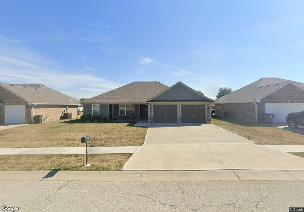
109 NW Michael Dr Grain Valley, MO 64029
Estimated Value: $338,359 - $369,000
3
Beds
2
Baths
1,571
Sq Ft
$225/Sq Ft
Est. Value
About This Home
This home is located at 109 NW Michael Dr, Grain Valley, MO 64029 and is currently estimated at $352,840, approximately $224 per square foot. 109 NW Michael Dr is a home located in Jackson County with nearby schools including Grain Valley High School.
Ownership History
Date
Name
Owned For
Owner Type
Purchase Details
Closed on
Oct 21, 2016
Sold by
Ebert David J and Ebert Sherri S
Bought by
Banks Real Estate Llc
Current Estimated Value
Home Financials for this Owner
Home Financials are based on the most recent Mortgage that was taken out on this home.
Original Mortgage
$16,730
Outstanding Balance
$13,404
Interest Rate
3.44%
Mortgage Type
Future Advance Clause Open End Mortgage
Estimated Equity
$339,436
Purchase Details
Closed on
Sep 19, 2005
Sold by
Rick Lafal Construction Inc
Bought by
Ebert David J and Ebert Sherri S
Create a Home Valuation Report for This Property
The Home Valuation Report is an in-depth analysis detailing your home's value as well as a comparison with similar homes in the area
Home Values in the Area
Average Home Value in this Area
Purchase History
| Date | Buyer | Sale Price | Title Company |
|---|---|---|---|
| Banks Real Estate Llc | -- | First American Title Co | |
| Ebert David J | -- | Stewart Title Of Kansas City |
Source: Public Records
Mortgage History
| Date | Status | Borrower | Loan Amount |
|---|---|---|---|
| Open | Banks Real Estate Llc | $16,730 |
Source: Public Records
Tax History
| Year | Tax Paid | Tax Assessment Tax Assessment Total Assessment is a certain percentage of the fair market value that is determined by local assessors to be the total taxable value of land and additions on the property. | Land | Improvement |
|---|---|---|---|---|
| 2025 | $4,249 | $55,239 | $5,482 | $49,757 |
| 2024 | $4,090 | $51,583 | $4,851 | $46,732 |
| 2023 | $4,090 | $51,583 | $6,827 | $44,756 |
| 2022 | $3,824 | $42,180 | $5,938 | $36,242 |
| 2021 | $3,734 | $42,180 | $5,938 | $36,242 |
| 2020 | $2,704 | $5,934 | $5,934 | $0 |
| 2019 | $522 | $5,934 | $5,934 | $0 |
| 2018 | $486 | $5,164 | $5,164 | $0 |
| 2017 | $486 | $5,164 | $5,164 | $0 |
| 2016 | $474 | $5,035 | $5,035 | $0 |
Source: Public Records
Map
Nearby Homes
- 1703 NW Willow Dr
- 1809 SE Ridgewood Dr
- 6205 Chiles Rd
- 408 NE Greenview Dr
- 2700 NE Wheatley Dr
- 2512 NE Wheatley Dr
- 2701 NE Wheatley Dr
- 2601 NE Wheatley Dr
- 29800 E 65th St
- 2605 NE Crestview St
- 2700 NE Crestview St
- 708 Pavillion Dr
- 2601 NE Amanda Ln
- 1121 SW Ephraim Dr Unit 45B
- 1007 SW Blue Branch Dr
- 1220 SW Dakota Star Ct
- 207 NW Barr Rd
- 400 Pavillion Dr
- 1014 SW Sandy Ln
- 0 Tract 1 Ryan Rd Unit HMS2604522
- 107 NW Michael Dr
- 111 NW Michael Dr
- 108 NW Jackie Ave
- 110 NW Jackie Ave
- 106 NW Jackie Ave
- 105 NW Michael Dr
- 110 NW Michael Dr
- 104 NW Jackie Ave
- 112 NW Michael Dr
- 112 NW Jackie Ave
- 108 NW Michael Dr
- 103 NW Michael Dr
- 201 NW Michael Dr
- 106 NW Michael Dr
- 114 NW Michael Dr
- 102 NW Jackie Ave
- 200 NW Jackie Ave
- 104 NW Michael Dr
- 203 NW Michael Dr
- 101 NW Michael Dr
Your Personal Tour Guide
Ask me questions while you tour the home.