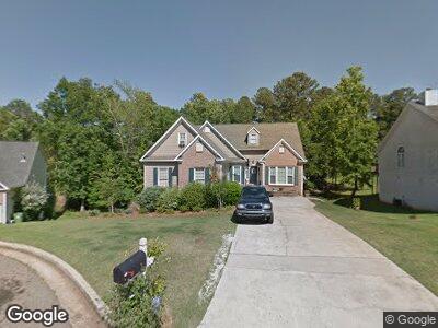
109 Raliegh Dr Macon, GA 31210
Estimated Value: $247,000 - $274,126
3
Beds
3
Baths
2,013
Sq Ft
$130/Sq Ft
Est. Value
About This Home
This home is located at 109 Raliegh Dr, Macon, GA 31210 and is currently estimated at $261,782, approximately $130 per square foot. 109 Raliegh Dr is a home located in Bibb County with nearby schools including Springdale Elementary School, Howard Middle School, and Howard High School.
Ownership History
Date
Name
Owned For
Owner Type
Purchase Details
Closed on
Jan 29, 2024
Sold by
Coley Renee C
Bought by
Renee C Coley Revocable Living Trust and Coley
Current Estimated Value
Purchase Details
Closed on
Dec 15, 2006
Sold by
Hernandez Edgar R and Hernandez Mary E
Bought by
Coley Renee
Home Financials for this Owner
Home Financials are based on the most recent Mortgage that was taken out on this home.
Original Mortgage
$159,000
Interest Rate
6.29%
Mortgage Type
New Conventional
Create a Home Valuation Report for This Property
The Home Valuation Report is an in-depth analysis detailing your home's value as well as a comparison with similar homes in the area
Home Values in the Area
Average Home Value in this Area
Purchase History
| Date | Buyer | Sale Price | Title Company |
|---|---|---|---|
| Renee C Coley Revocable Living Trust | -- | None Listed On Document | |
| Coley Renee | $159,000 | None Avilabale |
Source: Public Records
Mortgage History
| Date | Status | Borrower | Loan Amount |
|---|---|---|---|
| Previous Owner | Coley Renee | $34,244 | |
| Previous Owner | Coley Renee | $137,814 | |
| Previous Owner | Coley Renee | $138,400 | |
| Previous Owner | Coley Renee | $159,000 |
Source: Public Records
Tax History Compared to Growth
Tax History
| Year | Tax Paid | Tax Assessment Tax Assessment Total Assessment is a certain percentage of the fair market value that is determined by local assessors to be the total taxable value of land and additions on the property. | Land | Improvement |
|---|---|---|---|---|
| 2024 | $2,285 | $96,953 | $12,000 | $84,953 |
| 2023 | $2,377 | $87,230 | $10,000 | $77,230 |
| 2022 | $2,644 | $83,365 | $10,170 | $73,195 |
| 2021 | $2,633 | $76,280 | $9,450 | $66,830 |
| 2020 | $2,690 | $76,280 | $9,450 | $66,830 |
| 2019 | $2,378 | $67,742 | $8,550 | $59,192 |
| 2018 | $3,821 | $67,742 | $8,550 | $59,192 |
| 2017 | $2,035 | $61,308 | $7,650 | $53,658 |
| 2016 | $1,879 | $61,308 | $7,650 | $53,658 |
| 2015 | $2,660 | $61,308 | $7,650 | $53,658 |
| 2014 | $2,664 | $61,308 | $7,650 | $53,658 |
Source: Public Records
Map
Nearby Homes
- 480 Ashville Dr
- 305 Ashville Ct
- 109 Waterford Ct
- 172 Lake View Dr N
- 172 Lake View Dr N Unit North
- 102 Braxton Dr
- 1009 Brookford Rd
- 113 Lake Pointe Dr
- 1016 Brookford Rd
- 412 Old Mill Ct
- 113 Rivoli Oaks Cir
- 5262 White House Plantation Rd
- 163 Carriage Way
- 541 Edgefield Way
- 5124 Smoke Rise Dr
- 135 Chadwick Dr
- 109 Raliegh Dr
- 111 Raliegh Dr
- 105 Raliegh Dr
- 110 Raliegh Dr
- 484 Ashville Dr
- 478 Ashville Dr
- 470 Ashville Dr
- 186 Springfield Blvd
- 190 Springfield Blvd
- 190 Springfield Blvd Unit 232
- 468 Ashville Dr
- 104 Raliegh Dr
- 108 Raliegh Dr
- 194 Springfield Blvd
- 488 Ashville Dr
- 178 Springfield Blvd
- 196 Springfield Blvd
- 176 Springfield Blvd
- 198 Springfield Blvd
- 137 Brieghton Ct