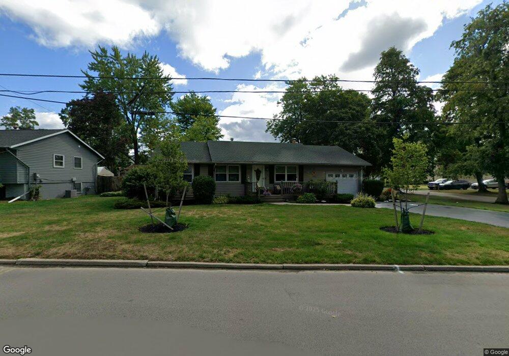
109 Roosevelt Dr Lockport, NY 14094
Estimated Value: $207,000 - $240,000
3
Beds
1
Bath
1,040
Sq Ft
$213/Sq Ft
Est. Value
About This Home
This home is located at 109 Roosevelt Dr, Lockport, NY 14094 and is currently estimated at $221,538, approximately $213 per square foot. 109 Roosevelt Dr is a home located in Niagara County with nearby schools including Aaron Mossell Junior High School, Lockport High School, and DeSales Catholic School.
Ownership History
Date
Name
Owned For
Owner Type
Purchase Details
Closed on
Jul 22, 2013
Sold by
Allen Michael G
Bought by
Allen Kristen M and Allen Kyle M
Current Estimated Value
Home Financials for this Owner
Home Financials are based on the most recent Mortgage that was taken out on this home.
Original Mortgage
$58,000
Outstanding Balance
$13,732
Interest Rate
3.95%
Mortgage Type
New Conventional
Estimated Equity
$207,806
Purchase Details
Closed on
May 27, 2003
Sold by
Allen Margaret
Bought by
Allen Margaret and Kristen M Allen Trust
Purchase Details
Closed on
May 23, 2003
Sold by
Allen Michael
Bought by
Allen Margaret
Create a Home Valuation Report for This Property
The Home Valuation Report is an in-depth analysis detailing your home's value as well as a comparison with similar homes in the area
Home Values in the Area
Average Home Value in this Area
Purchase History
| Date | Buyer | Sale Price | Title Company |
|---|---|---|---|
| Allen Kristen M | -- | Chicago Title Insurance Comp | |
| Allen Margaret | -- | Patricia A George | |
| Allen Margaret | -- | Patricia A George |
Source: Public Records
Mortgage History
| Date | Status | Borrower | Loan Amount |
|---|---|---|---|
| Open | Allen Kristen M | $58,000 |
Source: Public Records
Tax History Compared to Growth
Tax History
| Year | Tax Paid | Tax Assessment Tax Assessment Total Assessment is a certain percentage of the fair market value that is determined by local assessors to be the total taxable value of land and additions on the property. | Land | Improvement |
|---|---|---|---|---|
| 2024 | $3,919 | $162,000 | $12,500 | $149,500 |
| 2023 | $3,724 | $151,000 | $12,500 | $138,500 |
| 2022 | $2,762 | $135,000 | $12,500 | $122,500 |
| 2021 | $3,018 | $92,400 | $10,200 | $82,200 |
| 2020 | $2,868 | $92,400 | $10,200 | $82,200 |
| 2019 | $799 | $92,400 | $10,200 | $82,200 |
| 2018 | $1,861 | $92,400 | $10,200 | $82,200 |
| 2017 | $1,830 | $92,400 | $10,200 | $82,200 |
| 2016 | $1,721 | $92,400 | $10,200 | $82,200 |
| 2015 | -- | $92,400 | $10,200 | $82,200 |
| 2014 | -- | $92,400 | $10,200 | $82,200 |
Source: Public Records
Map
Nearby Homes
- 40 Georgia Ave
- 178 Continental Dr
- 105 Obrien Dr
- 27 Independence Dr
- 869 Lincoln Ave
- 206 Continental Dr
- 151 Independence Dr
- 144 Grant St
- 76 Morrow Ave
- 544 Willow St
- 60 Morrow Ave
- 546 High St
- 45 Morrow Ave
- 529 Willow St
- 0 Beattie Ave
- 76 Elizabeth Dr
- 20 Park Lane Cir
- 44 Coolidge Ave
- 465 Washburn St
- 89 Park Lane Cir
- 89 Vermont Ave
- 105 Roosevelt Dr
- 80 Pennsylvania Ave
- 95 Vermont Ave
- 65 Vermont Ave
- 119 Roosevelt Dr
- 86 Vermont Ave
- 68 Pennsylvania Ave
- 86 Pennsylvania Ave
- 94 Vermont Ave
- 101 Vermont Ave
- 62 Vermont Ave
- 100 Vermont Ave
- 94 Pennsylvania Ave
- 55 Vermont Ave
- 85 Roosevelt Dr
- 81 Carolina Ave
- 56 Pennsylvania Ave
- 75 Pennsylvania Ave
- 85 Carolina Ave