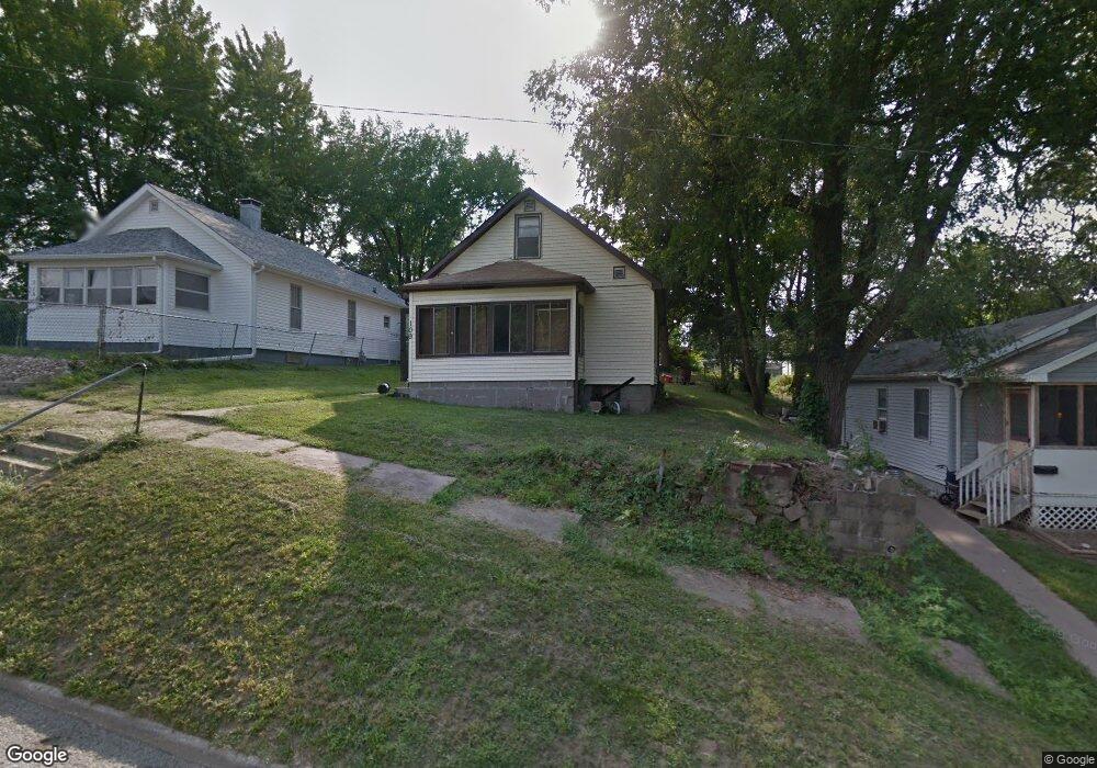
109 S Adams Ave Ottumwa, IA 52501
Estimated Value: $50,000 - $69,000
2
Beds
1
Bath
922
Sq Ft
$64/Sq Ft
Est. Value
About This Home
This home is located at 109 S Adams Ave, Ottumwa, IA 52501 and is currently estimated at $59,139, approximately $64 per square foot. 109 S Adams Ave is a home located in Wapello County with nearby schools including Wilson Elementary School, Evans Middle School, and Ottumwa High School.
Ownership History
Date
Name
Owned For
Owner Type
Purchase Details
Closed on
May 11, 2018
Sold by
Brewer Clayton J and Brewer Cassandra
Bought by
Bachman John E
Current Estimated Value
Purchase Details
Closed on
Aug 23, 2013
Sold by
Lee Zelda M and Lee Thomas
Bought by
Brewer Clayton J
Home Financials for this Owner
Home Financials are based on the most recent Mortgage that was taken out on this home.
Original Mortgage
$15,233
Interest Rate
4.29%
Mortgage Type
New Conventional
Create a Home Valuation Report for This Property
The Home Valuation Report is an in-depth analysis detailing your home's value as well as a comparison with similar homes in the area
Home Values in the Area
Average Home Value in this Area
Purchase History
| Date | Buyer | Sale Price | Title Company |
|---|---|---|---|
| Bachman John E | $8,500 | -- | |
| Brewer Clayton J | $15,000 | None Available |
Source: Public Records
Mortgage History
| Date | Status | Borrower | Loan Amount |
|---|---|---|---|
| Previous Owner | Brewer Clayton J | $15,233 |
Source: Public Records
Tax History Compared to Growth
Tax History
| Year | Tax Paid | Tax Assessment Tax Assessment Total Assessment is a certain percentage of the fair market value that is determined by local assessors to be the total taxable value of land and additions on the property. | Land | Improvement |
|---|---|---|---|---|
| 2025 | $824 | $41,260 | $4,700 | $36,560 |
| 2024 | $824 | $38,020 | $4,700 | $33,320 |
| 2023 | $926 | $38,020 | $4,700 | $33,320 |
| 2022 | $930 | $38,770 | $4,700 | $34,070 |
| 2021 | $931 | $36,650 | $4,700 | $31,950 |
| 2020 | $292 | $11,320 | $4,700 | $6,620 |
| 2019 | $818 | $31,180 | $0 | $0 |
| 2018 | $794 | $31,180 | $0 | $0 |
| 2017 | $810 | $31,180 | $0 | $0 |
| 2016 | $484 | $19,324 | $0 | $0 |
| 2015 | $484 | $19,324 | $0 | $0 |
| 2014 | $484 | $37,511 | $0 | $0 |
Source: Public Records
Map
Nearby Homes
- 317 N Walnut Ave
- 102 S Van Buren Ave
- 106 N Iowa Ave
- 306 N Fellows Ave
- 912 E Fourth St
- 721 N Ash St
- 1019 E Court St
- 504 S Tacoma Ave
- 316 E 5th St
- 1112 N Van Buren Ave
- 231 E Main St
- 1225 Brentwood Dr
- 616 Lamborn St
- 903 E Pennsylvania Ave
- 144 Lincoln Ave
- 1308 N Van Buren Ave
- 1212 Hutchinson Ave
- 750 N Green St
- 132 Lincoln Ave
- 749 N Green St
- 107 S Adams Ave
- 113 S Adams Ave
- 103 S Adams Ave
- 116 S Foster Ave
- 114 S Foster Ave
- 123 S Adams Ave
- 112 S Foster Ave
- 125 S Adams Ave
- 132 S Foster Ave
- 203 S Adams Ave
- 1807 E 2nd St
- 202 S Foster Ave
- 209 S Adams Ave
- 1715 E 2nd St
- 1717 E 2nd St
- 1707 E 2nd St
- 115 S Foster Ave
- 117 S Foster Ave
- 1703 E 2nd St
- 119 S Foster Ave