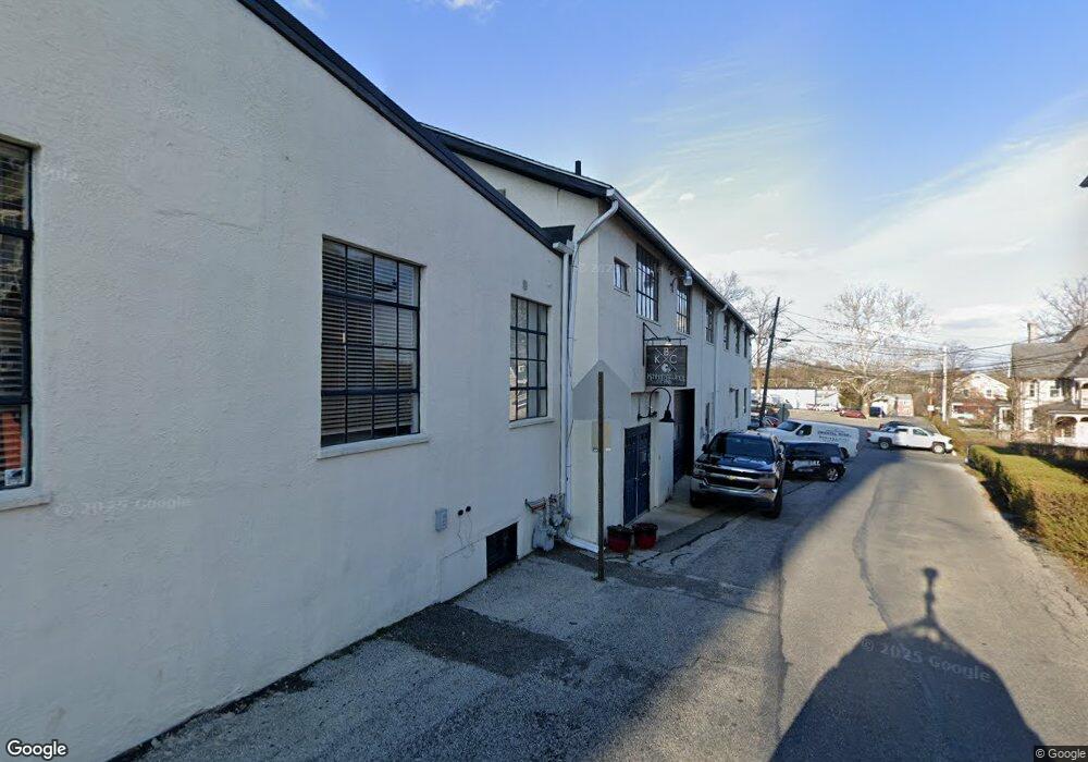
109 S Broad St Kennett Square, PA 19348
Estimated Value: $1,792,685
--
Bed
--
Bath
14,670
Sq Ft
$122/Sq Ft
Est. Value
About This Home
This home is located at 109 S Broad St, Kennett Square, PA 19348 and is currently estimated at $1,792,685, approximately $122 per square foot. 109 S Broad St is a home located in Chester County with nearby schools including Kennett Middle School and Kennett High School.
Ownership History
Date
Name
Owned For
Owner Type
Purchase Details
Closed on
Aug 27, 2008
Sold by
Hart Realty Partnership
Bought by
Peters Holly Anne
Current Estimated Value
Home Financials for this Owner
Home Financials are based on the most recent Mortgage that was taken out on this home.
Original Mortgage
$832,000
Outstanding Balance
$554,982
Interest Rate
6.58%
Mortgage Type
Future Advance Clause Open End Mortgage
Estimated Equity
$1,237,703
Purchase Details
Closed on
Apr 14, 1998
Sold by
Palumbo C John
Bought by
Hart Realty Partnership
Create a Home Valuation Report for This Property
The Home Valuation Report is an in-depth analysis detailing your home's value as well as a comparison with similar homes in the area
Home Values in the Area
Average Home Value in this Area
Purchase History
| Date | Buyer | Sale Price | Title Company |
|---|---|---|---|
| Peters Holly Anne | $1,040,000 | None Available | |
| Hart Realty Partnership | $300,000 | -- |
Source: Public Records
Mortgage History
| Date | Status | Borrower | Loan Amount |
|---|---|---|---|
| Open | Peters Holly Anne | $832,000 |
Source: Public Records
Tax History Compared to Growth
Tax History
| Year | Tax Paid | Tax Assessment Tax Assessment Total Assessment is a certain percentage of the fair market value that is determined by local assessors to be the total taxable value of land and additions on the property. | Land | Improvement |
|---|---|---|---|---|
| 2025 | $15,811 | $324,470 | $40,380 | $284,090 |
| 2024 | $15,811 | $324,470 | $40,380 | $284,090 |
| 2023 | $15,327 | $324,470 | $40,380 | $284,090 |
| 2022 | $14,008 | $324,470 | $40,380 | $284,090 |
| 2021 | $13,883 | $324,470 | $40,380 | $284,090 |
| 2020 | $13,650 | $324,470 | $40,380 | $284,090 |
| 2019 | $13,487 | $324,470 | $40,380 | $284,090 |
| 2018 | $13,173 | $324,470 | $40,380 | $284,090 |
| 2017 | $12,966 | $324,470 | $40,380 | $284,090 |
| 2016 | $1,190 | $324,470 | $40,380 | $284,090 |
| 2015 | $1,190 | $300,000 | $40,380 | $259,620 |
| 2014 | $1,190 | $300,000 | $40,380 | $259,620 |
Source: Public Records
Map
Nearby Homes
- 311 E State St
- 220 E Linden St
- 125 W State St
- 228 E Mulberry St
- 130 S Walnut St
- 312 Walnut Court Way Unit B12
- 426 S Walnut St
- 503 W State St
- 510 D St
- 606 Crossing Ct Unit 6
- 501 N Walnut Rd
- 602 D St
- 607 W Mulberry St
- 621 Magnolia Ct
- 619 W Mulberry St
- 631 Magnolia Ct
- 629 W Mulberry St
- 10102 Austin Dr
- 10101 Austin Dr
- 448 N Mill Rd
- 208 E State St
- 107 S Broad St
- 120 Marshall St
- 119 S Broad St Unit 3
- 119 S Broad St Unit 2
- 119 S Broad St Unit 4
- 119 S Broad St Unit 5
- 119 S Broad St Unit 1
- 119 S Broad St
- 112 S Broad St
- 116 S Broad St
- 135 E State St
- 135 State St
- 120 S Broad St
- 120 S Broad St Unit 2ND/3RD FLOOR
- 107 N Broad St
- 211 E State St
- 211 State St
- 131 E State St
- 131 E State St Unit 2