S
Seller's Agent in 2026
Steve Snyder
RE/MAX Tower
50 Total Sales

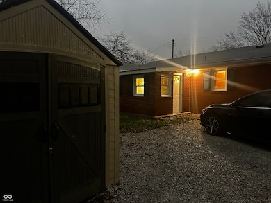
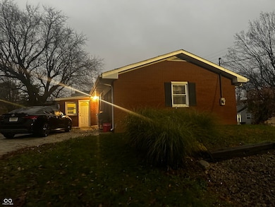
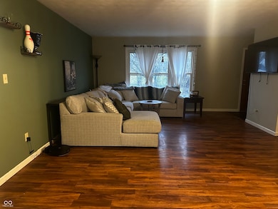
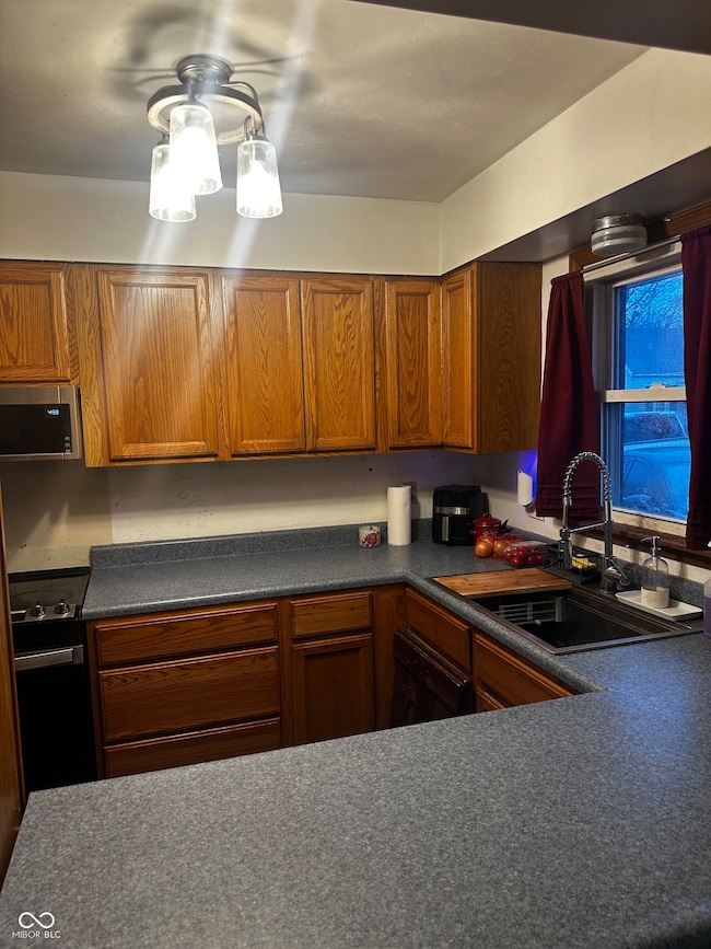
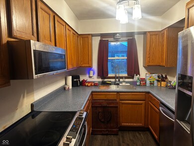
Nestled at 109 S Range ST, WESTPORT, IN, this single-family residence in Decatur County presents an inviting home, ready for you to move in. The living room is a bright and airy space that enhances the sense of openness and light within the home. Imagine relaxing in this comfortable setting, where the architectural design invites a sense of calm and relaxation. The kitchen features shaker cabinets, offering a blend of classic style and practical storage solutions. Envision preparing meals in this efficient and aesthetically pleasing culinary space, ideal for both everyday cooking and entertaining. Both bathrooms feature a double vanity, providing ample space and convenience for your daily routines. Start and end your day in this thoughtfully designed space, where functionality meets a touch of elegance. This residence also offers three bedrooms and a walk-in closet, providing essential storage and comfort. The property occupies a 5280 square feet lot area, with the living area encompassing 1466 square feet. This 1971 single-story home is a wonderful opportunity to own a home in a great location.
Last Agent to Sell the Property
RE/MAX Tower Brokerage Email: snyderpoint@hotmail.com License #RB14040398 Listed on: 11/21/2025

| Date | Type | Sale Price | Title Company |
|---|---|---|---|
| Warranty Deed | -- | First American Title | |
| Warranty Deed | $52,000 | None Listed On Document | |
| Warranty Deed | $52,000 | None Listed On Document | |
| Warranty Deed | -- | -- | |
| Deed | $60,000 | Mainsource Title, Llc | |
| Deed | $60,000 | Mainsource Title Llc |
| Date | Status | Loan Amount | Loan Type |
|---|---|---|---|
| Open | $171,830 | FHA |
| Date | Event | Price | List to Sale | Price per Sq Ft |
|---|---|---|---|---|
| 01/30/2026 01/30/26 | Sold | $175,000 | -1.4% | $119 / Sq Ft |
| 01/01/2026 01/01/26 | Pending | -- | -- | -- |
| 11/21/2025 11/21/25 | For Sale | $177,500 | -- | $121 / Sq Ft |
| Year | Tax Paid | Tax Assessment Tax Assessment Total Assessment is a certain percentage of the fair market value that is determined by local assessors to be the total taxable value of land and additions on the property. | Land | Improvement |
|---|---|---|---|---|
| 2025 | $800 | $130,800 | $14,300 | $116,500 |
| 2024 | $800 | $129,800 | $10,300 | $119,500 |
| 2023 | $731 | $120,000 | $10,300 | $109,700 |
| 2022 | $658 | $109,200 | $10,300 | $98,900 |
| 2021 | $713 | $101,800 | $10,300 | $91,500 |
| 2020 | $481 | $86,500 | $7,400 | $79,100 |
| 2019 | $356 | $76,200 | $7,400 | $68,800 |
| 2018 | $276 | $68,400 | $7,400 | $61,000 |
| 2017 | $245 | $65,000 | $7,400 | $57,600 |
| 2016 | $242 | $64,600 | $6,600 | $58,000 |
| 2014 | $1,151 | $61,100 | $6,600 | $54,500 |
| 2013 | $1,159 | $58,500 | $6,600 | $51,900 |
S
Seller's Agent in 2026
Steve Snyder
RE/MAX Tower
50 Total Sales
Buyer's Agent in 2026
Cat Kick
Berkshire Hathaway Home
(812) 595-2320
209 Total Sales
Source: MIBOR Broker Listing Cooperative®
MLS Number: 22074552
APN: 16-18-01-110-008.000-014
Disclaimer: Certain information contained herein is derived from information provided by parties other than Homes.com. All information provided is deemed reliable, but is not guaranteed to be accurate and should be independently verified.
![]() Based on information submitted to the MLS GRID. All data is obtained from various sources and may not have been verified by broker or MLS GRID. Supplied Open House Information is subject to change without notice. All information should be independently reviewed and verified for accuracy. Properties may or may not be listed by the office/agent presenting the information. Some IDX listings have been excluded from this website.
Based on information submitted to the MLS GRID. All data is obtained from various sources and may not have been verified by broker or MLS GRID. Supplied Open House Information is subject to change without notice. All information should be independently reviewed and verified for accuracy. Properties may or may not be listed by the office/agent presenting the information. Some IDX listings have been excluded from this website.
Based on information submitted to the MLS GRID
Ask me questions while you tour the home.