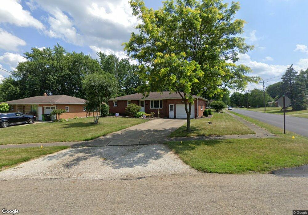
1090 Stark Dr Alliance, OH 44601
Estimated Value: $135,000 - $177,000
3
Beds
2
Baths
1,028
Sq Ft
$157/Sq Ft
Est. Value
About This Home
This home is located at 1090 Stark Dr, Alliance, OH 44601 and is currently estimated at $161,371, approximately $156 per square foot. 1090 Stark Dr is a home located in Stark County with nearby schools including Alliance Elementary School at Rockhill, Alliance Intermediate School at Northside, and Alliance Middle School.
Ownership History
Date
Name
Owned For
Owner Type
Purchase Details
Closed on
Jun 17, 2008
Sold by
Va
Bought by
Bosca Avrel
Current Estimated Value
Purchase Details
Closed on
Mar 11, 2008
Sold by
Davis Thomas M and Davis Marie R
Bought by
Va
Purchase Details
Closed on
Mar 15, 2002
Sold by
Harry Delong and Harry A
Bought by
Davis Thomas M
Home Financials for this Owner
Home Financials are based on the most recent Mortgage that was taken out on this home.
Original Mortgage
$86,598
Interest Rate
7.11%
Mortgage Type
VA
Purchase Details
Closed on
May 28, 1993
Create a Home Valuation Report for This Property
The Home Valuation Report is an in-depth analysis detailing your home's value as well as a comparison with similar homes in the area
Home Values in the Area
Average Home Value in this Area
Purchase History
| Date | Buyer | Sale Price | Title Company |
|---|---|---|---|
| Bosca Avrel | -- | None Available | |
| Va | $81,080 | None Available | |
| Davis Thomas M | $84,900 | -- | |
| -- | $68,000 | -- |
Source: Public Records
Mortgage History
| Date | Status | Borrower | Loan Amount |
|---|---|---|---|
| Previous Owner | Davis Thomas M | $86,598 |
Source: Public Records
Tax History Compared to Growth
Tax History
| Year | Tax Paid | Tax Assessment Tax Assessment Total Assessment is a certain percentage of the fair market value that is determined by local assessors to be the total taxable value of land and additions on the property. | Land | Improvement |
|---|---|---|---|---|
| 2025 | -- | $40,640 | $12,850 | $27,790 |
| 2024 | -- | $40,640 | $12,850 | $27,790 |
| 2023 | $1,406 | $34,160 | $9,310 | $24,850 |
| 2022 | $1,415 | $34,160 | $9,310 | $24,850 |
| 2021 | $1,419 | $34,160 | $9,310 | $24,850 |
| 2020 | $1,328 | $29,860 | $8,090 | $21,770 |
| 2019 | $1,310 | $29,860 | $8,090 | $21,770 |
| 2018 | $1,316 | $29,860 | $8,090 | $21,770 |
| 2017 | $1,130 | $25,170 | $6,650 | $18,520 |
| 2016 | $1,139 | $25,170 | $6,650 | $18,520 |
| 2015 | $1,149 | $25,170 | $6,650 | $18,520 |
| 2014 | $1,237 | $25,800 | $6,830 | $18,970 |
| 2013 | $617 | $25,800 | $6,830 | $18,970 |
Source: Public Records
Map
Nearby Homes
- 2112 Blenheim Ave
- 1059 Oakwood Dr
- 2050 Federal Ave
- 2220 Western Ave
- 884 W College Rd
- 2839 S Rockhill Ave
- 1515 S Rockhill Ave
- 3101 Ridgehill Ave
- 1201 Overlook Dr
- 1321 Parkway Blvd
- 0 Winchester St
- 0 Winchester St Unit 5162877
- 1038 Fairview Place
- 1325 W Beech St
- 970 Kingsway St
- 738 Kingsway St
- 896 Parkway Blvd
- 112 E College St
- 236 E Milton St
- 1475 Chatauqua Ct
- 1080 Stark Dr
- 2328 Eastern Ave
- 2342 Eastern Ave
- 2315 Eastern Ave
- 2315 Pleasant Place
- 2329 Pleasant Place
- 1133 Stark Dr
- 2329 Eastern Ave
- 2305 Pleasant Place
- 2354 Eastern Ave
- 2343 Pleasant Place
- 1155 Stark Dr
- 2345 Eastern Ave
- 1165 Stark Dr
- 2370 Eastern Ave
- 2371 Eastern Ave
- 1166 Stark Dr
- 2371 Pleasant Place
- 1171 Stark Dr
- 2300 Pleasant Place