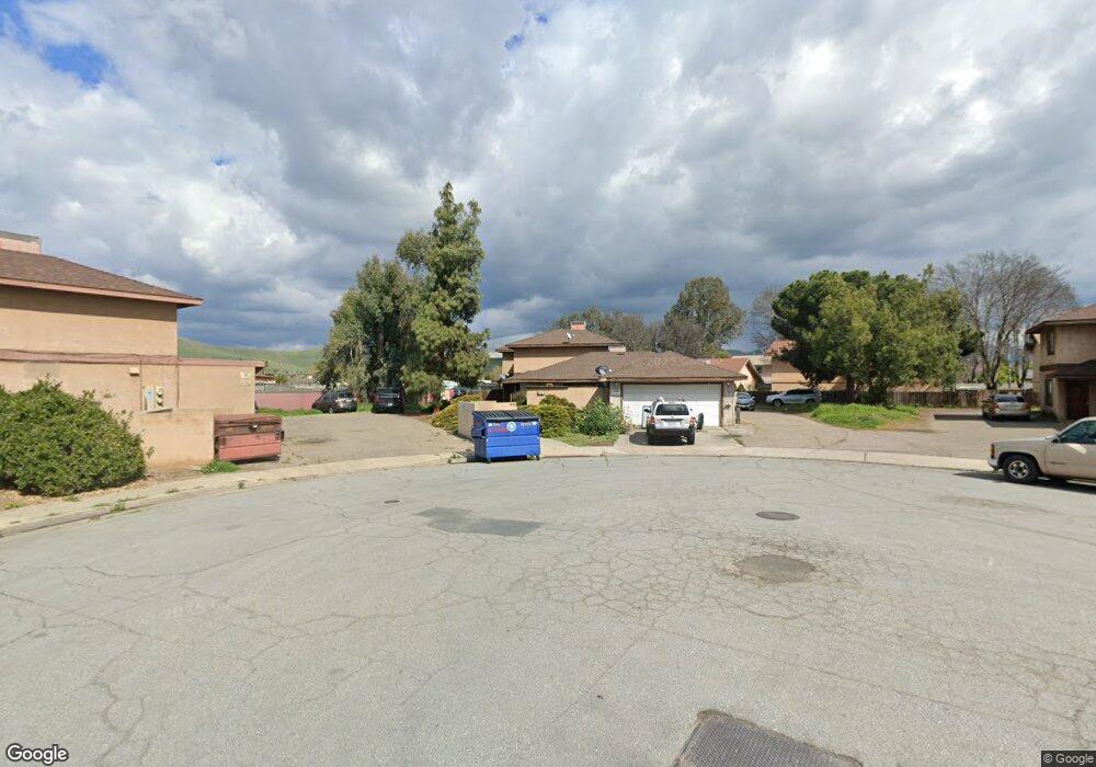
1090 Stonegate Cove Dr Porterville, CA 93257
Porterville Northwest NeighborhoodEstimated Value: $384,000 - $457,000
--
Bed
--
Bath
--
Sq Ft
0.34
Acres
About This Home
This home is located at 1090 Stonegate Cove Dr, Porterville, CA 93257 and is currently estimated at $411,333. 1090 Stonegate Cove Dr is a home located in Tulare County with nearby schools including Monte Vista Elementary School, Strathmore Elementary School, and Sequoia Middle School.
Ownership History
Date
Name
Owned For
Owner Type
Purchase Details
Closed on
Apr 23, 2016
Sold by
Wong Connie L
Bought by
The Connie Wong Living Trust
Current Estimated Value
Purchase Details
Closed on
Oct 8, 2001
Sold by
Wong Norman S
Bought by
Wong Norman S and Norman S Wong Revocable Trust
Purchase Details
Closed on
Jan 10, 2001
Sold by
Berg Diane
Bought by
Wong Connie L
Create a Home Valuation Report for This Property
The Home Valuation Report is an in-depth analysis detailing your home's value as well as a comparison with similar homes in the area
Home Values in the Area
Average Home Value in this Area
Purchase History
| Date | Buyer | Sale Price | Title Company |
|---|---|---|---|
| The Connie Wong Living Trust | -- | None Available | |
| Wong Norman S | -- | -- | |
| Wong Connie L | -- | None Available |
Source: Public Records
Tax History Compared to Growth
Tax History
| Year | Tax Paid | Tax Assessment Tax Assessment Total Assessment is a certain percentage of the fair market value that is determined by local assessors to be the total taxable value of land and additions on the property. | Land | Improvement |
|---|---|---|---|---|
| 2025 | $2,373 | $223,439 | $50,781 | $172,658 |
| 2024 | $2,373 | $219,059 | $49,786 | $169,273 |
| 2023 | $2,371 | $214,764 | $48,810 | $165,954 |
| 2022 | $2,298 | $210,553 | $47,853 | $162,700 |
| 2021 | $2,271 | $206,425 | $46,915 | $159,510 |
| 2020 | $2,247 | $204,308 | $46,434 | $157,874 |
| 2019 | $2,206 | $200,302 | $45,524 | $154,778 |
| 2018 | $2,167 | $196,374 | $44,631 | $151,743 |
| 2017 | $2,114 | $192,524 | $43,756 | $148,768 |
| 2016 | $2,029 | $188,749 | $42,898 | $145,851 |
| 2015 | $1,999 | $185,914 | $42,254 | $143,660 |
| 2014 | $1,951 | $182,272 | $41,426 | $140,846 |
Source: Public Records
Map
Nearby Homes
- 680 W Gerry Cir
- 681 W Mulberry Ave
- 829 Pioneer Ave
- 927 Shadowood Place
- 793 Pioneer Ave
- 701 W Theta Ave
- 701 Theta Ave
- 1045 N Westside St
- 1089 Pioneer Ave
- 816 W Grand Ave
- 1245 Atkins St
- 700 N Prospect St
- 824 W Grand Ave
- 1076 N Beverly St
- 640 N Prospect St
- 1167 N Main St
- 1370 Lindale Place
- 572 Memory Ln
- 1121 N Lindale Way
- 670 W Kanai Ave
- 811 W Morton Ave
- 1065 N Wisconsin Way
- 1099 Stonegate Cove Dr
- 1086 N Wisconsin Way
- 1055 N Wisconsin Way
- 1091 Stonegate Cove Dr
- 1081 Stonegate Cove Dr
- 880 Gerry Ln
- 1040 Stonegate Cove Dr
- 895 W Westfield Ave
- 1045 N Wisconsin Way
- 881 Gerry Ln
- 1035 N Wisconsin Way
- 880 Sandra Ln
- 870 Gerry Ln
- 880 Sandra Ln
- 1041 Stonegate Cove Dr
- 871 Gerry Ln
- 1025 N Wisconsin Way
- 870 Sandra Ln