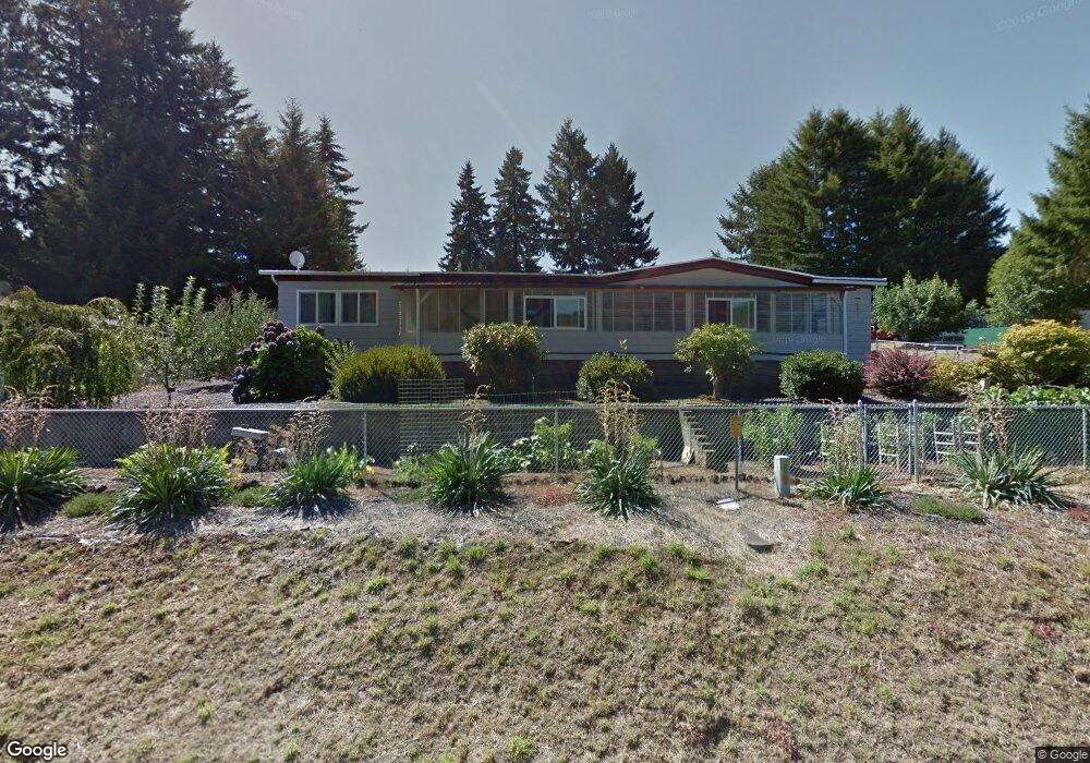
1090 Wooley Ct Yoncalla, OR 97499
Estimated Value: $262,000 - $554,000
3
Beds
2
Baths
1,782
Sq Ft
$204/Sq Ft
Est. Value
About This Home
This home is located at 1090 Wooley Ct, Yoncalla, OR 97499 and is currently estimated at $362,903, approximately $203 per square foot. 1090 Wooley Ct is a home located in Douglas County with nearby schools including Yoncalla Elementary School and Yoncalla High School.
Ownership History
Date
Name
Owned For
Owner Type
Purchase Details
Closed on
Jul 15, 2005
Sold by
Pritchard John R and Pritchard Gertrude
Bought by
Edwards Billy Jack and Edwards Arlene Elizabeth
Current Estimated Value
Home Financials for this Owner
Home Financials are based on the most recent Mortgage that was taken out on this home.
Original Mortgage
$232,400
Interest Rate
5.58%
Mortgage Type
Fannie Mae Freddie Mac
Purchase Details
Closed on
Jul 6, 2005
Sold by
Ebner Benjamin L and Ebner Jennifer L
Bought by
Cook Alan D and Cook Sandra L
Home Financials for this Owner
Home Financials are based on the most recent Mortgage that was taken out on this home.
Original Mortgage
$232,400
Interest Rate
5.58%
Mortgage Type
Fannie Mae Freddie Mac
Purchase Details
Closed on
Mar 26, 1998
Sold by
Ellison Luther H
Bought by
Stratton Bros Inc
Create a Home Valuation Report for This Property
The Home Valuation Report is an in-depth analysis detailing your home's value as well as a comparison with similar homes in the area
Purchase History
| Date | Buyer | Sale Price | Title Company |
|---|---|---|---|
| Edwards Billy Jack | $114,000 | First American Title Ins Co | |
| Cook Alan D | $290,500 | First American Title Ins Co | |
| Stratton Bros Inc | $400,000 | Douglas County Title Company |
Source: Public Records
Mortgage History
| Date | Status | Borrower | Loan Amount |
|---|---|---|---|
| Previous Owner | Cook Alan D | $232,400 |
Source: Public Records
Tax History
| Year | Tax Paid | Tax Assessment Tax Assessment Total Assessment is a certain percentage of the fair market value that is determined by local assessors to be the total taxable value of land and additions on the property. | Land | Improvement |
|---|---|---|---|---|
| 2025 | $1,161 | $108,835 | -- | -- |
| 2024 | $1,127 | $105,666 | -- | -- |
| 2023 | $1,094 | $102,589 | $0 | $0 |
| 2022 | $1,063 | $99,601 | $0 | $0 |
| 2021 | $1,032 | $96,700 | $0 | $0 |
| 2020 | $1,002 | $93,884 | $0 | $0 |
| 2019 | $972 | $91,150 | $0 | $0 |
| 2018 | $944 | $88,496 | $0 | $0 |
| 2017 | $917 | $85,919 | $0 | $0 |
| 2016 | $890 | $83,417 | $0 | $0 |
| 2015 | $864 | $80,988 | $0 | $0 |
| 2014 | $839 | $78,630 | $0 | $0 |
| 2013 | -- | $76,340 | $0 | $0 |
Source: Public Records
Map
Nearby Homes
- 1059 Wooley Ct
- 1019 Wooley Ct
- 1039 Wooley Ct
- 1079 Wooley Ct
- 1089 Wooley Ct
- 0 Anne St Unit Lot 1 220196575
- 0 Anne St Unit LOT 1 289234974
- 373 Hayhurst Rd
- 656 Applegate Ave
- 703 Main St
- 644 Main St
- 173 Main St
- 0 1st St
- 485 Andrews Rd
- 435 Spruce St
- 420 Halo Trail Rd
- 0 Wilson Rd Unit 22339417
- 773 Upper Ridge Rd
- 841 Skelly Rd
- 408 Whipple Ave
- 1050 Wooley Ct
- 1075 Whipple Ct
- 1035 Whipple Ct
- 0 Westlog St
- 1040 Wooley Ct Unit D
- 521 Westlog St
- 541 Westlog St
- 501 Westlog St
- 1015 Whipple Ct
- 561 Westlog St
- 491 Westlog St
- 1020 Wooley Ct
- 581 Westlog St
- 1009 Wooley Ct
- 1005 Whipple Ct
- 1076 Whipple Ct
- 1096 Whipple Ct
- 601 Westlog St
- 451 Westlog St
- 1056 Whipple Ct
Your Personal Tour Guide
Ask me questions while you tour the home.