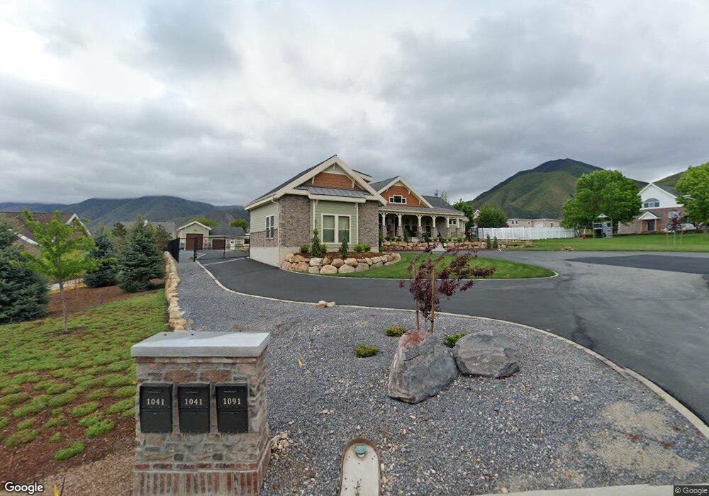
1091 Hawks Rest Dr Mapleton, UT 84664
Estimated Value: $1,826,000 - $2,140,134
4
Beds
5
Baths
3,437
Sq Ft
$577/Sq Ft
Est. Value
About This Home
This home is located at 1091 Hawks Rest Dr, Mapleton, UT 84664 and is currently estimated at $1,983,067, approximately $576 per square foot. 1091 Hawks Rest Dr is a home with nearby schools including Mapleton School, Mapleton Junior High School, and Maple Mountain High School.
Ownership History
Date
Name
Owned For
Owner Type
Purchase Details
Closed on
Nov 30, 2021
Sold by
Fulton and Joan
Bought by
Michael And Joan Fulton Family Trust
Current Estimated Value
Purchase Details
Closed on
Aug 26, 2015
Sold by
W A Properties Llc
Bought by
Fulton Michael and Fulton Joan
Purchase Details
Closed on
Apr 1, 2005
Sold by
Walker Annie and The Annie Walker Family Living
Bought by
W A Properties Llc
Purchase Details
Closed on
Oct 5, 2001
Sold by
Walker Stewart Lee and Walker Anna Marie
Bought by
Walker Annie and Annie Walker Family Living Tru
Purchase Details
Closed on
Sep 25, 2001
Sold by
Mcdonald Daniel M and Mcdonald Karina M
Bought by
Walker Stewart Lee and Walker Anna Marie
Purchase Details
Closed on
Aug 12, 1999
Sold by
Sommerset Park Lc
Bought by
Mcdonald Daniel M and Mcdonald Karina M
Create a Home Valuation Report for This Property
The Home Valuation Report is an in-depth analysis detailing your home's value as well as a comparison with similar homes in the area
Home Values in the Area
Average Home Value in this Area
Purchase History
| Date | Buyer | Sale Price | Title Company |
|---|---|---|---|
| Michael And Joan Fulton Family Trust | -- | None Listed On Document | |
| Fulton Michael | -- | Utah First Title Ins Ag | |
| W A Properties Llc | -- | Fidelity Land & Title | |
| Walker Annie | -- | Fidelity Land & Title | |
| Walker Stewart Lee | -- | Fidelity Land & Title | |
| Mcdonald Daniel M | -- | Mountain West Title Co |
Source: Public Records
Tax History
| Year | Tax Paid | Tax Assessment Tax Assessment Total Assessment is a certain percentage of the fair market value that is determined by local assessors to be the total taxable value of land and additions on the property. | Land | Improvement |
|---|---|---|---|---|
| 2025 | $9,556 | $1,079,100 | -- | -- |
| 2024 | $9,556 | $936,135 | $0 | $0 |
| 2023 | $9,467 | $933,220 | $0 | $0 |
| 2022 | $9,082 | $1,594,000 | $612,900 | $981,100 |
| 2021 | $7,372 | $1,090,900 | $336,200 | $754,700 |
| 2020 | $7,251 | $1,038,900 | $313,200 | $725,700 |
| 2019 | $6,969 | $1,018,900 | $293,200 | $725,700 |
| 2018 | $6,858 | $955,900 | $280,700 | $675,200 |
| 2017 | $6,470 | $482,955 | $0 | $0 |
| 2016 | $3,357 | $249,100 | $0 | $0 |
| 2015 | $3,038 | $224,100 | $0 | $0 |
| 2014 | $2,714 | $196,600 | $0 | $0 |
Source: Public Records
Map
Nearby Homes
- 644 S 1330 E
- 4021 S Ironwood Ln Unit 428
- 4886 S Englemann Ln Unit 525
- 2254 715 S Unit 60
- 4013 S Ironwood Ln Unit 432
- 4014 S Ironwood Ln
- 4001 S Ironwood Ln Unit 438
- 2254 715 S
- 4012 S Ironwood Ln Unit 424
- 2042 715 S Unit 57
- 4019 S Ironwood Ln Unit 429
- 2042 715 S
- 1759 S Perry Dr
- 575 S 1560 E
- 1377 E Maple St
- 745 E Maple St
- 753 Sierra View Dr
- 748 Sierra View Dr
- 162 N 800 E
- 1515 E Maple St
- 1041 Hawks Rest Dr Unit 4
- 634 S 1200 E
- 572 S 1200 E
- 1034 E Hawks Rest Dr Unit 13
- 1086 E Hawks Rest Dr Unit 14
- 920 E Hawks Rest Dr Unit 11
- 947 E Hawks Rest Dr Unit 12
- 887 E Hawks Rest Dr Unit 7
- 941 E Hawks Rest Dr Unit 6
- 985 E Hawks Rest Dr Unit 5
- 1041 E Hawks Rest Dr Unit 4
- 1155 E Hawks Rest Dr Unit 2
- 1160 E Hawks Rest Dr Unit 15
- 1091 E Hawks Rest Dr Unit 3
- 1704 E 700 S Unit 18
- 1086 Hawks Rest Dr
- 468 S 1200 E
- 1034 Hawks Rest Dr
- 1086 Hawks Rest Dr
- 985 Hawks Rest Dr Unit 5
Your Personal Tour Guide
Ask me questions while you tour the home.