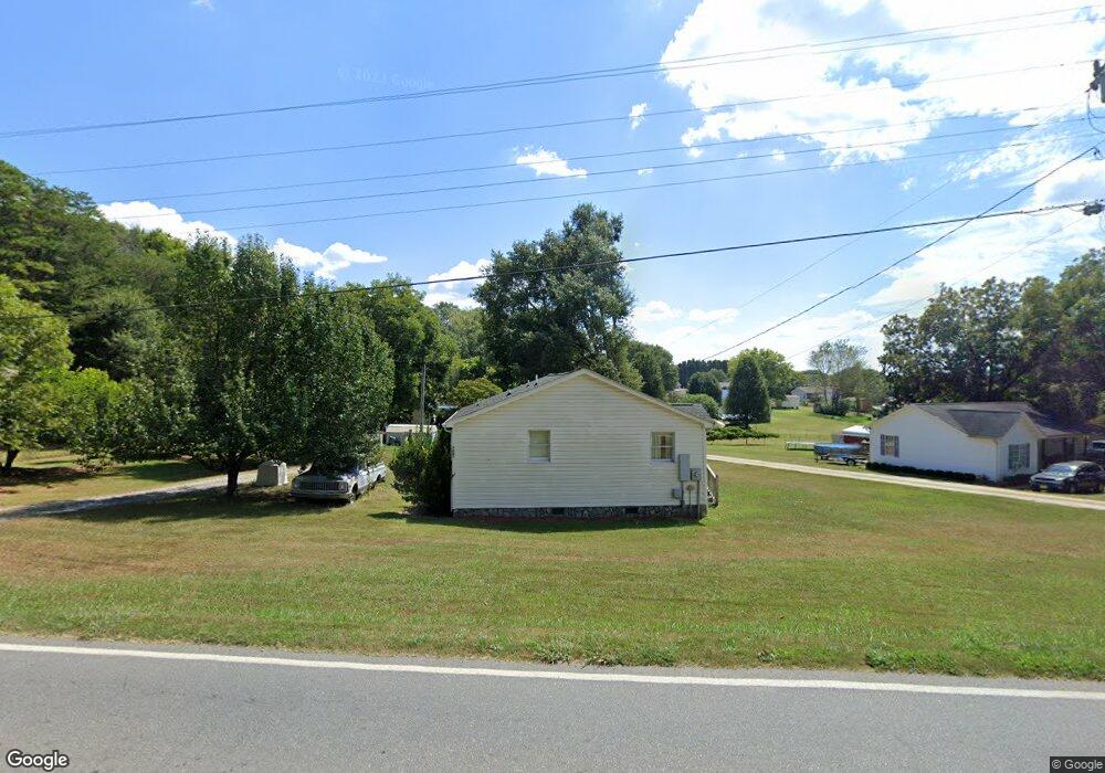
1091 Highway 182 Lincolnton, NC 28092
Estimated Value: $153,000 - $195,000
2
Beds
1
Bath
840
Sq Ft
$207/Sq Ft
Est. Value
About This Home
This home is located at 1091 Highway 182, Lincolnton, NC 28092 and is currently estimated at $173,908, approximately $207 per square foot. 1091 Highway 182 is a home located in Lincoln County with nearby schools including Love Memorial Elementary School, West Lincoln Middle, and West Lincoln High School.
Ownership History
Date
Name
Owned For
Owner Type
Purchase Details
Closed on
Oct 11, 2012
Sold by
Morrison Kenneth Moore and Morrison Terri Rich
Bought by
Morrison Kenneth Moore
Current Estimated Value
Purchase Details
Closed on
Mar 23, 2001
Bought by
Morrison Kenneth Moore and Terri Ric
Purchase Details
Closed on
Aug 17, 1999
Bought by
Sutton Scott M and Sutton Kimberly R
Purchase Details
Closed on
Apr 26, 1999
Bought by
Heafner William L and Milh Michael R
Purchase Details
Closed on
May 19, 1997
Bought by
Bingham Paul
Create a Home Valuation Report for This Property
The Home Valuation Report is an in-depth analysis detailing your home's value as well as a comparison with similar homes in the area
Home Values in the Area
Average Home Value in this Area
Purchase History
| Date | Buyer | Sale Price | Title Company |
|---|---|---|---|
| Morrison Kenneth Moore | -- | None Available | |
| Morrison Kenneth Moore | $69,000 | -- | |
| Sutton Scott M | $16,500 | -- | |
| Heafner William L | $10,000 | -- | |
| Bingham Paul | $16,000 | -- |
Source: Public Records
Tax History Compared to Growth
Tax History
| Year | Tax Paid | Tax Assessment Tax Assessment Total Assessment is a certain percentage of the fair market value that is determined by local assessors to be the total taxable value of land and additions on the property. | Land | Improvement |
|---|---|---|---|---|
| 2025 | $1,070 | $151,406 | $24,000 | $127,406 |
| 2024 | $1,050 | $151,406 | $24,000 | $127,406 |
| 2023 | $1,001 | $151,406 | $24,000 | $127,406 |
| 2022 | $581 | $66,092 | $20,000 | $46,092 |
| 2021 | $581 | $66,092 | $20,000 | $46,092 |
| 2020 | $453 | $66,092 | $20,000 | $46,092 |
| 2019 | $453 | $66,092 | $20,000 | $46,092 |
| 2018 | $484 | $53,877 | $18,500 | $35,377 |
| 2017 | $364 | $53,877 | $18,500 | $35,377 |
| 2016 | $364 | $53,877 | $18,500 | $35,377 |
| 2015 | $442 | $53,877 | $18,500 | $35,377 |
| 2014 | $514 | $65,404 | $20,000 | $45,404 |
Source: Public Records
Map
Nearby Homes
- 1070 N Carolina 182
- 0 N Carolina 182 Unit CAR4246688
- 668 Riverside Dr
- 776 S Grove St Unit EXT
- 515 Willow St
- 1338 Pell Dr
- 00 Glenn St
- 697 S Grove St
- 743 Lore Rd
- 689 S Grove St
- 681 S Grove St
- 524 Bonview Ave
- 536 Lincolnview Rd
- 1231 Better Brook Ln
- 792 Carolina Mill Cir
- 217 Blossom Hill Rd
- 411 W Sycamore St
- 627 W Main St
- 502 Forney Ave
- 000 Better Brook Ln
- 197 Old Lincolnton Crouse Rd
- 1142 Westward Trail
- 1031 Highway 182
- 1070 Highway 182
- 211 Old Lincolnton Crouse Rd
- 1133 Westward Trail
- 1133 Westward Dr
- 1062 Highway 182
- 1062 Nc-182
- 1053 Highway 182
- 223 Old Lincolnton Crouse Rd
- 164 Hilltop Rd
- 1128 Westward Dr
- 0 Davis Rd Unit 2 3433529
- 0 Davis Rd Unit 789471
- 0 Davis Rd Unit 2012756
- 0 Davis Rd Unit 3142320
- 00 Davis Rd
- 0 Davis Rd Unit 2
- 1208 Tiny Trail