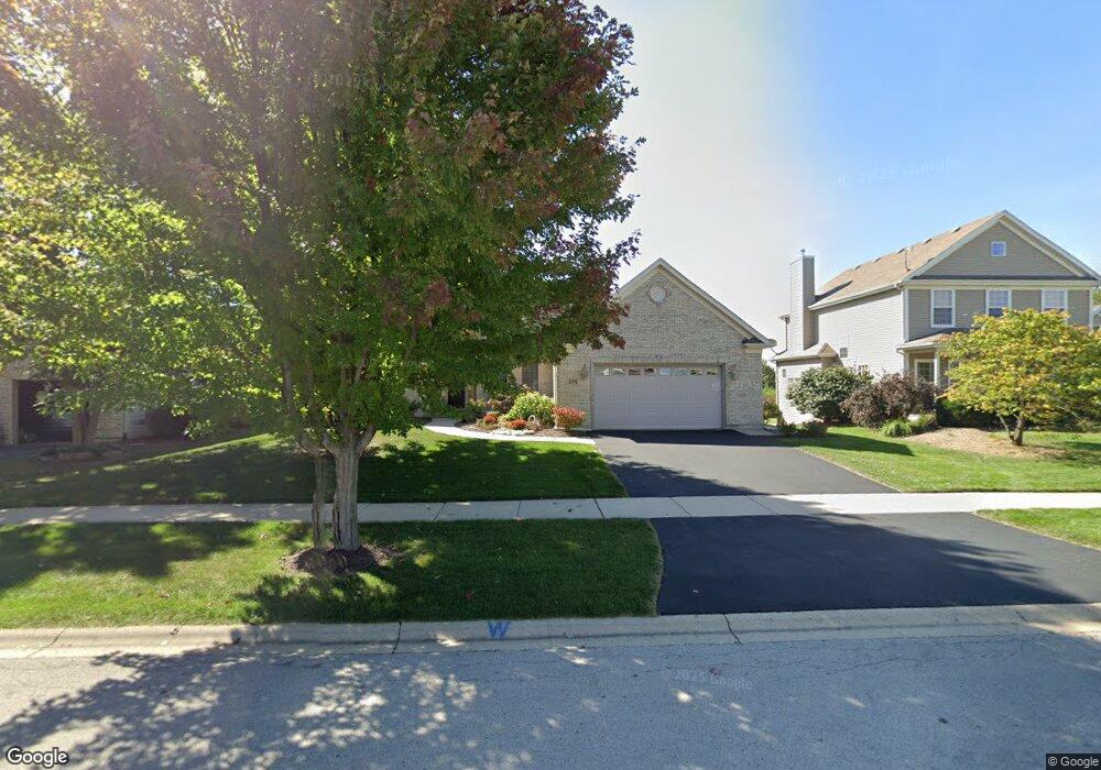
1091 Independence Ave Elburn, IL 60119
Estimated Value: $502,415 - $572,000
3
Beds
2
Baths
2,386
Sq Ft
$227/Sq Ft
Est. Value
About This Home
This home is located at 1091 Independence Ave, Elburn, IL 60119 and is currently estimated at $542,604, approximately $227 per square foot. 1091 Independence Ave is a home located in Kane County with nearby schools including Kaneland Blackberry Creek Elementary School, Harter Middle School, and Kaneland High School.
Ownership History
Date
Name
Owned For
Owner Type
Purchase Details
Closed on
Nov 14, 2025
Sold by
Robinson Sandra D
Bought by
Sandra D Robinson Living Trust and Robinson
Current Estimated Value
Purchase Details
Closed on
Jan 25, 2006
Sold by
Schmidt Builders Inc
Bought by
Robinson Donald J and Robinson Sandra D
Home Financials for this Owner
Home Financials are based on the most recent Mortgage that was taken out on this home.
Original Mortgage
$150,000
Interest Rate
6.46%
Mortgage Type
Fannie Mae Freddie Mac
Create a Home Valuation Report for This Property
The Home Valuation Report is an in-depth analysis detailing your home's value as well as a comparison with similar homes in the area
Home Values in the Area
Average Home Value in this Area
Purchase History
| Date | Buyer | Sale Price | Title Company |
|---|---|---|---|
| Sandra D Robinson Living Trust | -- | None Listed On Document | |
| Robinson Donald J | $405,000 | Chicago Title Insurance Comp |
Source: Public Records
Mortgage History
| Date | Status | Borrower | Loan Amount |
|---|---|---|---|
| Previous Owner | Robinson Donald J | $150,000 |
Source: Public Records
Tax History
| Year | Tax Paid | Tax Assessment Tax Assessment Total Assessment is a certain percentage of the fair market value that is determined by local assessors to be the total taxable value of land and additions on the property. | Land | Improvement |
|---|---|---|---|---|
| 2024 | $11,801 | $153,477 | $18,723 | $134,754 |
| 2023 | $11,303 | $138,517 | $16,898 | $121,619 |
| 2022 | $12,008 | $137,243 | $15,508 | $121,735 |
| 2021 | $11,553 | $131,358 | $14,843 | $116,515 |
| 2020 | $11,333 | $128,279 | $14,495 | $113,784 |
| 2019 | $11,334 | $126,396 | $14,282 | $112,114 |
| 2018 | $11,575 | $126,567 | $14,282 | $112,285 |
| 2017 | $11,574 | $125,128 | $14,120 | $111,008 |
| 2016 | $11,906 | $125,166 | $13,747 | $111,419 |
| 2015 | -- | $91,655 | $9,285 | $82,370 |
| 2014 | -- | $95,840 | $15,216 | $80,624 |
| 2013 | -- | $95,840 | $15,216 | $80,624 |
Source: Public Records
Map
Nearby Homes
- 1171 Souders Ave
- 1557 Melbourne St
- 1383 Dodson Ave
- 765 Carolyn Ct
- 931 Patriot Pkwy
- 801 Citizen Ave
- 1038 Veteran Ave
- 1106 Kendall St Unit 6
- 1074 Freedom Rd
- 1076 Freedom Rd
- 1123 Sears Cir
- 980 Sears Cir
- 815 Kindberg Ct
- 16 Derek Dr
- 713 Elizabeth St
- 671 Virginia St
- Lot #11 Derek Dr
- Lot #12 Derek Dr
- Lot #5 Derek Dr
- Lot #6 Derek Dr
- 1077 Independence Ave
- 1107 Independence Ave
- 1095 Independence Ave
- 1087 Independence Ave
- 1033 Independence Ave
- 1063 Independence Ave Unit 10
- 1121 Independence Ave
- 1090 Independence Ave
- 1082 Independence Ave
- Lot 948 Independence Ave
- 1059 Independence Ave
- 1145 Independence Ave
- 1076 Independence Ave Unit 10
- 1126 Independence Ave
- 1129 Lakin Ave Unit 10
- 1054 Independence Ave
- 1091 Lakin Ave
- 1169 Independence Ave
- 1140 Independence Ave
- 1087 Lakin Ave
Your Personal Tour Guide
Ask me questions while you tour the home.