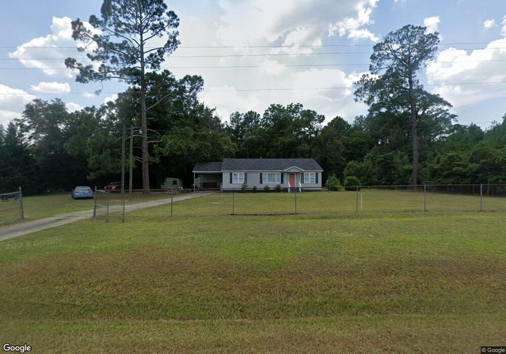
1091 Us Highway 80 Allentown, GA 31017
Estimated Value: $132,783 - $212,000
3
Beds
2
Baths
2,056
Sq Ft
$84/Sq Ft
Est. Value
About This Home
This home is located at 1091 Us Highway 80, Allentown, GA 31017 and is currently estimated at $172,196, approximately $83 per square foot. 1091 Us Highway 80 is a home located in Wilkinson County with nearby schools including Wilkinson County Primary School, Wilkinson County Elementary School, and Wilkinson County Middle School.
Ownership History
Date
Name
Owned For
Owner Type
Purchase Details
Closed on
May 26, 2022
Sold by
Jackson Rose Gail
Bought by
Fountain Vetrina Axom
Current Estimated Value
Home Financials for this Owner
Home Financials are based on the most recent Mortgage that was taken out on this home.
Original Mortgage
$123,256
Outstanding Balance
$117,103
Interest Rate
5.1%
Mortgage Type
FHA
Estimated Equity
$55,093
Purchase Details
Closed on
Sep 28, 2006
Sold by
Mershon Christina Sumner
Bought by
Jackson Rose Gail
Purchase Details
Closed on
Feb 22, 2005
Sold by
Sapp David
Bought by
Elks Charles Sanders
Purchase Details
Closed on
Oct 12, 2000
Sold by
Sumner
Bought by
Sumner Frances Ann
Create a Home Valuation Report for This Property
The Home Valuation Report is an in-depth analysis detailing your home's value as well as a comparison with similar homes in the area
Home Values in the Area
Average Home Value in this Area
Purchase History
| Date | Buyer | Sale Price | Title Company |
|---|---|---|---|
| Fountain Vetrina Axom | $125,531 | -- | |
| Jackson Rose Gail | $15,085 | -- | |
| Elks Charles Sanders | $24,000 | -- | |
| Sumner Frances Ann | -- | -- |
Source: Public Records
Mortgage History
| Date | Status | Borrower | Loan Amount |
|---|---|---|---|
| Open | Fountain Vetrina Axom | $123,256 |
Source: Public Records
Tax History Compared to Growth
Tax History
| Year | Tax Paid | Tax Assessment Tax Assessment Total Assessment is a certain percentage of the fair market value that is determined by local assessors to be the total taxable value of land and additions on the property. | Land | Improvement |
|---|---|---|---|---|
| 2024 | $1,104 | $33,943 | $3,000 | $30,943 |
| 2023 | $1,317 | $33,732 | $3,150 | $30,582 |
| 2022 | $719 | $21,106 | $3,150 | $17,956 |
| 2021 | $698 | $20,280 | $3,150 | $17,130 |
| 2020 | $698 | $20,280 | $3,150 | $17,130 |
| 2019 | $698 | $20,280 | $3,150 | $17,130 |
| 2018 | $698 | $20,280 | $3,150 | $17,130 |
| 2017 | $653 | $20,280 | $3,150 | $17,130 |
| 2016 | $653 | $20,280 | $3,150 | $17,130 |
| 2015 | $656 | $20,280 | $3,150 | $17,130 |
| 2014 | $656 | $20,280 | $3,150 | $17,130 |
| 2013 | $656 | $20,280 | $3,150 | $17,129 |
Source: Public Records
Map
Nearby Homes
- 1409 Allen Ave
- 32 Second St
- 314 N 2nd St
- 309 Walnut St
- 676 N 2nd St
- 239 Canton Rd
- 200 George Gray Rd
- 2382 Gallimore Mill Rd
- 0 Riggins Mills Rd Unit 179911
- 0 Lucy Chapel Rd
- 0 Morton Rd
- 269 Pea Ridge Rd
- 217 Rainbow Rd
- 1 Woodland Rd
- 0 Allgood Rd Unit 10642638
- 0 Allgood Rd Unit 182144
- 103 Constitution Circle Dr Unit D
- 103 Constitution Circle Dr Unit B
- 103 Constitution Circle Dr Unit C
- 103 Constitution Circle Dr Unit A