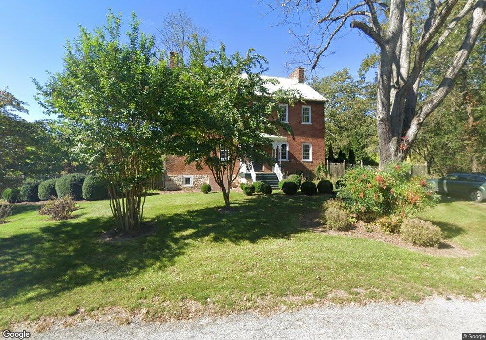
10914 Dam Number 5 Rd Unit AND Clear Spring, MD 21722
Estimated Value: $380,000 - $588,000
--
Bed
2
Baths
2,752
Sq Ft
$183/Sq Ft
Est. Value
About This Home
This home is located at 10914 Dam Number 5 Rd Unit AND, Clear Spring, MD 21722 and is currently estimated at $503,215, approximately $182 per square foot. 10914 Dam Number 5 Rd Unit AND is a home located in Washington County with nearby schools including Clear Spring Elementary School, Clear Spring Middle School, and Clear Spring High School.
Ownership History
Date
Name
Owned For
Owner Type
Purchase Details
Closed on
Mar 16, 2007
Sold by
Lay Billy H and Lay Elizabeth A
Bought by
Dolan Ronald J and Dolan Jean M
Current Estimated Value
Purchase Details
Closed on
Mar 14, 2007
Sold by
Lay Billy H and Lay Elizabeth A
Bought by
Dolan Ronald J and Dolan Jean M
Purchase Details
Closed on
Jan 10, 2000
Sold by
Dichiro Marco C
Bought by
Lay Billy H and Lay Elizabeth A
Purchase Details
Closed on
Sep 3, 1998
Sold by
O'Reagan Kevin P and O'Reagan Debra L
Bought by
Dichiro Marco C
Create a Home Valuation Report for This Property
The Home Valuation Report is an in-depth analysis detailing your home's value as well as a comparison with similar homes in the area
Home Values in the Area
Average Home Value in this Area
Purchase History
| Date | Buyer | Sale Price | Title Company |
|---|---|---|---|
| Dolan Ronald J | $737,500 | -- | |
| Dolan Ronald J | $737,500 | -- | |
| Lay Billy H | $208,000 | -- | |
| Dichiro Marco C | $190,000 | -- |
Source: Public Records
Tax History Compared to Growth
Tax History
| Year | Tax Paid | Tax Assessment Tax Assessment Total Assessment is a certain percentage of the fair market value that is determined by local assessors to be the total taxable value of land and additions on the property. | Land | Improvement |
|---|---|---|---|---|
| 2025 | $3,167 | $354,167 | $0 | $0 |
| 2024 | $3,167 | $319,933 | $0 | $0 |
| 2023 | $3,018 | $285,700 | $140,400 | $145,300 |
| 2022 | $2,939 | $278,033 | $0 | $0 |
| 2021 | $2,913 | $270,367 | $0 | $0 |
| 2020 | $2,832 | $262,700 | $140,400 | $122,300 |
| 2019 | $2,845 | $262,700 | $140,400 | $122,300 |
| 2018 | $2,845 | $262,700 | $140,400 | $122,300 |
| 2017 | $2,880 | $266,000 | $0 | $0 |
| 2016 | -- | $259,300 | $0 | $0 |
| 2015 | -- | $252,600 | $0 | $0 |
| 2014 | $2,884 | $245,900 | $0 | $0 |
Source: Public Records
Map
Nearby Homes
- 134 Saunders Dr
- Lot 23 Emerald Dr
- 0 Bella Vista Subdivision -Section 2 Lot 25 Unit WVBE2036136
- 265 Haventree Terrace
- 0 Bella Vista Subdivision - Section 2 Lot 26
- 148 Vinca Ln
- Block 33 Lot 3 Yogi Bear Blvd
- Block 78 Lot 58 Yogi Bear Blvd
- Block 78 Lot 66 Yogi Bear Blvd
- Block 32 Lot 5 Hilo Rd
- Block 1 Lot 42 Boo Blvd
- 127 Sussex Dr
- 139-118 Boo Blvd
- Block 1 Lot 36 Boo Blvd
- Block 1 Lot 35 Boo Blvd
- 165 Chesley Dr
- 196 Chesley Dr
- Block 5 Lot 9 Poison Oak Ln
- 258 Merrimack Dr
- Block 5 lots 6 and 7 Poison Oak
- 10940 Dam Number 5 Rd Unit AND
- 10968 Dam Number 5 Rd Unit AND
- 29 Dash Dr
- 183 Henson Blvd
- 10862 Dam Number 5 Rd Unit AND
- 217 Henson Blvd
- 197 Henson Blvd
- 159 Henson Blvd
- 4 Dash Dr
- 67 Dash Dr
- 119 Henson Blvd
- 0 Saunders Dr Unit WVBE2037596
- 0 Saunders Dr Unit WVBE2010648
- Lot 48 Forest Dr
- 0 Forest Dr
- 117 Henson Blvd
- 0 Folk Rd
- 152 Henson Blvd
- 320 Burnside Dr
- 85 Dash Dr