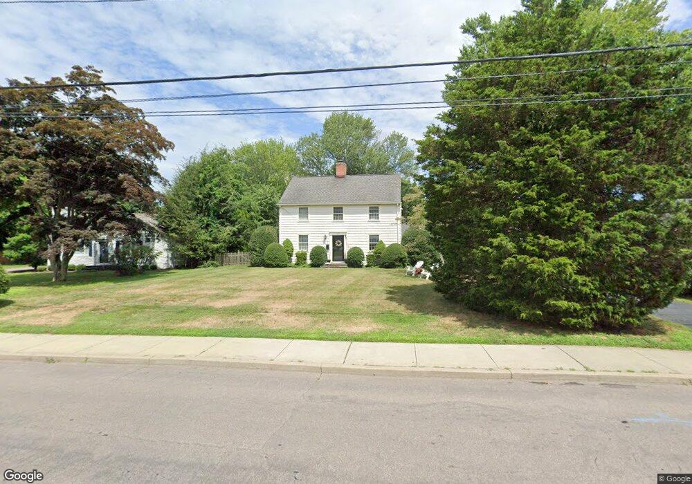
1092 Unquowa Rd Fairfield, CT 06824
University NeighborhoodEstimated Value: $1,339,000 - $1,400,000
4
Beds
4
Baths
2,576
Sq Ft
$531/Sq Ft
Est. Value
About This Home
This home is located at 1092 Unquowa Rd, Fairfield, CT 06824 and is currently estimated at $1,368,450, approximately $531 per square foot. 1092 Unquowa Rd is a home located in Fairfield County with nearby schools including Riverfield Elementary School, Roger Ludlowe Middle School, and Fairfield Ludlowe High School.
Ownership History
Date
Name
Owned For
Owner Type
Purchase Details
Closed on
Dec 9, 1998
Sold by
Ogilvy Peter G and Ogilvy Lynn M
Bought by
Quinn Joanne S and Quinn David
Current Estimated Value
Purchase Details
Closed on
Jun 3, 1991
Sold by
Durkee John W and Durkee Patricia M
Bought by
Ogilvy Peter G and Ogilvy Lynn M
Create a Home Valuation Report for This Property
The Home Valuation Report is an in-depth analysis detailing your home's value as well as a comparison with similar homes in the area
Home Values in the Area
Average Home Value in this Area
Purchase History
| Date | Buyer | Sale Price | Title Company |
|---|---|---|---|
| Quinn Joanne S | $396,000 | -- | |
| Quinn Joanne S | $396,000 | -- | |
| Ogilvy Peter G | $295,000 | -- |
Source: Public Records
Mortgage History
| Date | Status | Borrower | Loan Amount |
|---|---|---|---|
| Open | Ogilvy Peter G | $200,000 | |
| Open | Ogilvy Peter G | $386,500 |
Source: Public Records
Tax History Compared to Growth
Tax History
| Year | Tax Paid | Tax Assessment Tax Assessment Total Assessment is a certain percentage of the fair market value that is determined by local assessors to be the total taxable value of land and additions on the property. | Land | Improvement |
|---|---|---|---|---|
| 2025 | $15,320 | $539,630 | $325,920 | $213,710 |
| 2024 | $15,056 | $539,630 | $325,920 | $213,710 |
| 2023 | $14,845 | $539,630 | $325,920 | $213,710 |
| 2022 | $14,700 | $539,630 | $325,920 | $213,710 |
| 2021 | $14,559 | $539,630 | $325,920 | $213,710 |
| 2020 | $14,809 | $552,790 | $322,560 | $230,230 |
| 2019 | $14,809 | $552,790 | $322,560 | $230,230 |
| 2018 | $14,572 | $552,790 | $322,560 | $230,230 |
| 2017 | $14,273 | $552,790 | $322,560 | $230,230 |
| 2016 | $14,069 | $552,790 | $322,560 | $230,230 |
| 2015 | $14,125 | $569,800 | $339,850 | $229,950 |
| 2014 | $13,903 | $569,800 | $339,850 | $229,950 |
Source: Public Records
Map
Nearby Homes
- 647 Bronson Rd
- 232 Pell Meadow Dr
- 83 Pell Meadow Dr
- 400 Bronson Rd
- 476 Mill Hill Terrace
- 245 Unquowa Rd Unit 34
- 245 Unquowa Rd Unit 11
- 245 Unquowa Rd Unit 33
- 11 Twin Brooks Ln
- 53 Hilltop Dr
- 21 Beaumont St
- 20 Ermine St
- 43 Helen St
- 88 Overhill Rd
- 100 Overhill Rd
- 105 Charter Oak Rd
- 1135 Mill Hill Rd
- 844 Mill Hill Terrace
- 28 Mill Hill Rd Unit 28
- 209 S Pine Creek Rd
- 1112 Unquowa Rd
- 1084 Unquowa Rd
- 50 Dunnlea Rd
- 278 Old Mill Rd
- 1058 Unquowa Rd
- 1107 Unquowa Rd
- 57 Dunnlea Rd
- 306 Old Mill Rd
- 1085 Unquowa Rd
- 240 Old Mill Rd
- 56 Dunnlea Rd
- 1065 Unquowa Rd
- 71 Dunnlea Rd
- 320 Old Mill Rd
- 1040 Unquowa Rd
- 70 Dunnlea Rd
- 1024 Unquowa Rd
- 1160 Unquowa Rd
- 221 Old Mill Rd
- 701 Mill Plain Rd