Estimated Value: $171,000 - $185,000
3
Beds
1
Bath
999
Sq Ft
$180/Sq Ft
Est. Value
About This Home
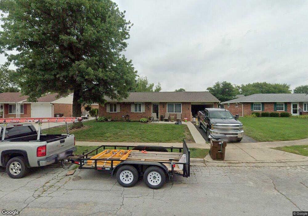
This home is located at 1093 Massachusetts Dr, Xenia, OH 45385 and is currently estimated at $180,236, approximately $180 per square foot. 1093 Massachusetts Dr is a home located in Greene County with nearby schools including Xenia High School, Summit Academy Community School for Alternative Learners - Xenia, and Legacy Christian Academy.
Ownership History
Date
Name
Owned For
Owner Type
Purchase Details
Closed on
Jun 22, 2001
Sold by
Hoskins Charles E and Hoskins Mary R
Bought by
Douglas Robin B
Current Estimated Value
Purchase Details
Closed on
Mar 5, 1998
Sold by
Nolen Todd S and Anderson Karen J
Bought by
Hoskins Charles E and Hoskins Mary R
Home Financials for this Owner
Home Financials are based on the most recent Mortgage that was taken out on this home.
Original Mortgage
$67,000
Interest Rate
7.08%
Create a Home Valuation Report for This Property
The Home Valuation Report is an in-depth analysis detailing your home's value as well as a comparison with similar homes in the area
Home Values in the Area
Average Home Value in this Area
Purchase History
| Date | Buyer | Sale Price | Title Company |
|---|---|---|---|
| Douglas Robin B | $82,500 | -- | |
| Hoskins Charles E | $71,500 | First Title Agency Inc |
Source: Public Records
Mortgage History
| Date | Status | Borrower | Loan Amount |
|---|---|---|---|
| Previous Owner | Hoskins Charles E | $67,000 |
Source: Public Records
Tax History Compared to Growth
Tax History
| Year | Tax Paid | Tax Assessment Tax Assessment Total Assessment is a certain percentage of the fair market value that is determined by local assessors to be the total taxable value of land and additions on the property. | Land | Improvement |
|---|---|---|---|---|
| 2024 | $1,852 | $43,290 | $10,950 | $32,340 |
| 2023 | $1,852 | $43,290 | $10,950 | $32,340 |
| 2022 | $1,493 | $30,530 | $6,440 | $24,090 |
| 2021 | $1,513 | $30,530 | $6,440 | $24,090 |
| 2020 | $1,448 | $30,530 | $6,440 | $24,090 |
| 2019 | $1,370 | $27,180 | $6,310 | $20,870 |
| 2018 | $1,375 | $27,180 | $6,310 | $20,870 |
| 2017 | $1,264 | $27,180 | $6,310 | $20,870 |
| 2016 | $1,265 | $24,540 | $6,310 | $18,230 |
| 2015 | $1,268 | $24,540 | $6,310 | $18,230 |
| 2014 | $1,213 | $24,540 | $6,310 | $18,230 |
Source: Public Records
Map
Nearby Homes
- 1107 Arkansas Dr
- 1255 Colorado Dr
- 2345 Tennessee Dr
- 1908 Whitt St
- 2499 Jenny Marie Dr
- 2421 Louisiana Dr
- 2540 Jenny Marie Dr
- 2257 Maryland Dr
- 1829 Gayhart Dr
- 2540 Cornwall Dr
- 0 Berkshire Dr Unit 942854
- 1866 Roxbury Dr
- 1769 Gayhart Dr
- 1403 Texas Dr
- 2142 Michigan Dr
- 2692 Kingman Dr
- 2545 Harmony Dr
- 2705 Tennessee Dr
- 1778 Arapaho Dr
- 2784 Greystoke Dr
- 1077 Massachusetts Dr
- 1111 Massachusetts Dr
- 1094 Arkansas Dr
- 1061 Massachusetts Dr
- 1112 Arkansas Dr
- 1078 Massachusetts Dr
- 1132 Arkansas Dr
- 1064 Arkansas Dr
- 1129 Massachusetts Dr
- 2179 Tennessee Dr
- 1148 Arkansas Dr
- 1145 Massachusetts Dr
- 1102 Massachusetts Dr
- 2193 Tennessee Dr
- 1162 Arkansas Dr
- 1161 Massachusetts Dr
- 1093 Arkansas Dr
- 1079 Arkansas Dr
- 2162 Tennessee Dr
- 2148 Tennessee Dr