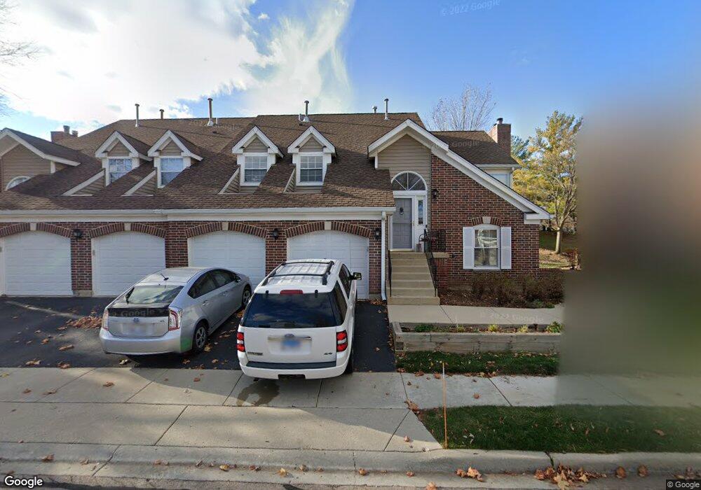
1093 Saint Andrews Ct Unit 293 Algonquin, IL 60102
Estimated Value: $268,000 - $280,880
2
Beds
2
Baths
1,649
Sq Ft
$166/Sq Ft
Est. Value
About This Home
This home is located at 1093 Saint Andrews Ct Unit 293, Algonquin, IL 60102 and is currently estimated at $274,470, approximately $166 per square foot. 1093 Saint Andrews Ct Unit 293 is a home located in McHenry County with nearby schools including Westfield Community School, Kenneth E Neubert Elementary School, and Harry D Jacobs High School.
Ownership History
Date
Name
Owned For
Owner Type
Purchase Details
Closed on
Sep 29, 2008
Sold by
Foran Marynell M
Bought by
Buscemi Dominic
Current Estimated Value
Home Financials for this Owner
Home Financials are based on the most recent Mortgage that was taken out on this home.
Original Mortgage
$100,000
Outstanding Balance
$66,943
Interest Rate
6.57%
Mortgage Type
Purchase Money Mortgage
Estimated Equity
$207,527
Create a Home Valuation Report for This Property
The Home Valuation Report is an in-depth analysis detailing your home's value as well as a comparison with similar homes in the area
Home Values in the Area
Average Home Value in this Area
Purchase History
| Date | Buyer | Sale Price | Title Company |
|---|---|---|---|
| Buscemi Dominic | $169,900 | Ticor |
Source: Public Records
Mortgage History
| Date | Status | Borrower | Loan Amount |
|---|---|---|---|
| Open | Buscemi Dominic | $100,000 |
Source: Public Records
Tax History Compared to Growth
Tax History
| Year | Tax Paid | Tax Assessment Tax Assessment Total Assessment is a certain percentage of the fair market value that is determined by local assessors to be the total taxable value of land and additions on the property. | Land | Improvement |
|---|---|---|---|---|
| 2024 | $4,538 | $74,009 | $15,898 | $58,111 |
| 2023 | $4,871 | $66,192 | $14,219 | $51,973 |
| 2022 | $4,823 | $62,243 | $22,054 | $40,189 |
| 2021 | $4,613 | $57,987 | $20,546 | $37,441 |
| 2020 | $4,484 | $55,935 | $19,819 | $36,116 |
| 2019 | $4,365 | $53,536 | $18,969 | $34,567 |
| 2018 | $3,973 | $47,678 | $17,523 | $30,155 |
| 2017 | $3,875 | $44,916 | $16,508 | $28,408 |
| 2016 | $3,799 | $42,127 | $15,483 | $26,644 |
| 2013 | -- | $46,232 | $14,444 | $31,788 |
Source: Public Records
Map
Nearby Homes
- 1028 Interloch Ct Unit 163
- 1820 Crofton Dr
- 12 White Oak Ct
- 1850 White Oak Dr
- 2021 Brindlewood Ln
- SWC Talaga and Algonquin Rd
- 1 N Hubbard St
- 741 Regal Ln
- 731 Roaring Brook Ln
- 1721 Fernwood Ln
- 700 Fairfield Ln
- 2043 Peach Tree Ln Unit 4122
- 1210 Brandywine Cir
- 18 Dellwood Ct Unit 4204
- 6 Sutcliff Ct
- 000 County Line Rd
- 2101 Peach Tree Ln Unit 4094
- 1455 Saddlebrook Cir
- 1362 S Parkview Terrace
- 2235 Dawson Ln
- 1662 Edgewood Dr Unit 634
- 1091 Saint Andrews Ct Unit 291
- 1668 Edgewood Dr Unit 631
- 1097 Saint Andrews Ct Unit 294
- 1093 St Andrews Ct
- 1666 Edgewood Dr Unit 632
- 1664 Edgewood Dr Unit 633
- 1071 Saint Andrews Ct Unit 301
- 1071 Saint Andrews Ct Unit 1071
- 1672 Edgewood Dr
- 1678 Edgewood Dr
- 1073 Saint Andrews Ct Unit 303
- 1075 Saint Andrews Ct Unit 302
- 1073 Saint Andrews Ct Unit 4
- 1075 Saint Andrews Ct Unit 1
- 1077 Saint Andrews Ct Unit 304
- 1653 Edgewood Dr Unit 183
- 1651 Edgewood Dr Unit 181
- 1655 Edgewood Dr
- 1657 Edgewood Dr Unit 18B