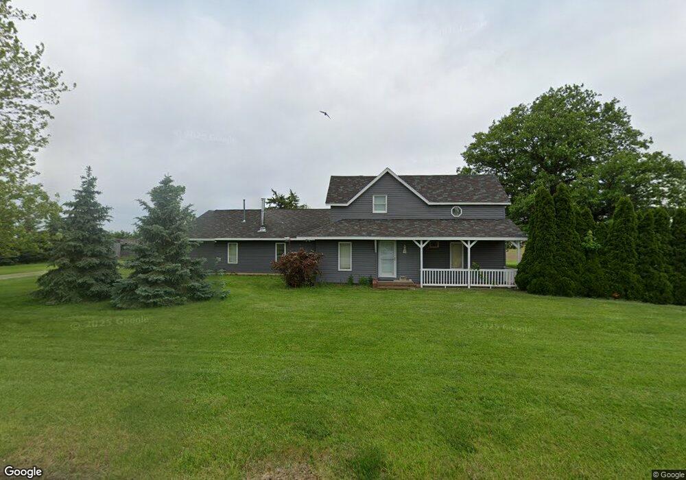
10933 State Route 500 Paulding, OH 45879
Estimated Value: $147,338 - $202,000
3
Beds
1
Bath
1,541
Sq Ft
$114/Sq Ft
Est. Value
About This Home
This home is located at 10933 State Route 500, Paulding, OH 45879 and is currently estimated at $176,085, approximately $114 per square foot. 10933 State Route 500 is a home located in Paulding County with nearby schools including Paulding High School.
Ownership History
Date
Name
Owned For
Owner Type
Purchase Details
Closed on
Feb 4, 2008
Sold by
Reighter Rex E and Reighter Barbara A
Bought by
Sukup Stephen M and Sukup Christine J
Current Estimated Value
Home Financials for this Owner
Home Financials are based on the most recent Mortgage that was taken out on this home.
Original Mortgage
$58,000
Outstanding Balance
$36,277
Interest Rate
5.9%
Mortgage Type
Future Advance Clause Open End Mortgage
Estimated Equity
$139,808
Purchase Details
Closed on
Aug 1, 1997
Bought by
Reighter Rex E Reighter Barbara A
Create a Home Valuation Report for This Property
The Home Valuation Report is an in-depth analysis detailing your home's value as well as a comparison with similar homes in the area
Purchase History
| Date | Buyer | Sale Price | Title Company |
|---|---|---|---|
| Sukup Stephen M | $78,110 | None Available | |
| Reighter Rex E Reighter Barbara A | $800 | -- |
Source: Public Records
Mortgage History
| Date | Status | Borrower | Loan Amount |
|---|---|---|---|
| Open | Sukup Stephen M | $58,000 |
Source: Public Records
Tax History
| Year | Tax Paid | Tax Assessment Tax Assessment Total Assessment is a certain percentage of the fair market value that is determined by local assessors to be the total taxable value of land and additions on the property. | Land | Improvement |
|---|---|---|---|---|
| 2024 | $1,060 | $32,690 | $11,060 | $21,630 |
| 2023 | $800 | $32,690 | $11,060 | $21,630 |
| 2022 | $817 | $32,690 | $11,060 | $21,630 |
| 2021 | $635 | $26,260 | $10,330 | $15,930 |
| 2020 | $656 | $26,260 | $10,330 | $15,930 |
| 2019 | $662 | $24,820 | $10,330 | $14,490 |
| 2018 | $613 | $24,820 | $10,330 | $14,490 |
| 2017 | $614 | $24,820 | $10,330 | $14,490 |
| 2016 | $614 | $24,820 | $10,330 | $14,490 |
| 2015 | $575 | $24,050 | $9,660 | $14,390 |
| 2014 | $572 | $24,050 | $9,660 | $14,390 |
| 2013 | $631 | $24,050 | $9,660 | $14,390 |
Source: Public Records
Map
Nearby Homes
- 11051 Road 93
- 120 S Grant St
- 720 W Wayne St
- 714 W Wayne St
- 717 W Harrison St
- 520 W Wayne St
- 614 W Jackson St
- 215 N Dewitt St
- 829 Greenbriar Ave
- 402 N Williams St
- 308 N Main St
- 516 N Williams St
- 301 N Main St
- 726 N Main St
- 830 N Walnut St
- 606 Lincoln Ave
- 701 E Wayne St
- 741 Tom Tim Dr
- 1065 Emerald Rd
- 13688 Kay St
- 10475 Road 95
- 10968 State Route 500
- 10904 Road 95
- 10950 Road 95
- 10841 State Route 500
- 10841 Ohio 500
- 10876 State Route 500
- 10815 State Route 500
- 11056 State Route 500
- 11090 State Route 500
- 11090 State Route 500 Unit 500
- 10781 State Route 500
- 11132 State Route 500
- 10289 Road 95
- 10546 Road 95
- 11188 State Route 500
- 10468 Road 95
- 10693 State Route 500
- 10267 Road 95
- 10312 Road 95