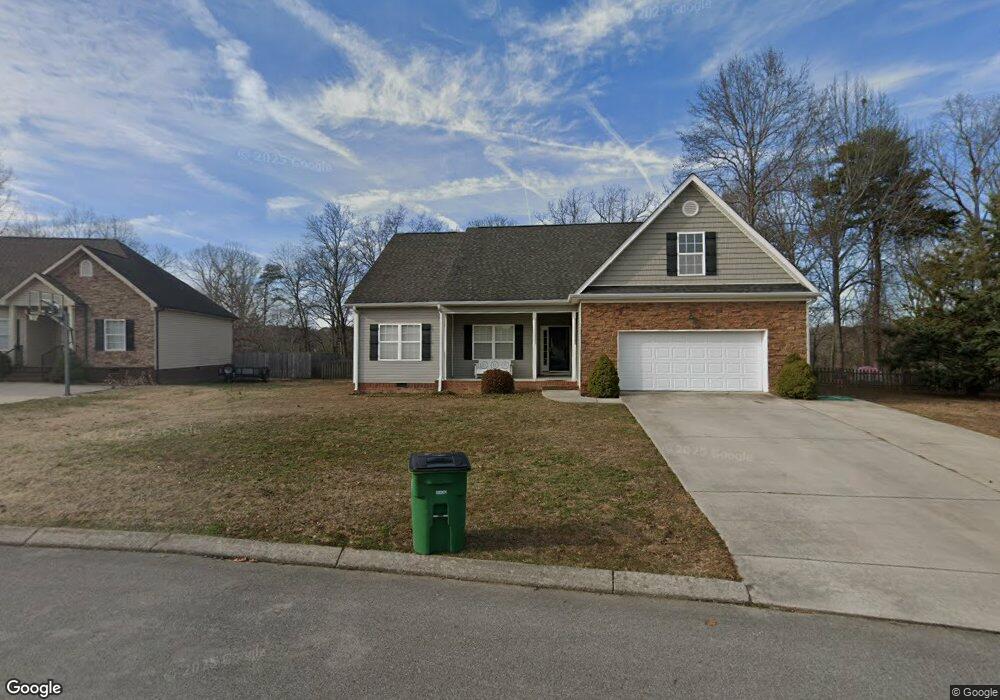
10933 Thatcher Crest Dr Soddy Daisy, TN 37379
Estimated Value: $359,261 - $416,000
--
Bed
--
Bath
1,725
Sq Ft
$230/Sq Ft
Est. Value
About This Home
This home is located at 10933 Thatcher Crest Dr, Soddy Daisy, TN 37379 and is currently estimated at $397,565, approximately $230 per square foot. 10933 Thatcher Crest Dr is a home located in Hamilton County.
Ownership History
Date
Name
Owned For
Owner Type
Purchase Details
Closed on
Jun 15, 2007
Sold by
Redman William and Petra Homes
Bought by
Spain Carl W
Current Estimated Value
Home Financials for this Owner
Home Financials are based on the most recent Mortgage that was taken out on this home.
Original Mortgage
$143,120
Interest Rate
6.35%
Mortgage Type
Purchase Money Mortgage
Purchase Details
Closed on
Nov 30, 2006
Sold by
Bates Laura and Higgins Myra
Bought by
Redman William and Petra Homes
Home Financials for this Owner
Home Financials are based on the most recent Mortgage that was taken out on this home.
Original Mortgage
$140,000
Interest Rate
6.33%
Mortgage Type
Purchase Money Mortgage
Create a Home Valuation Report for This Property
The Home Valuation Report is an in-depth analysis detailing your home's value as well as a comparison with similar homes in the area
Home Values in the Area
Average Home Value in this Area
Purchase History
| Date | Buyer | Sale Price | Title Company |
|---|---|---|---|
| Spain Carl W | $178,900 | Gateway Title Company Llc | |
| Redman William | $32,500 | Title Ins Co Of Chattanooga |
Source: Public Records
Mortgage History
| Date | Status | Borrower | Loan Amount |
|---|---|---|---|
| Closed | Spain Carl W | $143,120 | |
| Previous Owner | Redman William | $140,000 |
Source: Public Records
Tax History Compared to Growth
Tax History
| Year | Tax Paid | Tax Assessment Tax Assessment Total Assessment is a certain percentage of the fair market value that is determined by local assessors to be the total taxable value of land and additions on the property. | Land | Improvement |
|---|---|---|---|---|
| 2024 | $1,525 | $68,175 | $0 | $0 |
| 2023 | $1,534 | $68,175 | $0 | $0 |
| 2022 | $1,534 | $68,175 | $0 | $0 |
| 2021 | $1,534 | $68,175 | $0 | $0 |
| 2020 | $1,447 | $52,000 | $0 | $0 |
| 2019 | $1,447 | $52,000 | $0 | $0 |
| 2018 | $1,447 | $52,000 | $0 | $0 |
| 2017 | $1,447 | $52,000 | $0 | $0 |
| 2016 | $1,432 | $0 | $0 | $0 |
| 2015 | $1,432 | $51,450 | $0 | $0 |
| 2014 | $1,432 | $0 | $0 | $0 |
Source: Public Records
Map
Nearby Homes
- 1524 Green Pond Rd
- 10224 Tommys Ln
- 11036 High River Dr
- 10947 High River Dr
- 11015 High River Dr
- 2110 Autumn River Dr
- 10496 Sovereign Pointe Dr
- 2137 Autumn River Dr
- 10627 Jeneva Ln
- 10428 Jeneva Ln
- 1008 Trojan Run Dr
- 1055 Apollo Dr
- 1270 Jacob Dr
- 1230 Green Pond Rd
- 10166 Hunters Hollow Dr
- 10160 Hunters Hollow Dr
- 1052 Trojan Run Dr
- 1724 Magnum Ln
- 2338 Stonesage Rd
- 11734 Armstrong Rd
- 10925 Thatcher Crest Dr
- 10947 Thatcher Crest Dr
- 10934 Thratcher Crest Dr
- 10911 Thatcher Crest Dr
- 10959 Thatcher Crest Dr
- 10982 Thatcher Crest Dr Unit 2
- 10982 Thatcher Crest Dr
- 10934 Thatcher Crest Dr
- 10912 Thatcher Crest Dr
- 10912 Thatcher Crest Dr Unit 21
- 10897 Thatcher Crest Dr
- 10956 Thatcher Crest Dr
- 10898 Thatcher Crest Dr
- 10981 Thatcher Crest Dr Unit 56
- 10981 Thatcher Crest Dr
- 10883 Thatcher Crest Dr
- 10989 Thatcher Crest Dr
- 10880 Thatcher Crest Dr
- 10970 Thatcher Crest Dr
- 1883 Sugar Maple Ln