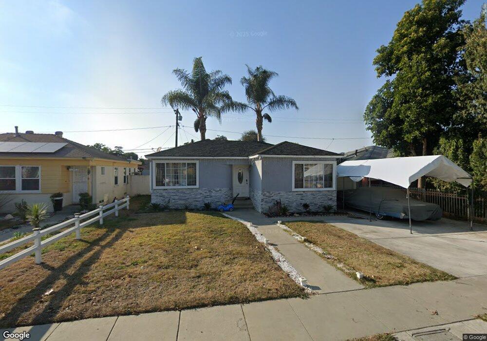
10943 Sampson Ave Lynwood, CA 90262
Estimated Value: $666,000 - $716,142
3
Beds
1
Bath
1,134
Sq Ft
$617/Sq Ft
Est. Value
About This Home
This home is located at 10943 Sampson Ave, Lynwood, CA 90262 and is currently estimated at $699,536, approximately $616 per square foot. 10943 Sampson Ave is a home located in Los Angeles County with nearby schools including Lugo Elementary School, Hosler Middle School, and Lynwood High School.
Ownership History
Date
Name
Owned For
Owner Type
Purchase Details
Closed on
Jan 19, 2007
Sold by
Druhet Miriam
Bought by
Cisneros Andy
Current Estimated Value
Home Financials for this Owner
Home Financials are based on the most recent Mortgage that was taken out on this home.
Original Mortgage
$352,000
Outstanding Balance
$217,973
Interest Rate
6.87%
Mortgage Type
New Conventional
Estimated Equity
$481,563
Purchase Details
Closed on
Oct 7, 2002
Sold by
Smith Vivian J
Bought by
Druhet Miriam
Home Financials for this Owner
Home Financials are based on the most recent Mortgage that was taken out on this home.
Original Mortgage
$154,000
Interest Rate
6.99%
Mortgage Type
Purchase Money Mortgage
Create a Home Valuation Report for This Property
The Home Valuation Report is an in-depth analysis detailing your home's value as well as a comparison with similar homes in the area
Home Values in the Area
Average Home Value in this Area
Purchase History
| Date | Buyer | Sale Price | Title Company |
|---|---|---|---|
| Cisneros Andy | $440,000 | Chicago Title Co | |
| Druhet Miriam | -- | Chicago Title Co | |
| Cisneros Andy | -- | Chicago Title Co | |
| Druhet Miriam | $154,000 | Commonwealth Title Company |
Source: Public Records
Mortgage History
| Date | Status | Borrower | Loan Amount |
|---|---|---|---|
| Open | Cisneros Andy | $352,000 | |
| Previous Owner | Druhet Miriam | $154,000 |
Source: Public Records
Tax History Compared to Growth
Tax History
| Year | Tax Paid | Tax Assessment Tax Assessment Total Assessment is a certain percentage of the fair market value that is determined by local assessors to be the total taxable value of land and additions on the property. | Land | Improvement |
|---|---|---|---|---|
| 2025 | $8,150 | $589,489 | $471,598 | $117,891 |
| 2024 | $8,150 | $577,931 | $462,351 | $115,580 |
| 2023 | $8,089 | $566,600 | $453,286 | $113,314 |
| 2022 | $7,722 | $550,000 | $438,000 | $112,000 |
| 2021 | $6,958 | $502,000 | $400,000 | $102,000 |
| 2019 | $5,915 | $398,000 | $317,000 | $81,000 |
| 2018 | $5,568 | $398,000 | $317,000 | $81,000 |
| 2016 | $4,913 | $360,000 | $287,000 | $73,000 |
| 2015 | $4,160 | $302,000 | $241,000 | $61,000 |
| 2014 | $4,138 | $302,000 | $241,000 | $61,000 |
Source: Public Records
Map
Nearby Homes
- 10891 Standard Ave
- 11267 Sampson Ave
- 10502 Bryson Ave
- 11309 Annetta Ave
- 10307 Alexander Ave
- 10240 Atlantic Ave
- 4000 Platt Ave
- 4296 Platt Ave
- 11340 Virginia Ave
- 11363 Virginia Ave
- 4274 Walnut Ave
- 4296 Walnut Ave
- 11230 Louise Ave
- 3831 Walnut Ave
- 3805 Lugo Ave
- 3886 Cortland St
- 3644 Platt Ave
- 5151 Wood Ave
- 3685 Fernwood Ave
- 9718 Otis St
- 10933 Sampson Ave
- 10953 Sampson Ave
- 10923 Sampson Ave
- 10963 Sampson Ave
- 10942 Colyer Ave
- 10952 Colyer Ave
- 10932 Colyer Ave
- 10913 Sampson Ave
- 10973 Sampson Ave
- 10962 Colyer Ave
- 10922 Colyer Ave
- 10942 Sampson Ave
- 10952 Sampson Ave
- 10932 Sampson Ave
- 10912 Colyer Ave
- 10972 Colyer Ave
- 10962 Sampson Ave
- 10922 Sampson Ave
- 10983 Sampson Ave