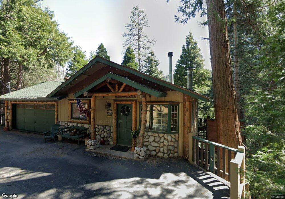
1095 Nesthorn Dr Crestline, CA 92325
Estimated Value: $399,000 - $425,000
4
Beds
3
Baths
1,632
Sq Ft
$252/Sq Ft
Est. Value
About This Home
This home is located at 1095 Nesthorn Dr, Crestline, CA 92325 and is currently estimated at $411,262, approximately $251 per square foot. 1095 Nesthorn Dr is a home located in San Bernardino County with nearby schools including Valley Of Enchantment Elementary School, Mary P. Henck Intermediate School, and Rim Of The World Senior High School.
Ownership History
Date
Name
Owned For
Owner Type
Purchase Details
Closed on
Nov 15, 2010
Sold by
Aurora Loan Services Llc
Bought by
Jacobsen Von
Current Estimated Value
Purchase Details
Closed on
Aug 4, 2010
Sold by
Hamby Charles E
Bought by
Aurora Loan Services Llc
Purchase Details
Closed on
Feb 9, 1994
Sold by
Federal Home Loan Mortgage Corporation
Bought by
Hamby Charles E and Hamby Bobbi Page
Home Financials for this Owner
Home Financials are based on the most recent Mortgage that was taken out on this home.
Original Mortgage
$124,489
Interest Rate
7.67%
Mortgage Type
FHA
Create a Home Valuation Report for This Property
The Home Valuation Report is an in-depth analysis detailing your home's value as well as a comparison with similar homes in the area
Home Values in the Area
Average Home Value in this Area
Purchase History
| Date | Buyer | Sale Price | Title Company |
|---|---|---|---|
| Jacobsen Von | $126,000 | Lsi Title Company | |
| Aurora Loan Services Llc | $147,900 | None Available | |
| Hamby Charles E | $125,500 | Continental Lawyers Title Co |
Source: Public Records
Mortgage History
| Date | Status | Borrower | Loan Amount |
|---|---|---|---|
| Previous Owner | Hamby Charles E | $124,489 |
Source: Public Records
Tax History
| Year | Tax Paid | Tax Assessment Tax Assessment Total Assessment is a certain percentage of the fair market value that is determined by local assessors to be the total taxable value of land and additions on the property. | Land | Improvement |
|---|---|---|---|---|
| 2025 | $2,467 | $178,083 | $25,623 | $152,460 |
| 2024 | $2,366 | $174,592 | $25,121 | $149,471 |
| 2023 | $2,336 | $171,168 | $24,628 | $146,540 |
| 2022 | $2,306 | $167,812 | $24,145 | $143,667 |
| 2021 | $2,261 | $164,522 | $23,672 | $140,850 |
| 2020 | $2,256 | $162,835 | $23,429 | $139,406 |
| 2019 | $2,204 | $159,643 | $22,970 | $136,673 |
| 2018 | $1,972 | $156,513 | $22,520 | $133,993 |
| 2017 | $1,937 | $153,444 | $22,078 | $131,366 |
| 2016 | $1,895 | $150,435 | $21,645 | $128,790 |
| 2015 | $1,859 | $148,175 | $21,320 | $126,855 |
| 2014 | $1,829 | $145,272 | $20,902 | $124,370 |
Source: Public Records
Map
Nearby Homes
- 24798 Felsen Dr
- 24738 Nestal Ct
- 1044 Nesthorn Dr
- 24622 Bernard Dr
- 24722 Bernard Dr
- 1015 Nesthorn Dr
- 24666 Geneva Dr
- 24646 Lake Gregory Dr
- 1212 Jungfrau Dr
- 990 Nesthorn Dr
- 24580 Bernard Dr
- 0 Balfrin Unit IV25279361
- 0 Balfrin Unit 25009429
- 24571 Geneva Dr
- 912 Berne Dr
- 24510 Altdorf Dr
- 818 Berne Dr
- 24989 Highland Dr
- 24514 Albrun Dr
- 0 Berne Dr Unit HD22154179
- 1101 Nesthorn Dr
- 24769 Faulhorn Dr
- 1087 Nesthorn Dr
- 1096 Nesthorn Dr
- 1088 Nesthorn Dr
- 1109 Nesthorn Dr
- 24798 Faulhorn Dr
- 1108 Nesthorn Dr
- 1069 Nesthorn Dr
- 24782 Faulkhorn
- 24782 Faulhorn Dr
- 24774 Faulhorn Dr
- 1067 Nesthorn Dr
- 24722 Finhaut
- 24791 Valle Dr
- 24732 Nestal Ct
- 24785 Faulhorn Dr
- 24722 Finhaut Dr
- 24770 Faulhorn Dr
- 24716 Finhaut Dr
Your Personal Tour Guide
Ask me questions while you tour the home.