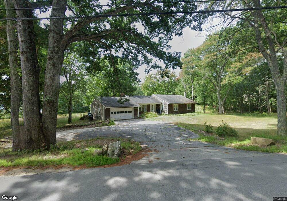
1095 Province Rd Strafford, NH 03884
Estimated Value: $523,035 - $649,000
3
Beds
3
Baths
1,596
Sq Ft
$375/Sq Ft
Est. Value
About This Home
This home is located at 1095 Province Rd, Strafford, NH 03884 and is currently estimated at $598,509, approximately $375 per square foot. 1095 Province Rd is a home located in Strafford County with nearby schools including Strafford School and Coe-Brown Northwood Academy.
Ownership History
Date
Name
Owned For
Owner Type
Purchase Details
Closed on
Sep 19, 2017
Sold by
Ernes B Brown Ret
Bought by
Brown Justin T and Brown Theresa-Marie D
Current Estimated Value
Home Financials for this Owner
Home Financials are based on the most recent Mortgage that was taken out on this home.
Original Mortgage
$272,250
Outstanding Balance
$146,977
Interest Rate
3.93%
Mortgage Type
New Conventional
Estimated Equity
$451,532
Create a Home Valuation Report for This Property
The Home Valuation Report is an in-depth analysis detailing your home's value as well as a comparison with similar homes in the area
Home Values in the Area
Average Home Value in this Area
Purchase History
| Date | Buyer | Sale Price | Title Company |
|---|---|---|---|
| Brown Justin T | -- | -- |
Source: Public Records
Mortgage History
| Date | Status | Borrower | Loan Amount |
|---|---|---|---|
| Open | Brown Justin T | $272,250 |
Source: Public Records
Tax History Compared to Growth
Tax History
| Year | Tax Paid | Tax Assessment Tax Assessment Total Assessment is a certain percentage of the fair market value that is determined by local assessors to be the total taxable value of land and additions on the property. | Land | Improvement |
|---|---|---|---|---|
| 2024 | $8,321 | $421,100 | $198,600 | $222,500 |
| 2023 | $7,829 | $420,000 | $198,600 | $221,400 |
| 2022 | $7,195 | $420,000 | $198,600 | $221,400 |
| 2021 | $7,753 | $420,000 | $198,600 | $221,400 |
| 2020 | $8,136 | $317,200 | $168,300 | $148,900 |
| 2019 | $7,445 | $317,200 | $168,300 | $148,900 |
| 2018 | $8,174 | $317,200 | $168,300 | $148,900 |
| 2016 | $6,741 | $317,200 | $168,300 | $148,900 |
| 2015 | $6,667 | $305,700 | $168,200 | $137,500 |
| 2014 | $7,080 | $305,700 | $168,200 | $137,500 |
| 2013 | $6,933 | $305,700 | $168,200 | $137,500 |
| 2012 | $6,844 | $305,800 | $168,200 | $137,600 |
Source: Public Records
Map
Nearby Homes
- 133 & 137 Browns Pasture Rd
- Map 3 Lot 18-2b and 18-2c Water St
- 11 Drake Hill Rd
- 1760 Province Rd
- Map 102 Lot 9 Kramas Ln
- Map 219 Lot 6-8 Ridge Rd
- M37 L40 Beaver Rd
- 8 Bow Lake Rd
- 0 1st New Hampshire Turnpike Unit 5026030
- 0 1st New Hampshire Turnpike Unit 5013320
- 150A 1st New Hampshire Turnpike
- 152 Evans Rd
- 21 Quimby Dr
- 20 Quimby Dr
- 268 Province Rd
- 64 Kelsey Mill Rd
- 17 Brook Circle Rd
- 152 Olde Canterbury Rd
- R11 07 Clough Rd
- 955 Catamount Rd
- 1105 Province Rd
- 1082 Province Rd
- 1100 Province Rd
- 1112 Province Rd
- 1112 Province Rd Unit 1
- Lot 90 Bow Lake Estates Rd Unit 90
- 87 Bow Lake Estates Rd
- 119 Bow Lake Estates Rd
- 1114 Province Rd
- 21 Bow Lake Estates Rd
- 6 Bow Lake Estates Rd
- 158 Bow Lake Estates Rd
- 156 Bow Lake Estates Rd
- 160 Bow Lake Estates Rd
- TBD Province Rd
- 154 Bow Lake Estates Rd
- 1068 Province Rd
- 152 Bow Lake Estates Rd
- 166 Bow Lake Estates Rd
- 150 Bow Lake Estates Rd