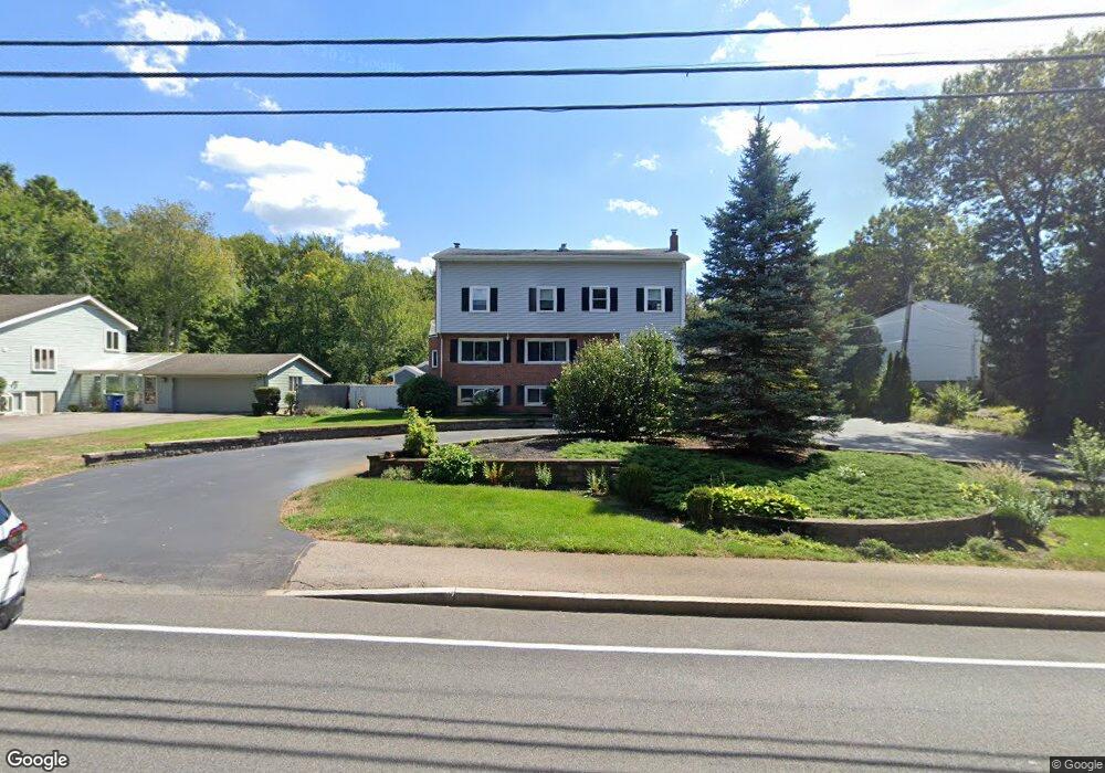
1096 Liberty St Braintree, MA 02184
South Braintree NeighborhoodEstimated Value: $1,161,000 - $1,547,000
5
Beds
4
Baths
5,778
Sq Ft
$229/Sq Ft
Est. Value
About This Home
This home is located at 1096 Liberty St, Braintree, MA 02184 and is currently estimated at $1,320,417, approximately $228 per square foot. 1096 Liberty St is a home located in Norfolk County with nearby schools including First Baptist Christian School, Thayer Academy, and St. Francis Xavier School.
Ownership History
Date
Name
Owned For
Owner Type
Purchase Details
Closed on
Jan 30, 2025
Sold by
Sanfilippo Charles and Sanfilippo Joseph
Bought by
Charles G Sanfilippo T G and Charles Sanfilippo
Current Estimated Value
Purchase Details
Closed on
Jun 15, 2020
Sold by
Sanfilippo Charles
Bought by
Sanfilippo Charles and Sanfilippo Joseph
Create a Home Valuation Report for This Property
The Home Valuation Report is an in-depth analysis detailing your home's value as well as a comparison with similar homes in the area
Home Values in the Area
Average Home Value in this Area
Purchase History
| Date | Buyer | Sale Price | Title Company |
|---|---|---|---|
| Charles G Sanfilippo T G | -- | None Available | |
| Charles G Sanfilippo T G | -- | None Available | |
| Sanfilippo Charles | -- | None Available | |
| Sanfilippo Charles | -- | None Available |
Source: Public Records
Tax History Compared to Growth
Tax History
| Year | Tax Paid | Tax Assessment Tax Assessment Total Assessment is a certain percentage of the fair market value that is determined by local assessors to be the total taxable value of land and additions on the property. | Land | Improvement |
|---|---|---|---|---|
| 2025 | $12,210 | $1,223,400 | $403,900 | $819,500 |
| 2024 | $10,993 | $1,159,600 | $379,400 | $780,200 |
| 2023 | $10,509 | $1,076,700 | $342,700 | $734,000 |
| 2022 | $10,469 | $1,052,200 | $318,200 | $734,000 |
| 2021 | $9,997 | $1,004,700 | $293,800 | $710,900 |
| 2020 | $9,651 | $978,800 | $269,300 | $709,500 |
| 2019 | $9,215 | $913,300 | $269,300 | $644,000 |
| 2018 | $9,075 | $861,000 | $244,800 | $616,200 |
| 2017 | $8,637 | $804,200 | $220,300 | $583,900 |
| 2016 | $8,339 | $759,500 | $195,800 | $563,700 |
| 2015 | $8,234 | $743,800 | $184,800 | $559,000 |
| 2014 | $7,554 | $661,500 | $176,300 | $485,200 |
Source: Public Records
Map
Nearby Homes
- 30 Thetford Ave
- 972 Liberty St
- 117 Amherst Rd
- 256 Evergreen Ave
- 441 Grove St
- 432 Grove St
- 115 Richard Rd
- 61 Grove St
- 184 Richard Rd
- 1501 Liberty St
- 30 Bradford Commons Ln
- 428 John Mahar Hwy Unit 301
- 134 Tyson Commons Ln
- 418 John Mahar Hwy Unit 408
- 414 John Mahar Hwy Unit 402
- 44 Arlington Ave
- 501 Commerce Dr Unit 2310
- 501 Commerce Dr Unit 1111
- 501 Commerce Dr Unit 4206
- 501 Commerce Dr Unit 4308
- 1094 Liberty St
- 1100 Liberty St
- 1108 Liberty St
- 1114 Liberty St
- 1107 Liberty St
- 1078 Liberty St
- 1093 Liberty St
- 1074 Liberty St
- 1 Proctor Rd
- 1124 Liberty St
- 11 Trainor Dr
- 1085 Liberty St
- 15 Forest St
- 1070 Liberty St
- 0 Trainor Dr
- 84 Geraldine Ln
- 14 Michele Ln
- 21 Trainor Dr
- 1134 Liberty St
- 21 Forest St