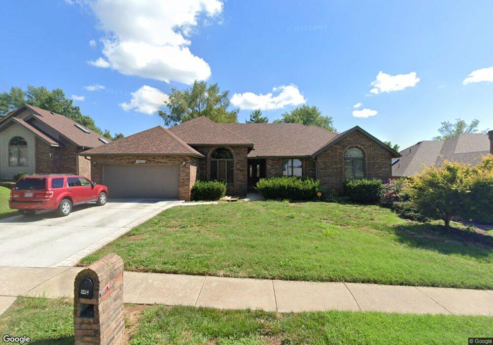
1096 W Pheasant Run St Springfield, MO 65810
Southwest Springfield NeighborhoodEstimated Value: $394,690 - $518,000
4
Beds
3
Baths
3,400
Sq Ft
$129/Sq Ft
Est. Value
About This Home
This home is located at 1096 W Pheasant Run St, Springfield, MO 65810 and is currently estimated at $438,173, approximately $128 per square foot. 1096 W Pheasant Run St is a home located in Greene County with nearby schools including Gray Elementary School, Wilson's Creek Intermediate School, and Cherokee Middle School.
Ownership History
Date
Name
Owned For
Owner Type
Purchase Details
Closed on
Feb 1, 2021
Sold by
Verheyen Nicholas and Verheyen Victoria
Bought by
Verheyen Construction Llc
Current Estimated Value
Purchase Details
Closed on
Jul 21, 2010
Sold by
Verheyen Gregory L and Verheyen Susan K
Bought by
Borup Joseph L and Borup April D
Home Financials for this Owner
Home Financials are based on the most recent Mortgage that was taken out on this home.
Original Mortgage
$231,392
Outstanding Balance
$153,840
Interest Rate
4.73%
Mortgage Type
VA
Estimated Equity
$284,333
Create a Home Valuation Report for This Property
The Home Valuation Report is an in-depth analysis detailing your home's value as well as a comparison with similar homes in the area
Home Values in the Area
Average Home Value in this Area
Purchase History
| Date | Buyer | Sale Price | Title Company |
|---|---|---|---|
| Verheyen Construction Llc | -- | Mtc | |
| Borup Joseph L | -- | None Available |
Source: Public Records
Mortgage History
| Date | Status | Borrower | Loan Amount |
|---|---|---|---|
| Open | Borup Joseph L | $231,392 |
Source: Public Records
Tax History
| Year | Tax Paid | Tax Assessment Tax Assessment Total Assessment is a certain percentage of the fair market value that is determined by local assessors to be the total taxable value of land and additions on the property. | Land | Improvement |
|---|---|---|---|---|
| 2025 | $2,851 | $55,330 | $7,130 | $48,200 |
| 2024 | $2,691 | $48,580 | $4,750 | $43,830 |
| 2023 | $2,676 | $48,580 | $4,750 | $43,830 |
| 2022 | $2,432 | $45,260 | $4,750 | $40,510 |
| 2021 | $2,432 | $45,260 | $4,750 | $40,510 |
| 2020 | $2,389 | $42,160 | $4,750 | $37,410 |
| 2019 | $2,320 | $42,160 | $4,750 | $37,410 |
| 2018 | $2,212 | $40,090 | $4,750 | $35,340 |
| 2017 | $2,190 | $36,770 | $4,750 | $32,020 |
| 2016 | $2,009 | $36,770 | $4,750 | $32,020 |
| 2015 | $1,993 | $36,770 | $4,750 | $32,020 |
| 2014 | $1,937 | $35,440 | $4,750 | $30,690 |
Source: Public Records
Map
Nearby Homes
- 989 E Siler Pkwy
- 5685 S Fox Hollow Ave
- 5337 S Dayton Ave
- 5341 S Dayton Ave
- 5333 S Dayton Ave
- 5393 S Newton Ave
- 5381 S Newton Ave
- 5328 S Dayton Ave
- 5332 S Dayton Ave
- 5336 S Dayton Ave
- 5204 S Nettleton Ave
- 5228 S Nettleton Ave
- 5216 S Nettleton Ave
- 000 W Farm Road 186
- 1165 W Gaslight Dr
- 1551 W Pheasant Run St
- 1097 W Franklin Ct
- 5678 S Fairview Ave
- 1302 W Gaslight Dr
- 5619 S Lexington Ave
- 1084 W Pheasant Run St
- 1108 W Pheasant Run St
- 1072 W Pheasant Run St
- 1128 W Pheasant Run St
- 1111 W Highpoint St
- 1091 W Highpoint St
- 5508 S Franklin Ave
- 1129 W Highpoint St
- 5507 S Franklin Ave
- 1073 W Highpoint St
- 1134 W Pheasant Run St
- 1054 W Pheasant Run St
- 1149 W Highpoint St
- 5496 S Franklin Ave
- 5505 S Parkhill Ave
- 5495 S Franklin Ave
- 1053 W Highpoint St
- 1169 W Highpoint St
- 1146 W Pheasant Run St
- 5495 S Parkhill Ave
Your Personal Tour Guide
Ask me questions while you tour the home.